Very moving video. This is awesome!
Category Archives: flying
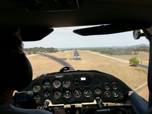
Ron on short final 35 @Spicewood
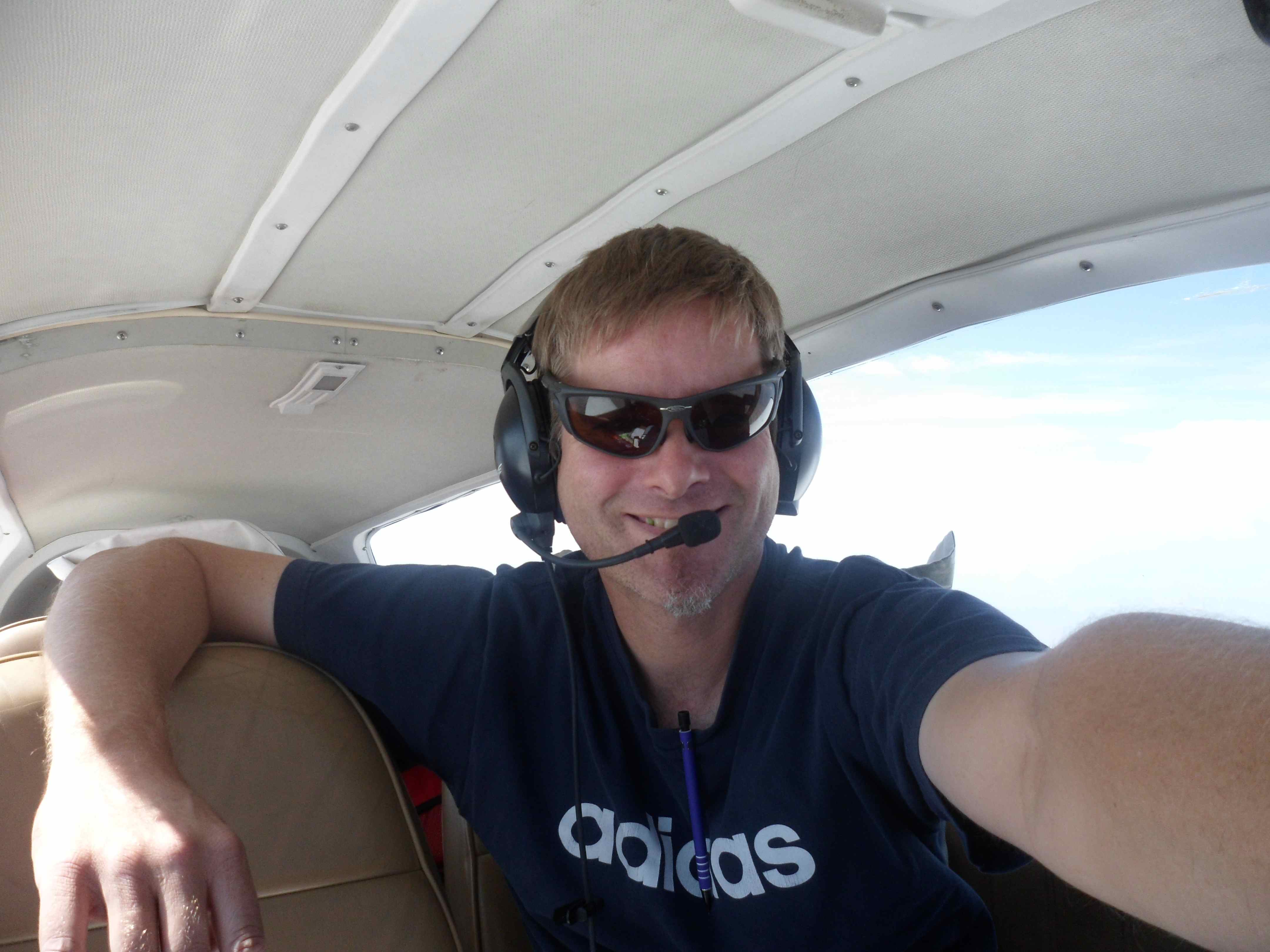
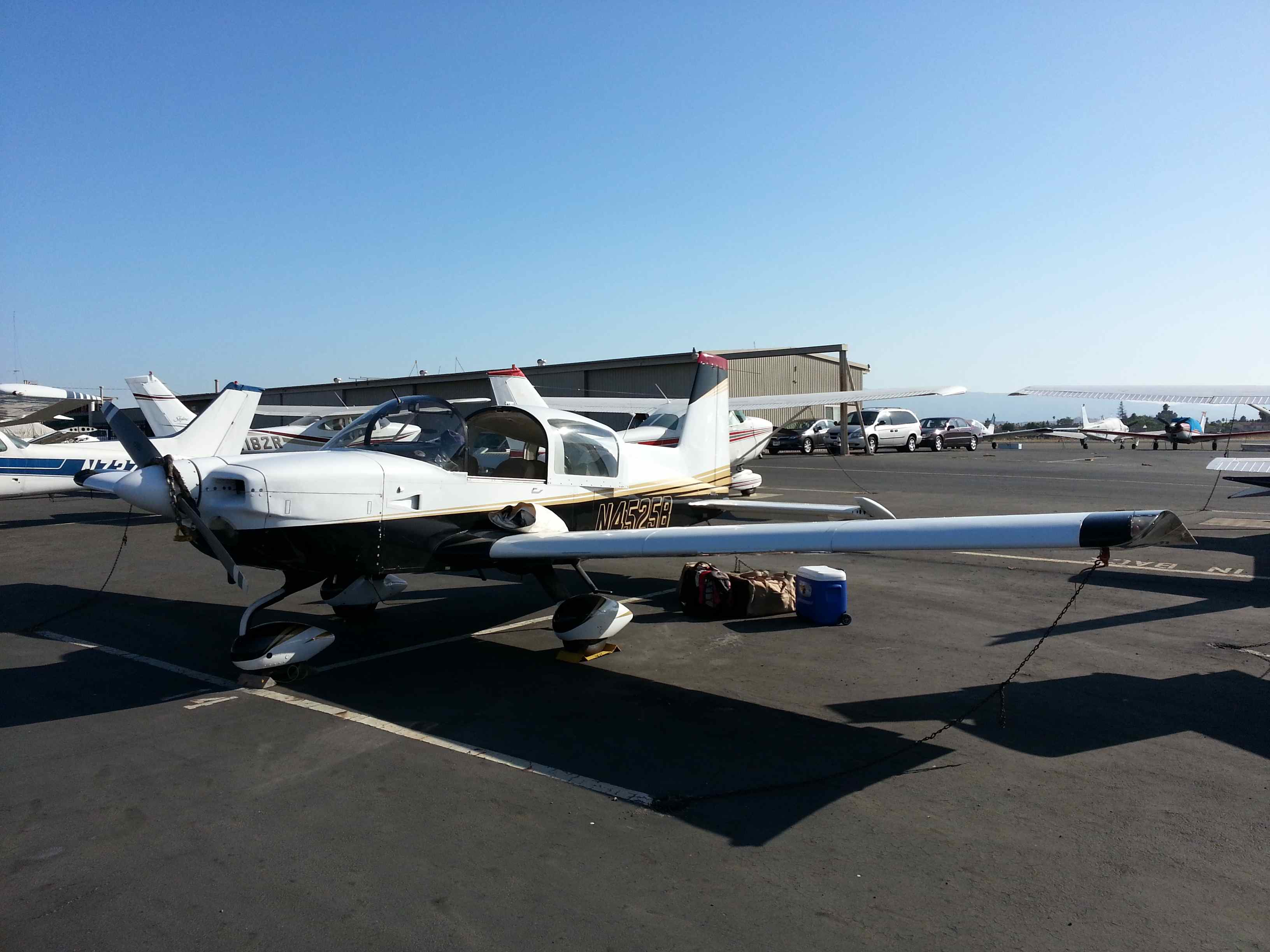
Tiger return flight RHV-AUS
Tiger return flight to Texas
After five days in the San Francisco bay area it was time to go home. For the return flight I expected some tail winds, but due to the shorter days going eastwards (you loose 2 hours of daytime) it wouldn’t be possible to fully conduct the flight during day time hours. With an estimated time enroute of 12 hours it was either a two day trip or a night VFR leg into Austin. I was leaning towards splitting the flight into two days until I learned about a TFR at El Paso for Obama’s campaign the next day. Unfortunately that TFR cut off all airspace towards Texas for VFR traffic, since it was extending all the way to 18000ft – unreachable for me with the Tiger without Oxygen. Seriously, why would you do that!? Thanks Secret Service and Homeland Security – NOT! Flying around it would have meant to fly around the prohibited area for missile and nuclear bomb testing south of Albuqeuerque, NM. Flying around that big restricted area would have added ~300NM to the trip. Not exactly feasible. Can we be smarter than that? – Maybe establish a VFR corridor? For that reason I planned to press on into the night to get past that TFR before it activates for the president’s visit the next day. I thought about Carlsbad, NM as an overnight stop – some 50NM north of my actual path.
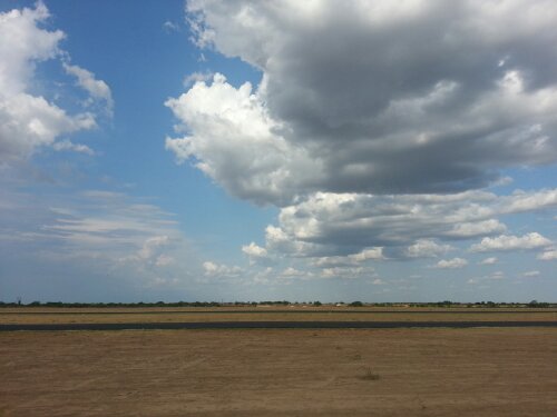
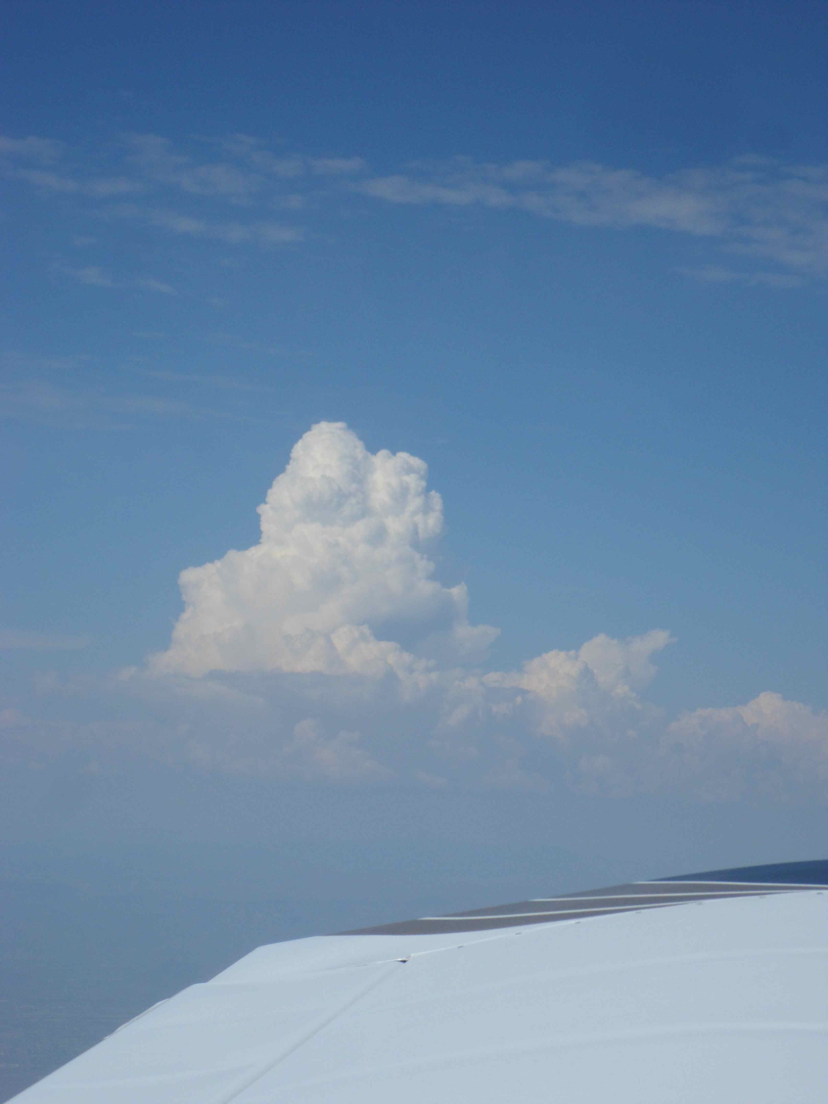
The weather briefing looked fine for a VFR flight all the way – the only issue was instability in the higher atmosphere in the L.A. area and South of it, as well as some scattered thunderstorms in the mountains north of Phoenix, AZ. At this time of the year, they are pretty much a constant weather feature and nothing to worry about as long as you can navigate around them. Flying through the Rockies after 2pm is pretty much a no-go. A big hurricane east of Texas influenced the winds enroute but didn’t affect Austin weather quite yet – other than northerly winds. College Station 80 miles to the east was a different story so a close watch was warranted.
Since I was unfamiliar with local procedures in the Bay Area I checked with a local flight instructor if my VFR departure plan was sound and legal, which he confirmed.
I was getting an early start out of the Bay (no marine layer this morning) and therefore I was planning to hit the high alitude airport Big Bear close to the the LA basin for cheap gas while temperatures were low.
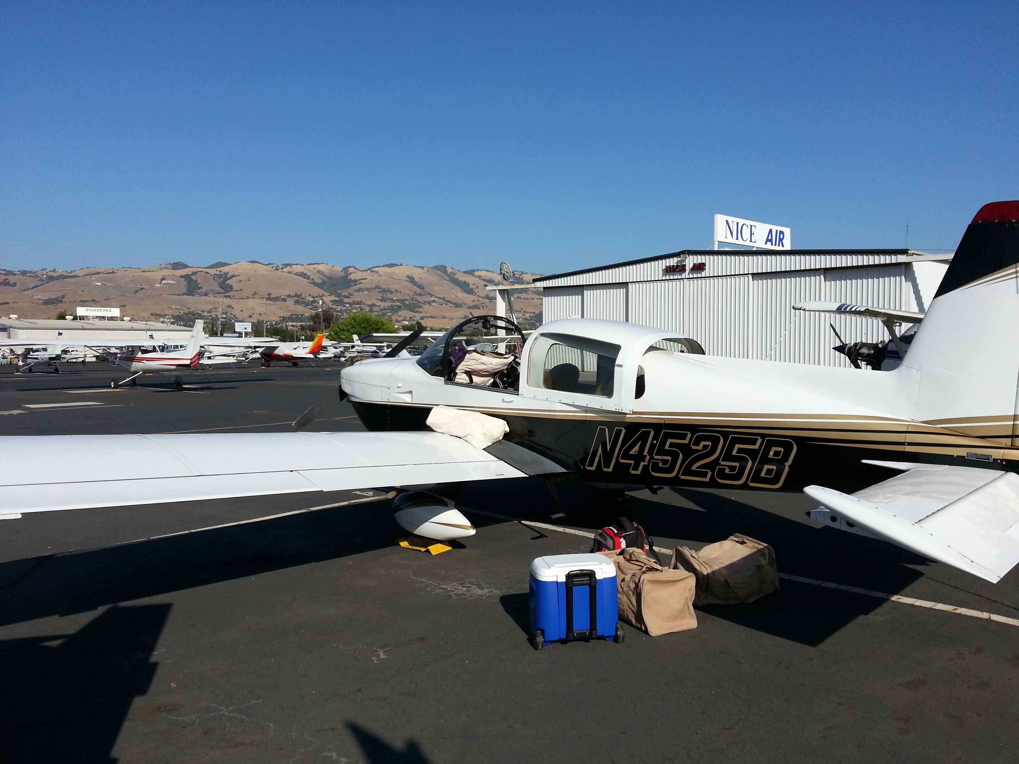
On the ramp I did my thorough pre-flight check, made sure food and drinks were accessible (lunch, snacks and dinner along with plenty of water and Gatorate), I checked gas and oil and made myself comfortable in the cockpit with cushions, maps, pens, headset and everything else a human needs for a 12 hour trip.
I said my “good-bye” to the bay area and fired up the engine. After a brief taxi and engine runup I was cleared for departure runway 31R for a southeast departure on a VFR squawk following another plane.
Departing traffic number one was a Cessna Skyhawk C172 which soon would be chased by me on the same heading. As he was turning crosswind I set full power. I followed his route but was closing in fast. I was going a solid 20mph faster than him, while climbing at a better rate. I left the C172 behind and continued my cruise climb at 90kts to 9.5k. A C172 has other qualities…
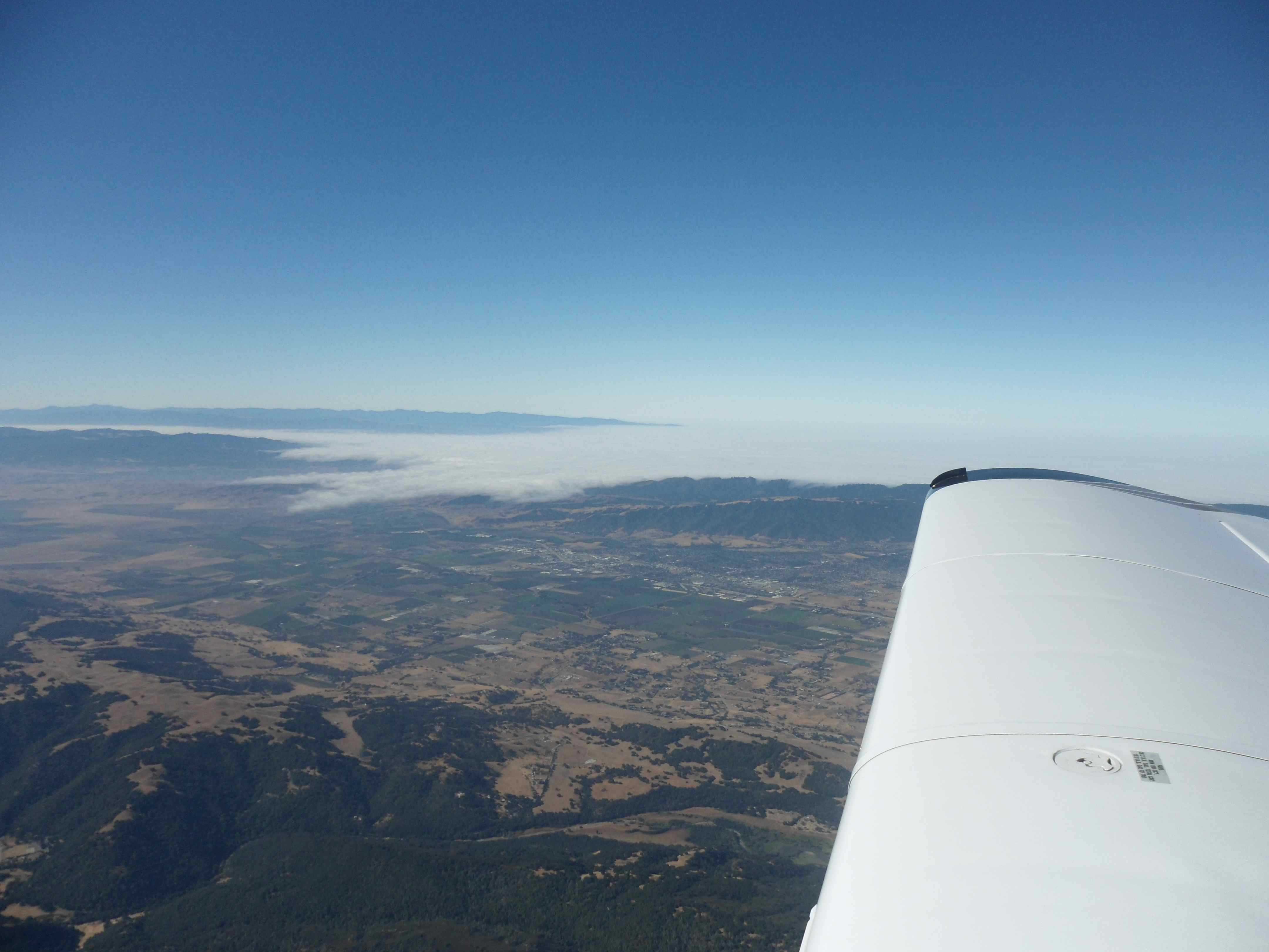
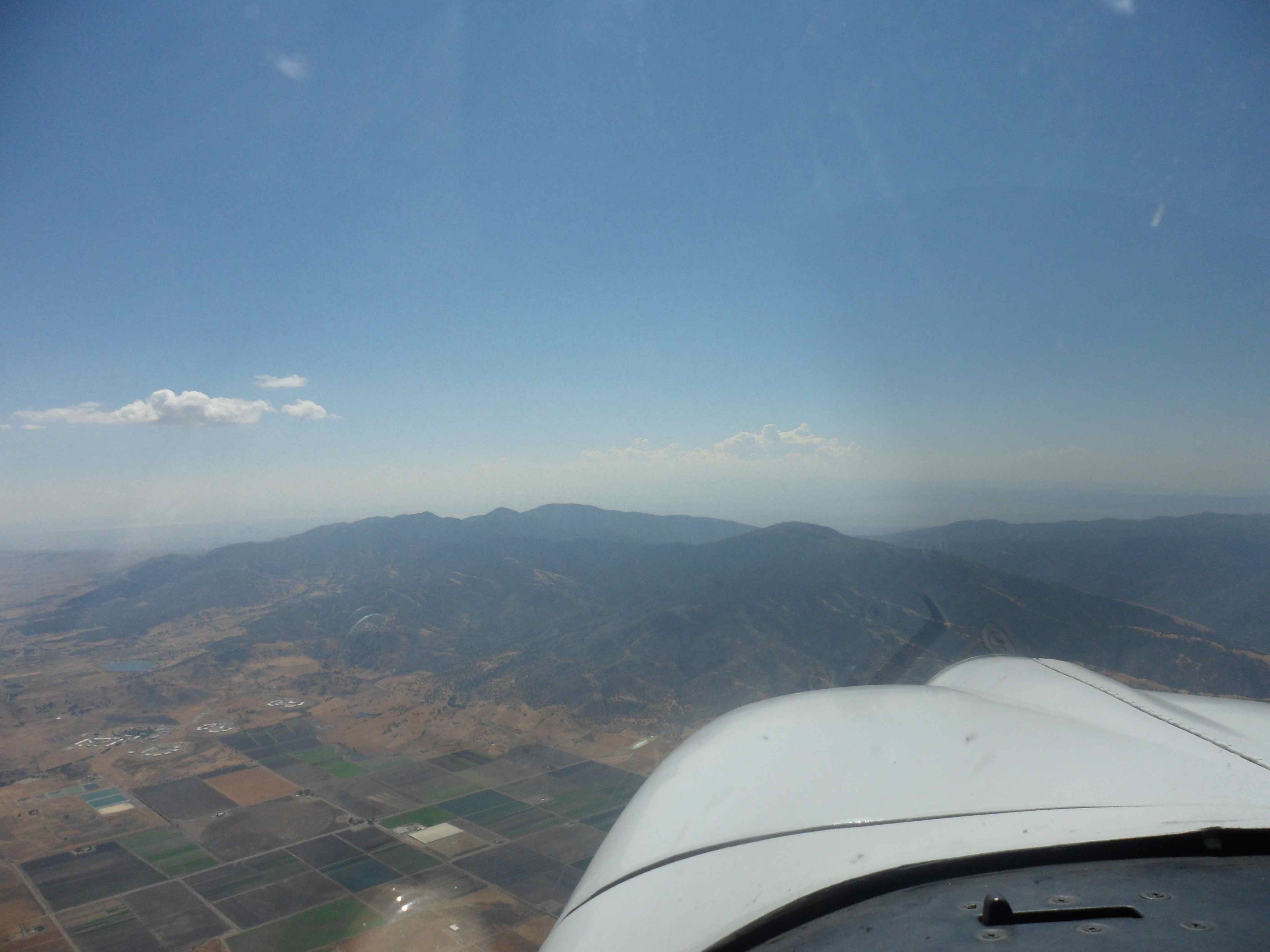
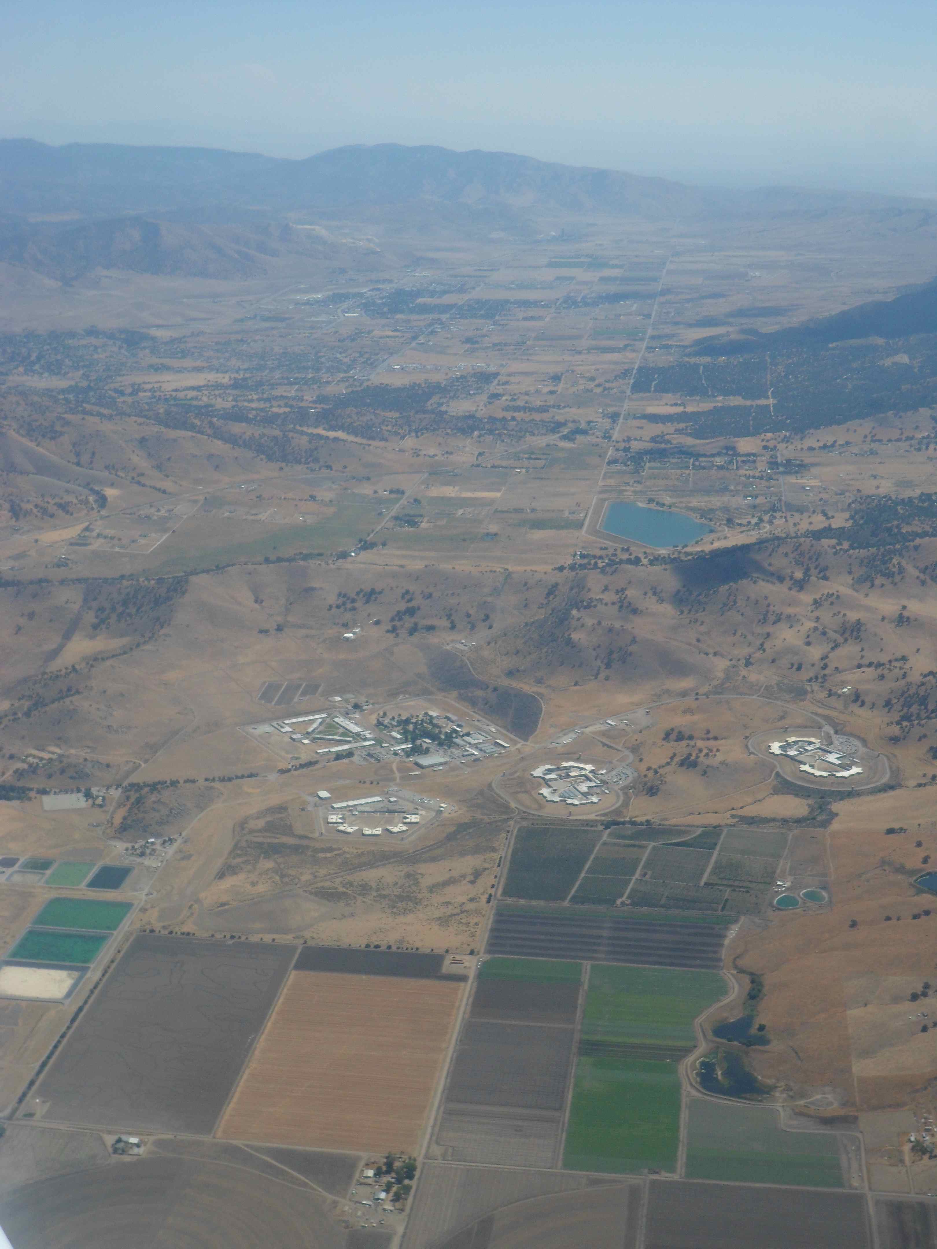
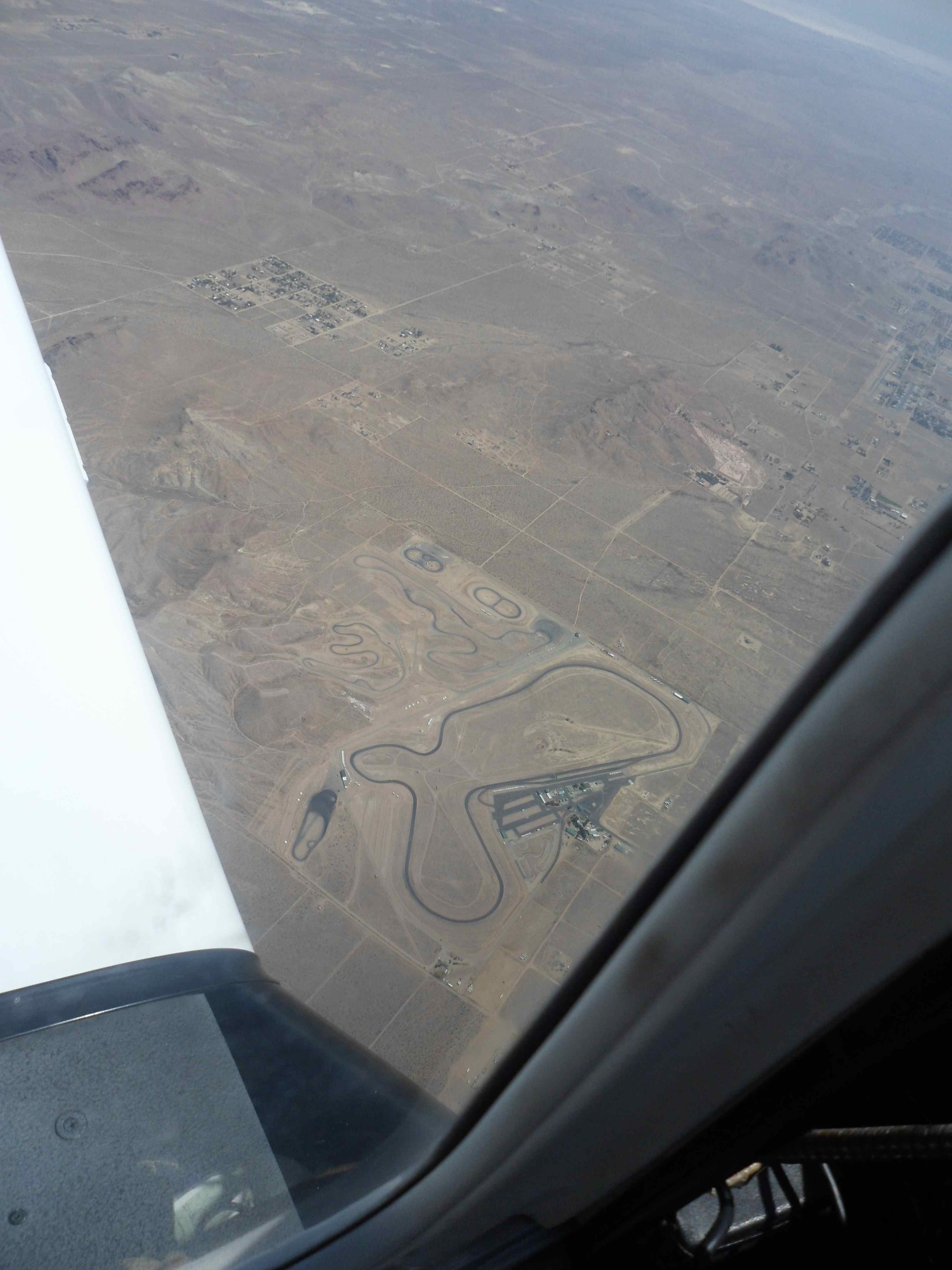
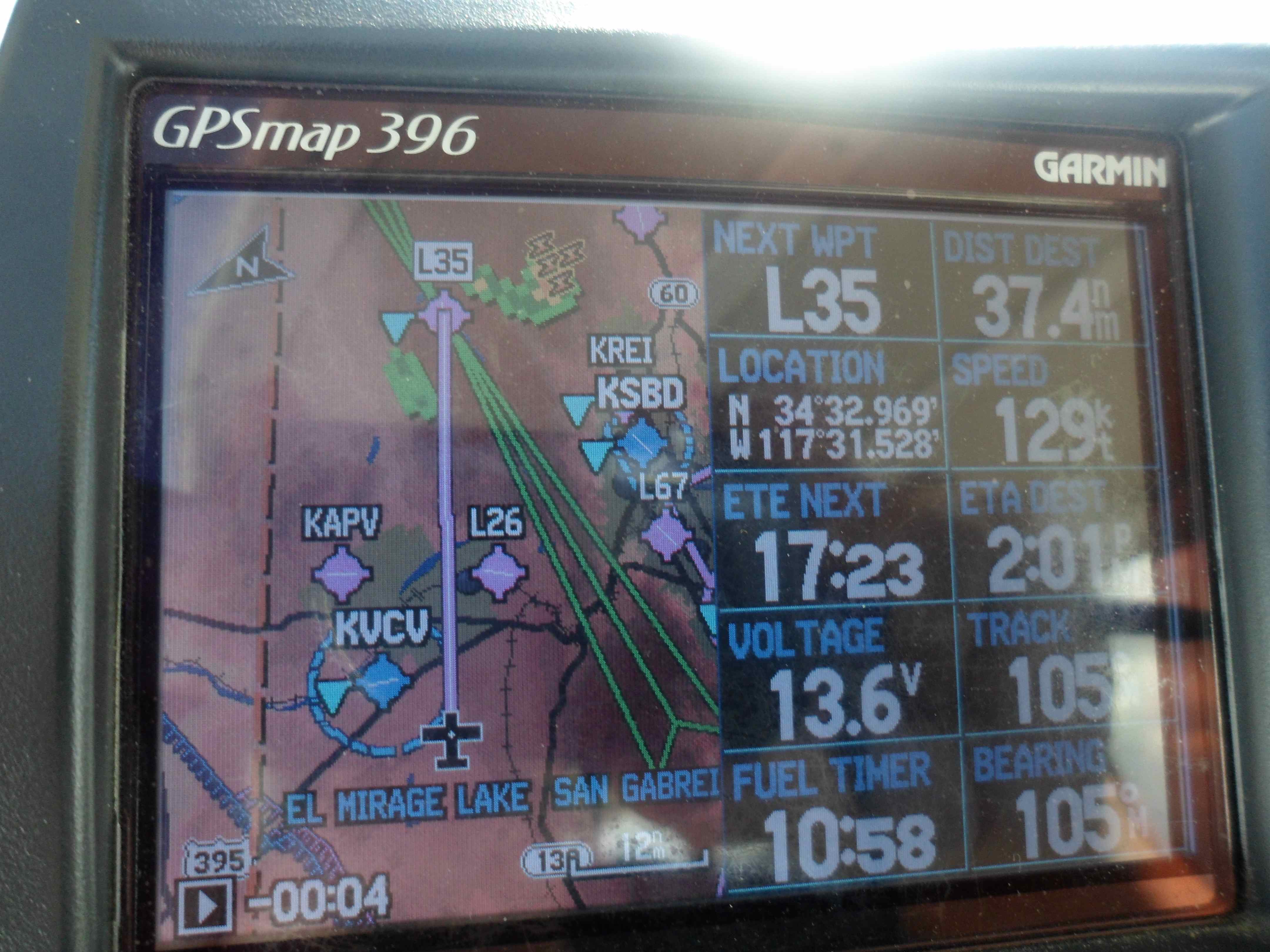
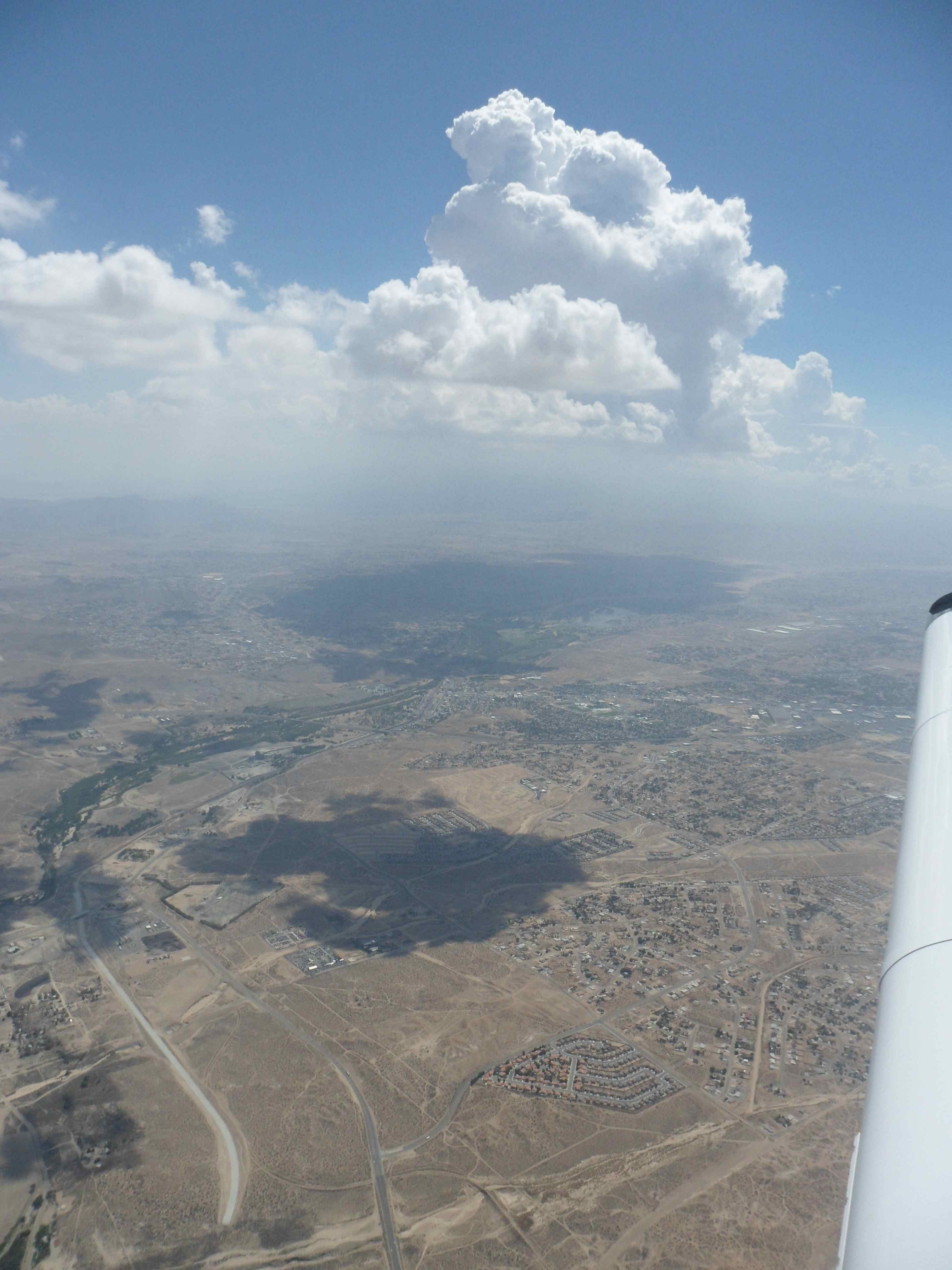
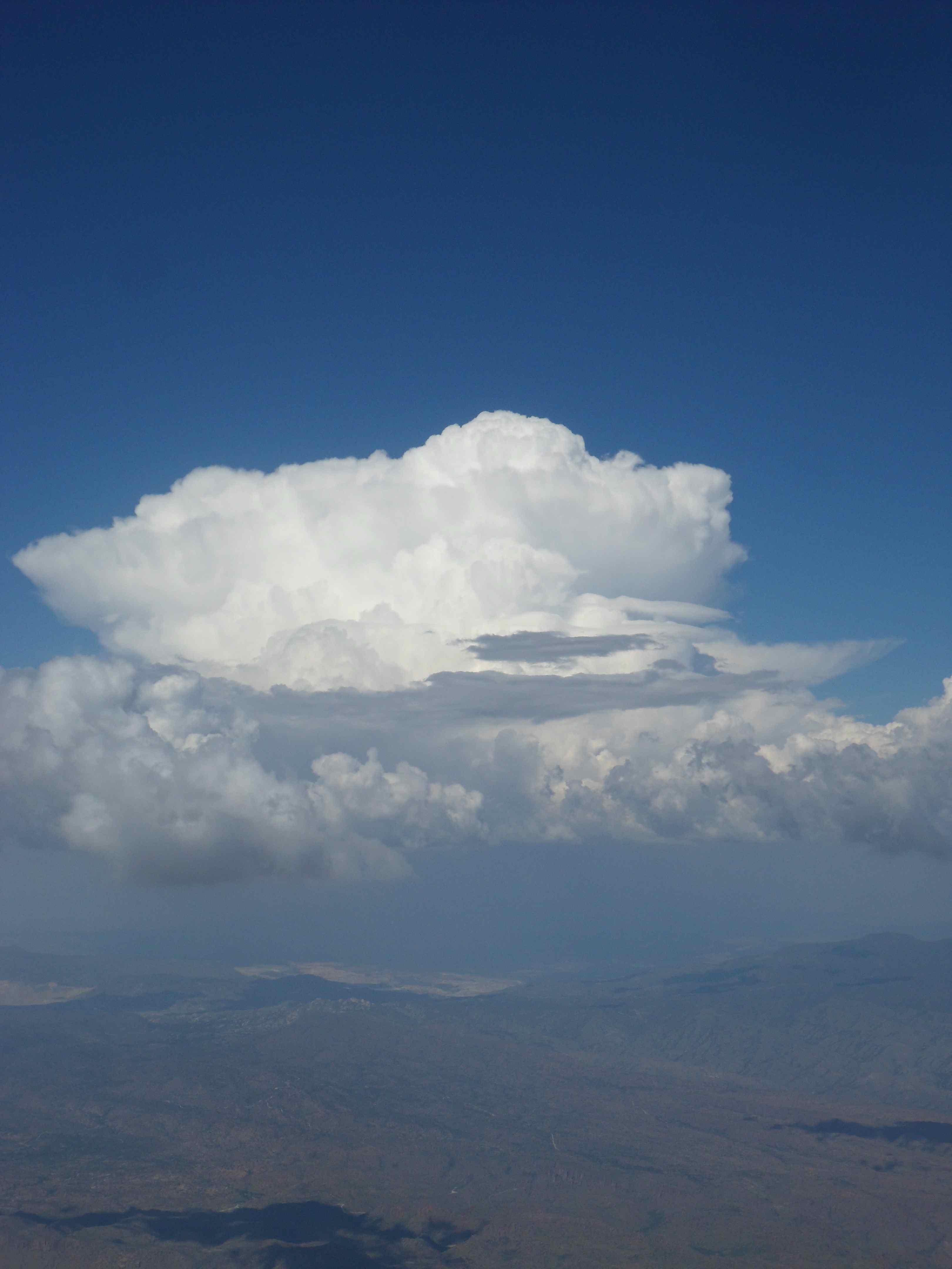
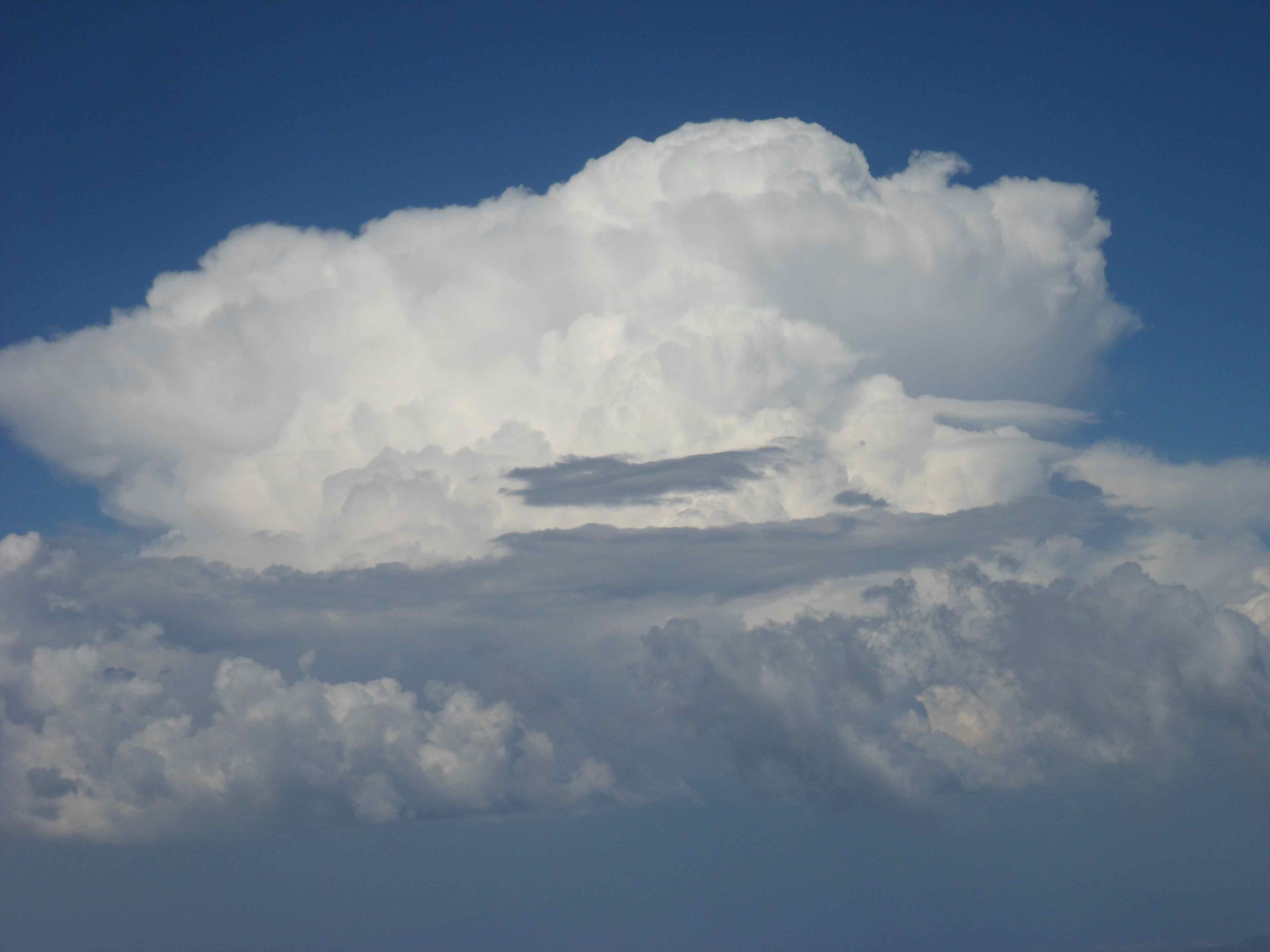
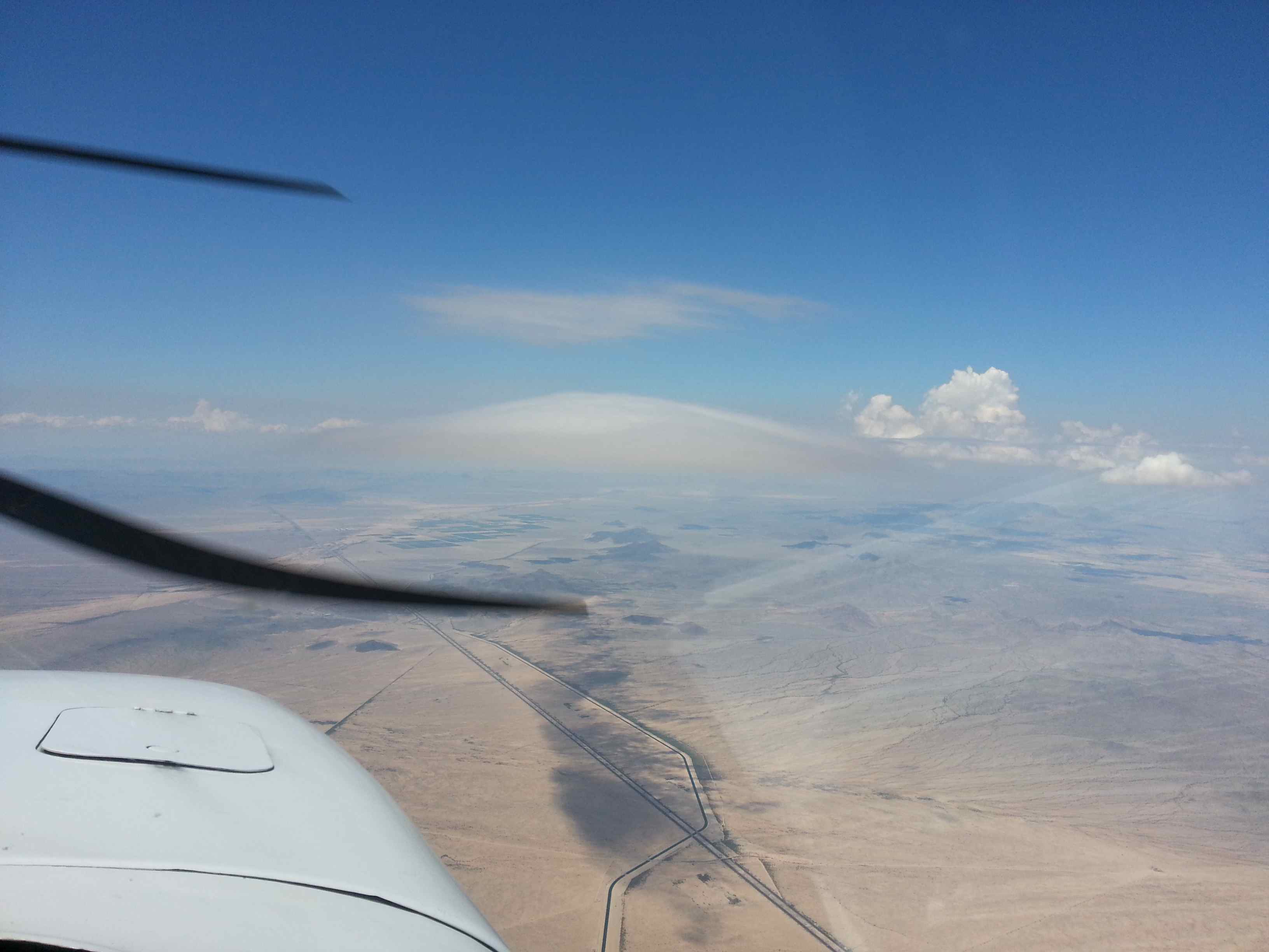
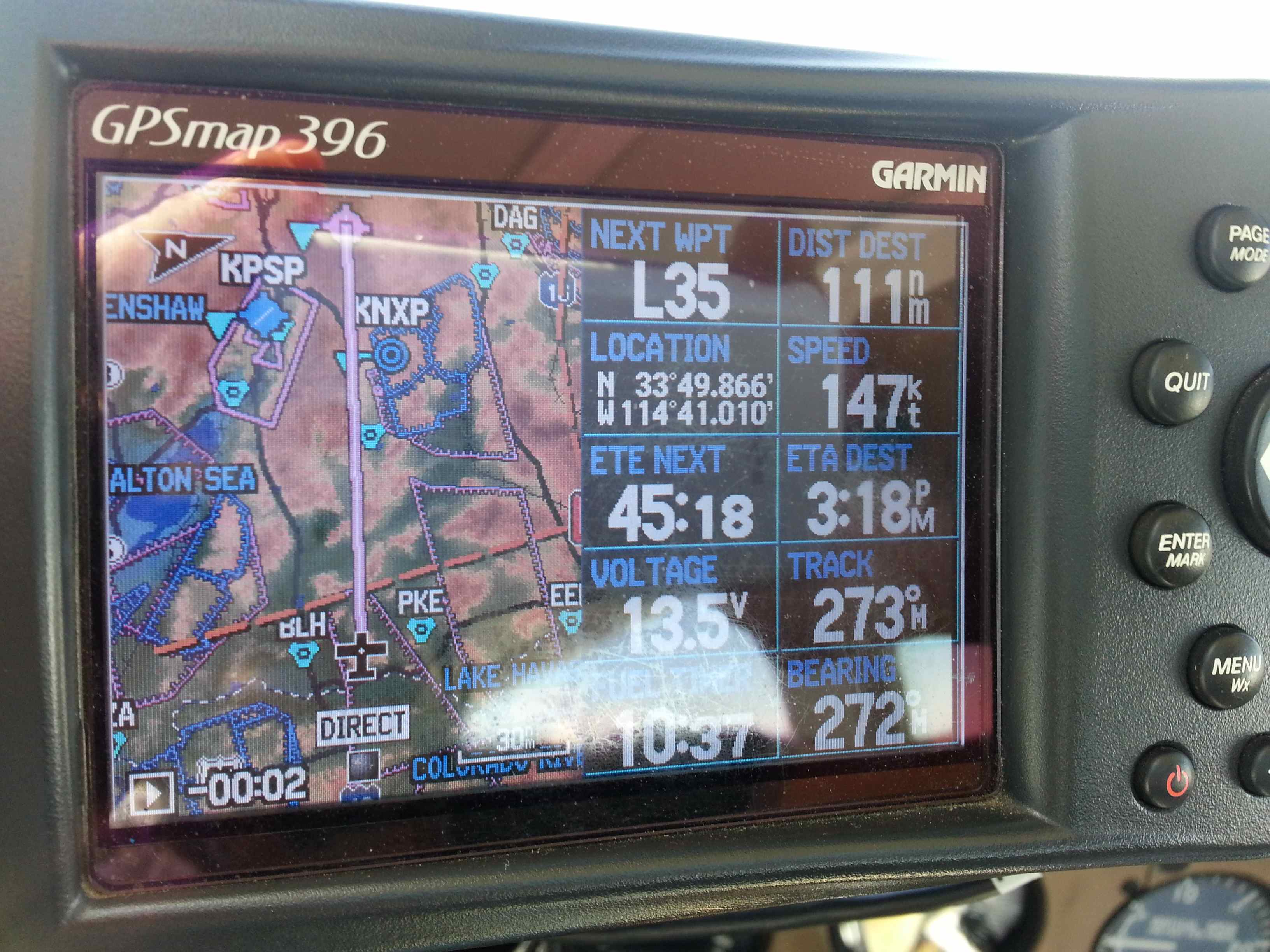
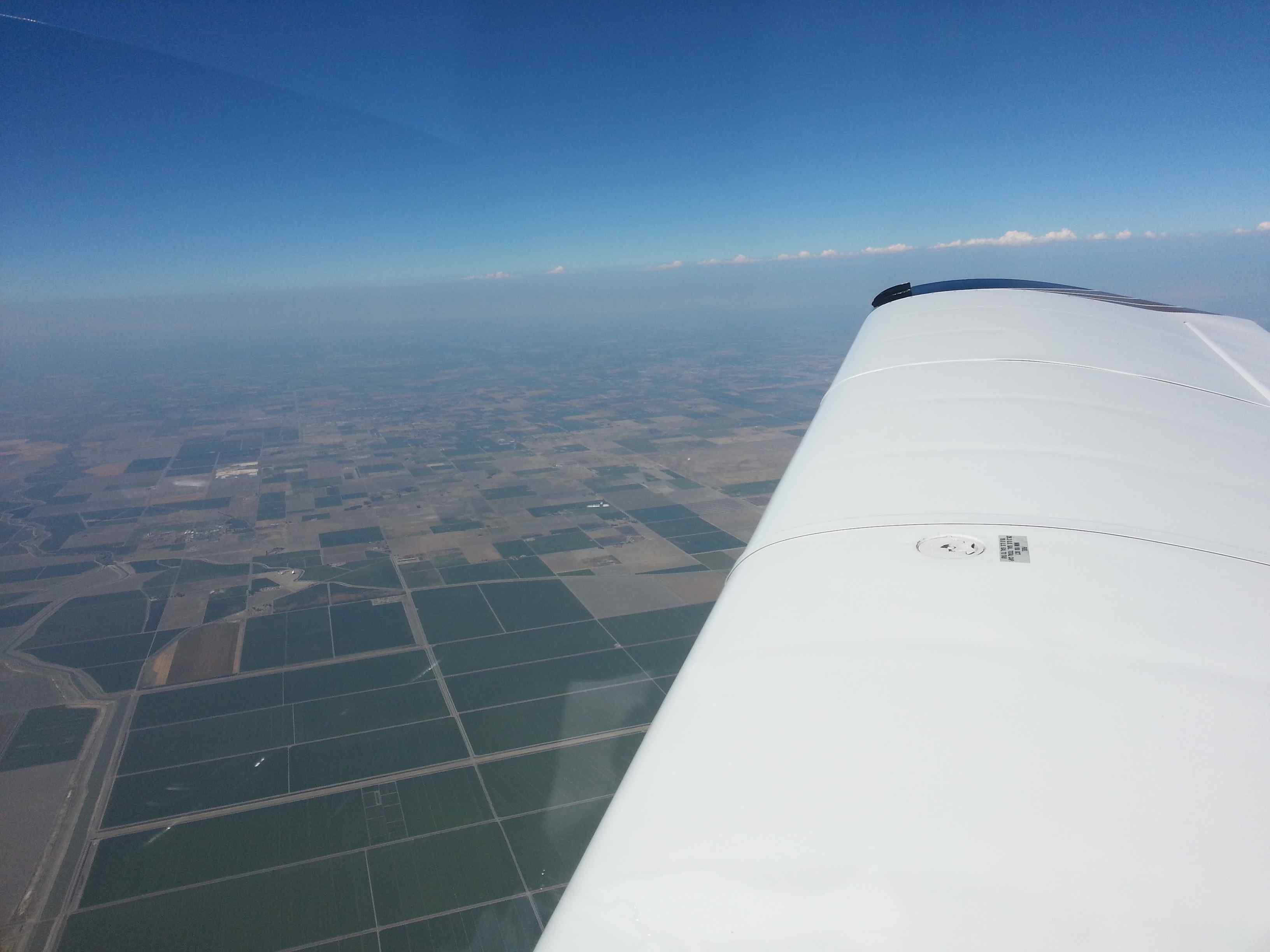
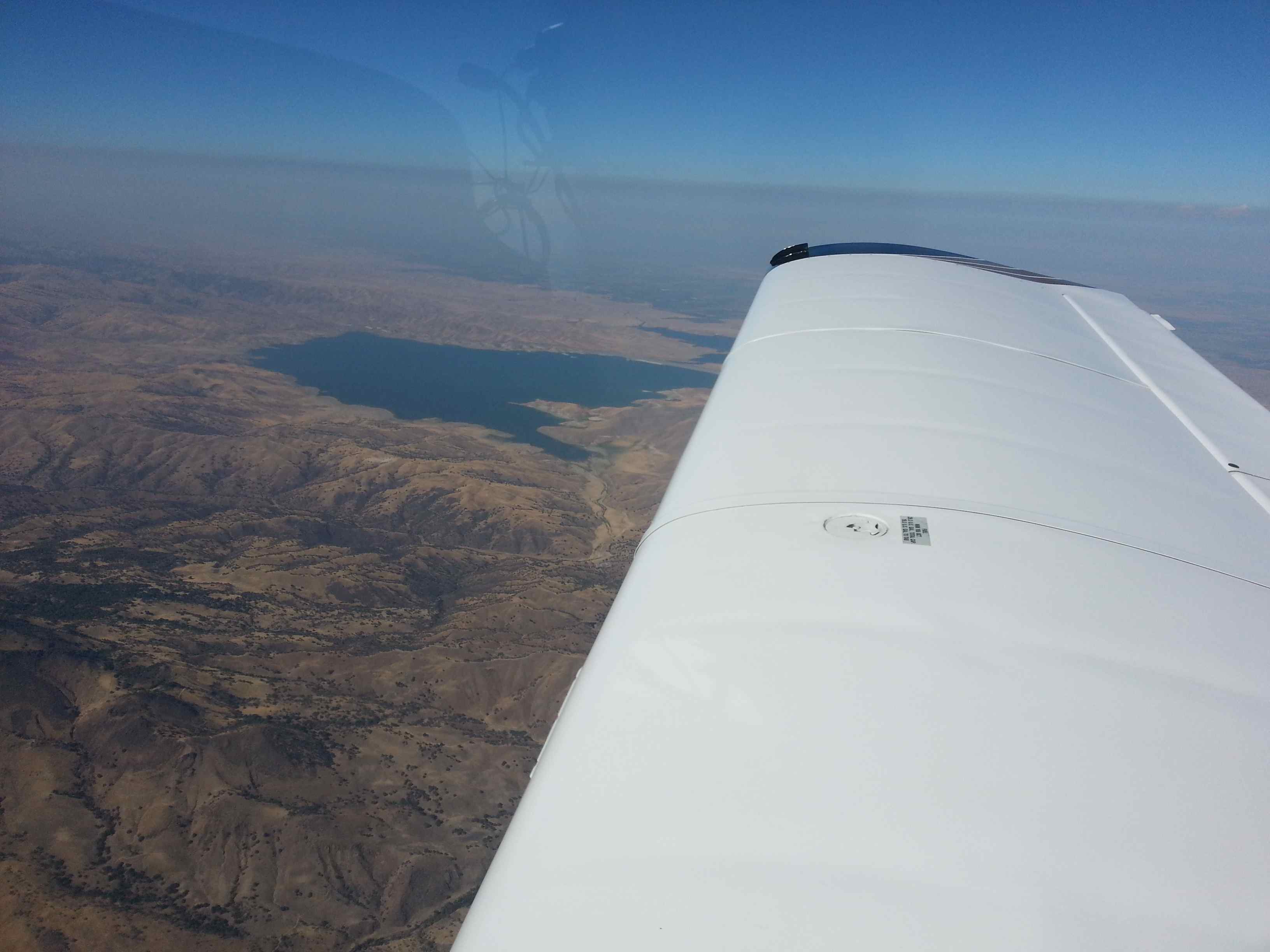
Switching frequencies from Reid Hillview Tower to NoCal approach, I picked up VFR flight following to Big Bear, CA (L35). The marine layer was very prominent this morning in the Monterey Bay with thick overcast lurking over into the next valley. I made my way into the central valley, where I leveled at cruising altitude at 9500ft. There was the occasional jet traffic that was called out for me but nothing that came close into my flight path. A quick check at the weather showed the unstable airmass at my destination with tops already popping. I figured that as long as the significant weather stayed to the west I could make my way into the high altitude airport. Density altitude was reported at 8000ft – doable, at least that’s what the POH said. As I was leaving the central valley south of Bakersfield I spotted a famous glider port and a race track. XM weather was now showing lightning less than 10 miles towards the west of Big Bear airport. Density altitude had risen to 8600ft by then. Apparently someone was trying to ensure that I wasn’t going to land at L35 during this trip. Somewhat frustrated I took a picture of the now impressive Cb towering close to the airport and informed ATC of my new plans: to divert to, – you guessed it -Barstow-Dagget on the desert floor, 20 miles to the north east.
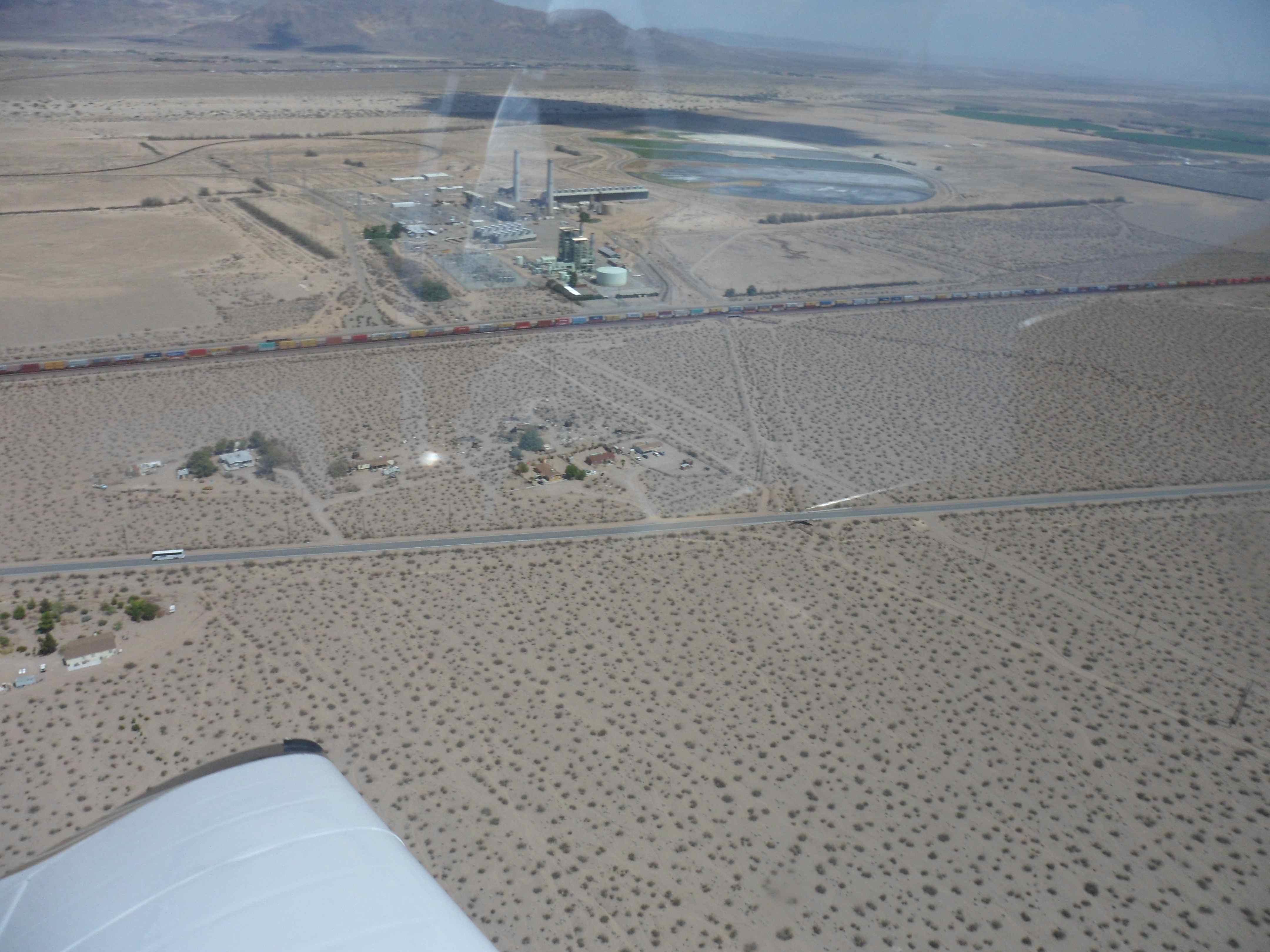
On descend I raced a cargo train paralleling the runway into the airport – OK, that wasn’t really a race. Later, I should catch that very same train during climb out again – it was that slow 🙂
The line man remembered me from five days ago and after a quick chat and phone call ahead to the airport for my next planned fuel stop I was again on my way. To save some time I departed from mid-field, which was met by surprise from the locals. I got a: “Wind 280@4, remaining runway 3400ft” over the radio – information I already knew. But apparently they were worried. I was not. I was by myself in the airplane and flying 400 lbs below gross weight. Acceleration was sluggish at first, but I had plenty of runway to spare by the time I was airborne. I probably wouldn’t do this departure with passengers (leaving runway behind you is always higher risk) but I didn’t see anything wrong with my decision – I did the math before and didn’t just blindly take off… the freedom and responsibility that comes with flying from uncontrolled airports under VFR flight rules…
On the climb out I was hugging the mountains to the south to catch some lift from the developing thermals. I managed to climb between 800-1200 fpm which is really good for the Tiger in these warm temperatures. Back at altitude I was trying to pick up flight following again, but to no avail. The briefer had mentioned a radar coverage outage east of LA – I was flying right in the middle of it. I checked back with Joshua Approach, the previous flight service station and they confirmed that I would be without coverage until the next pass – they didn’t mention that that pass was another 120NM away …
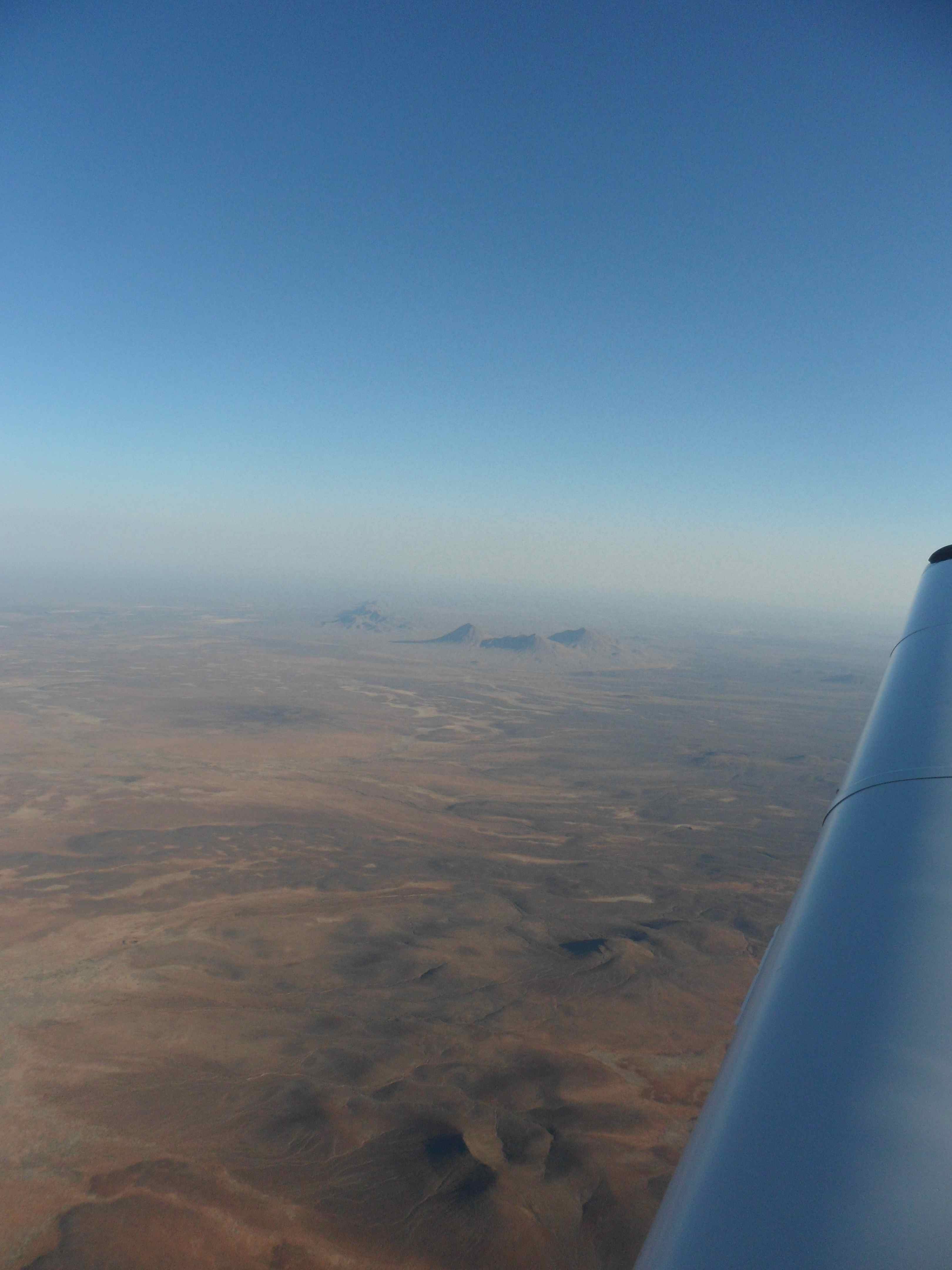
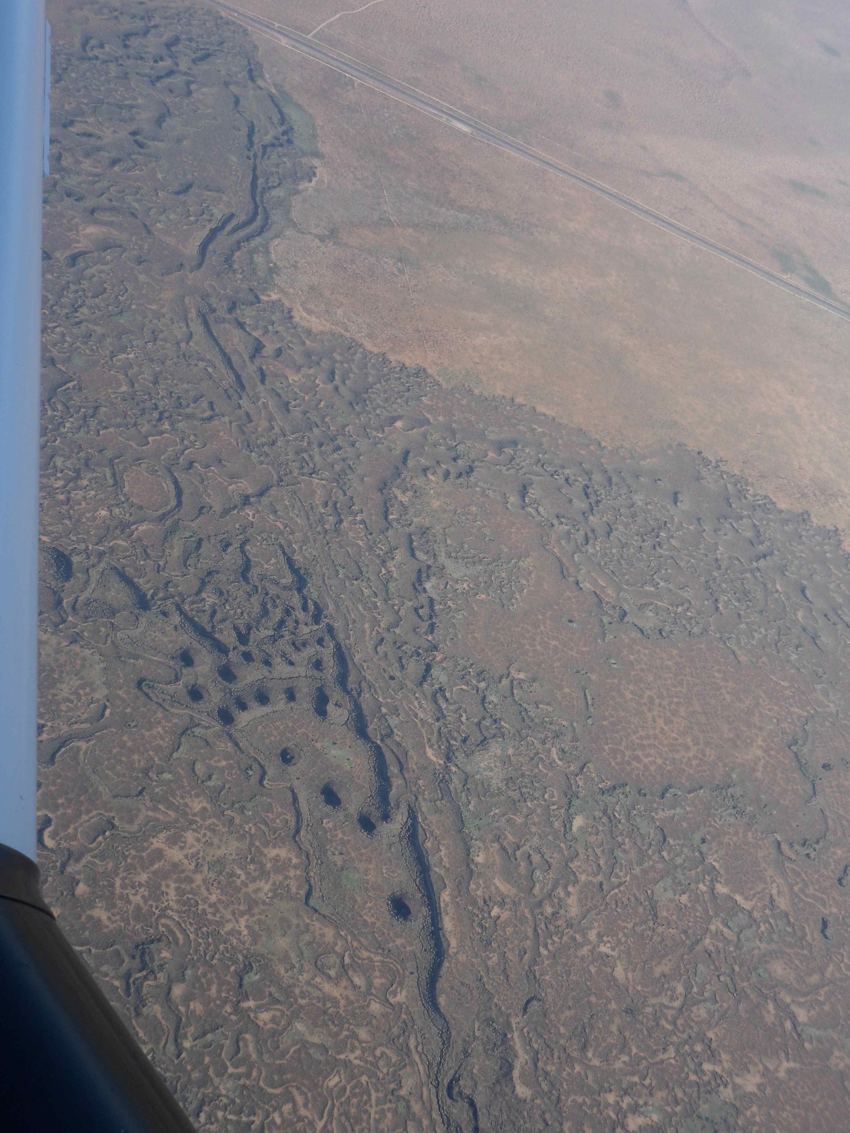
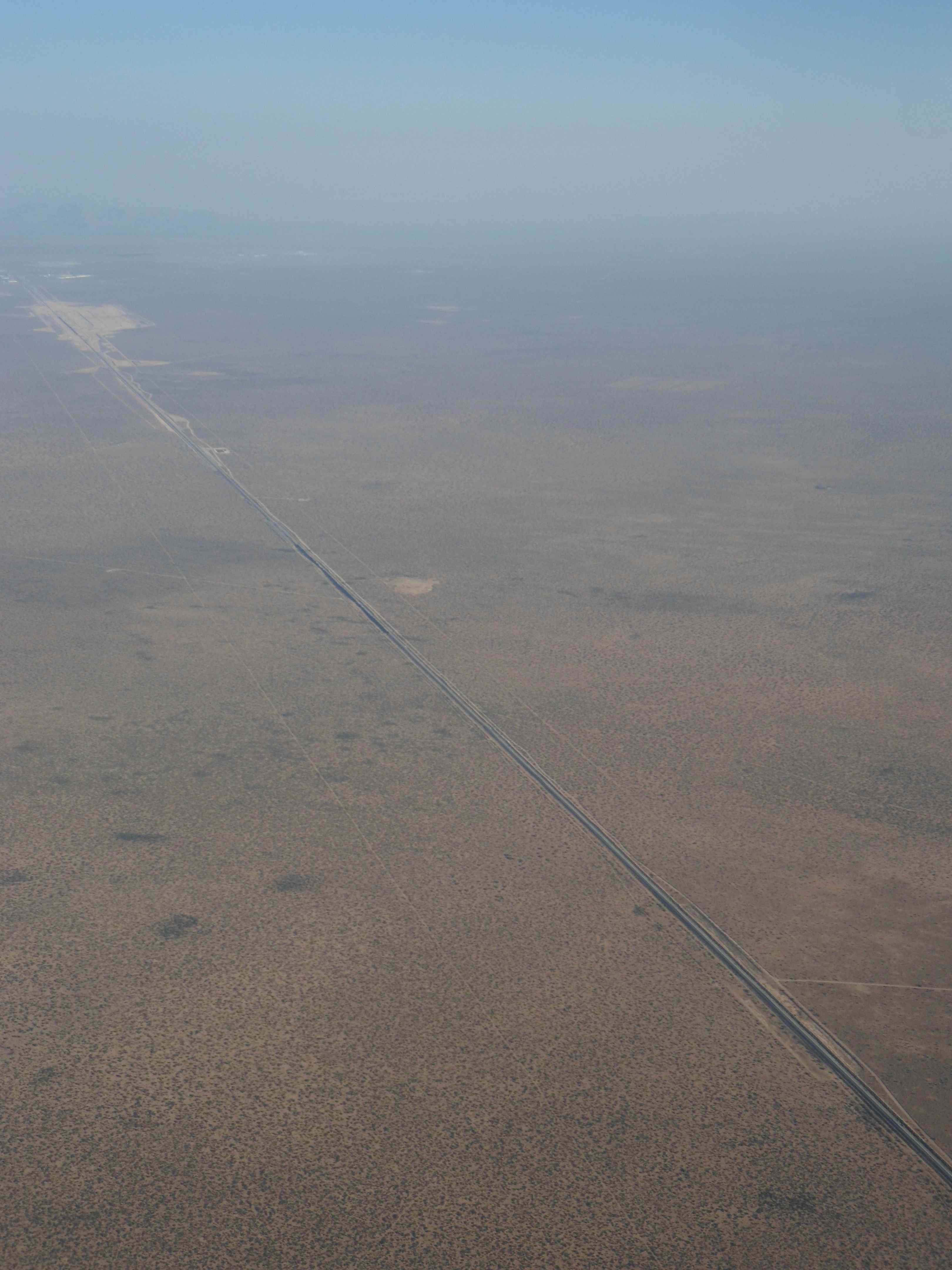
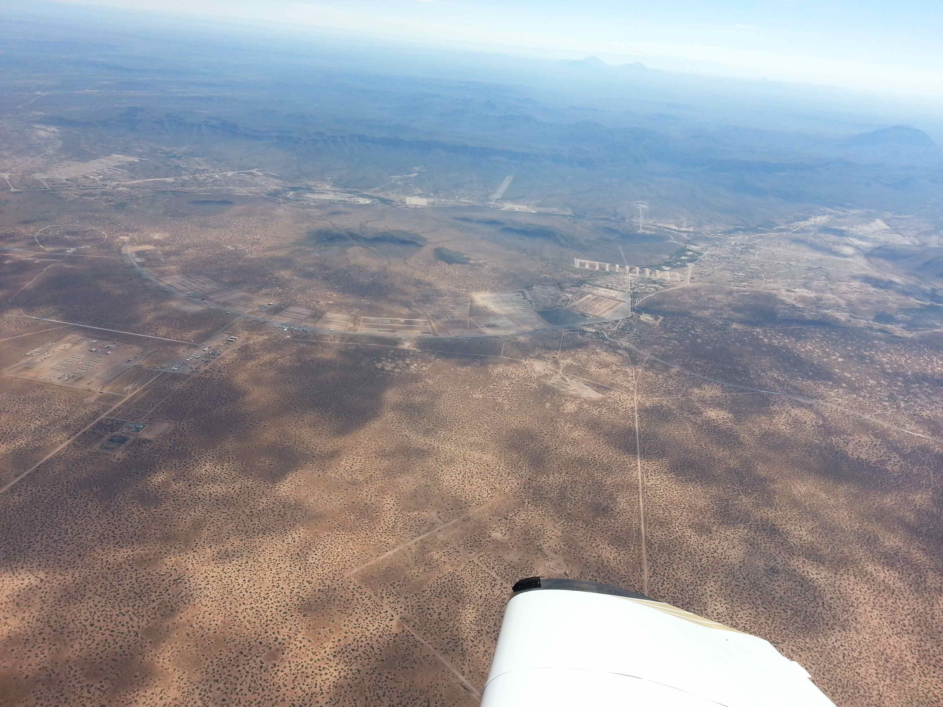
So I stayed on my 1200 VFR squawk and droned along over the desert trying not to hit anything. Well, that is a vast dramatization as I didn’t really see *anybody* for the next hour – it’s desert after all – and who’s crazy enough to fly VFR at 9.5k over deserted area? Not many, but I am.
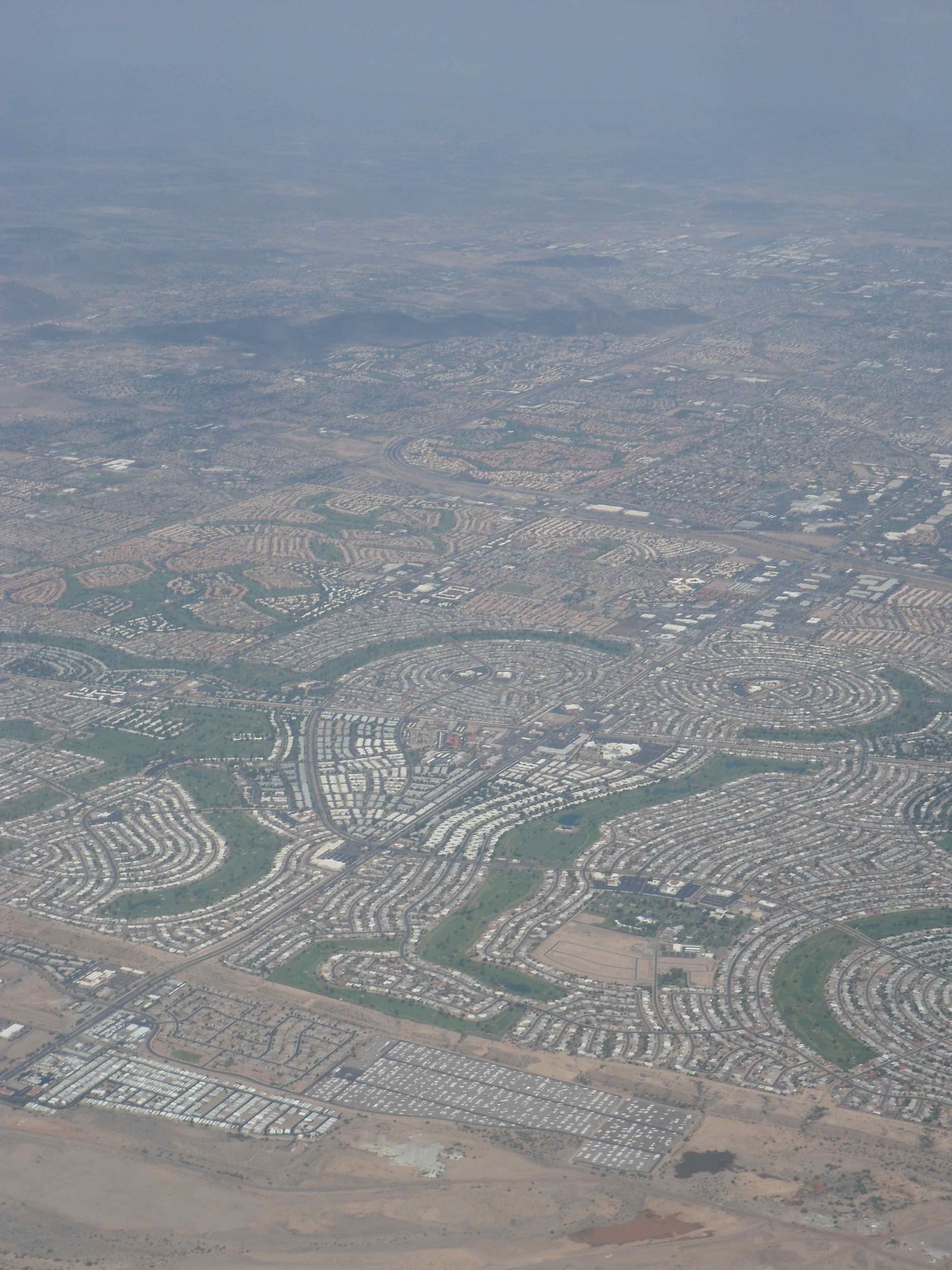
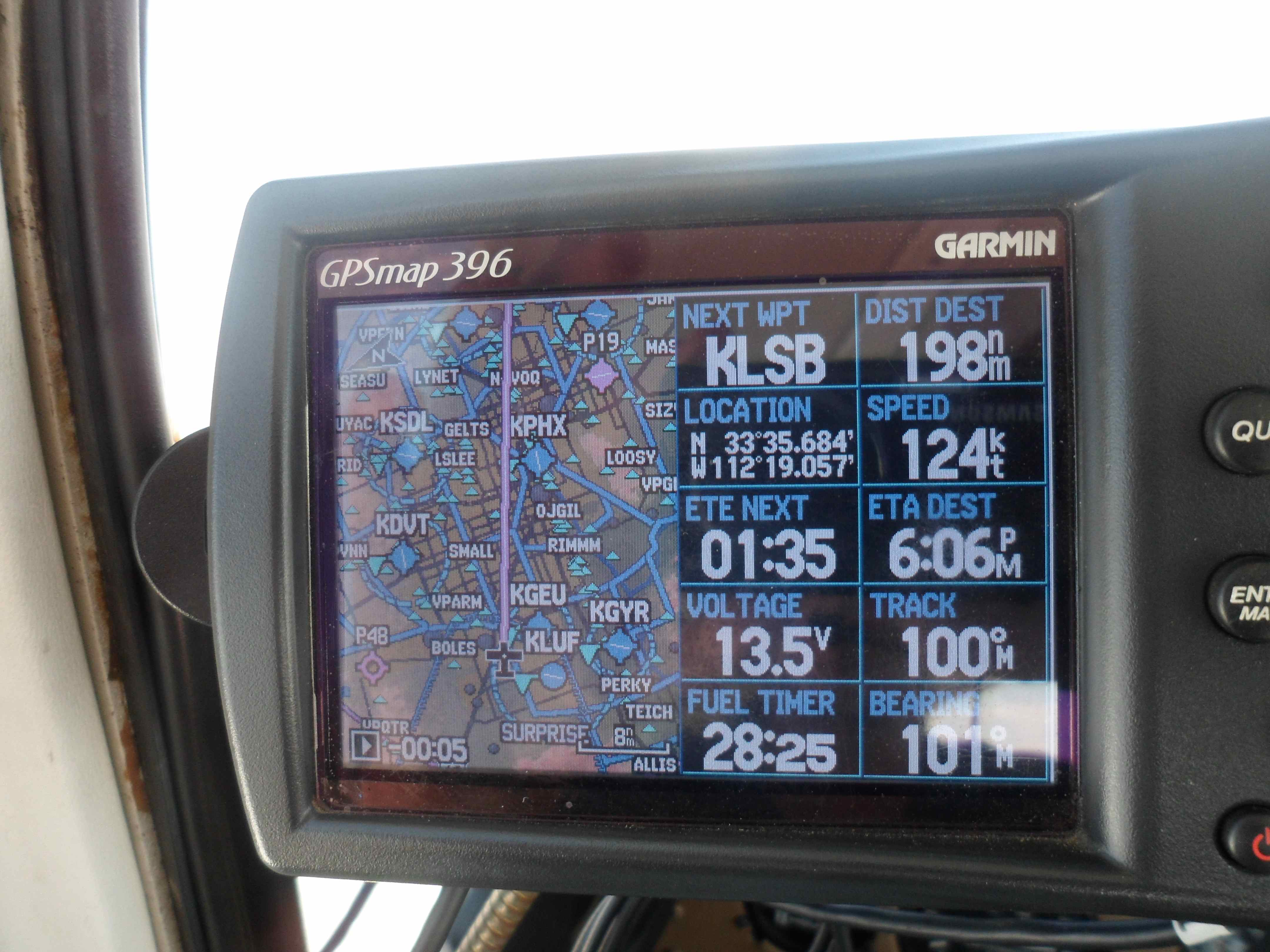
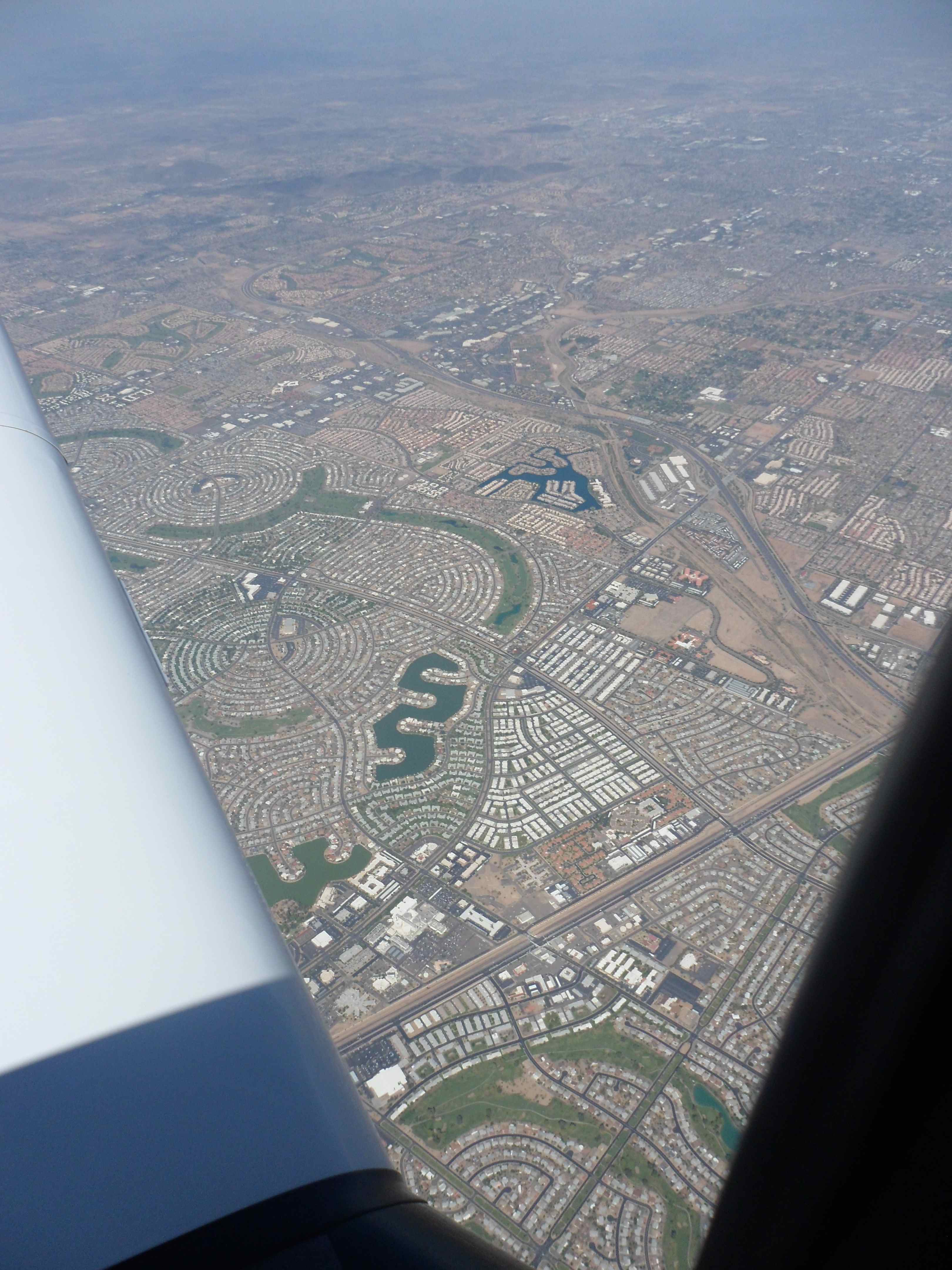
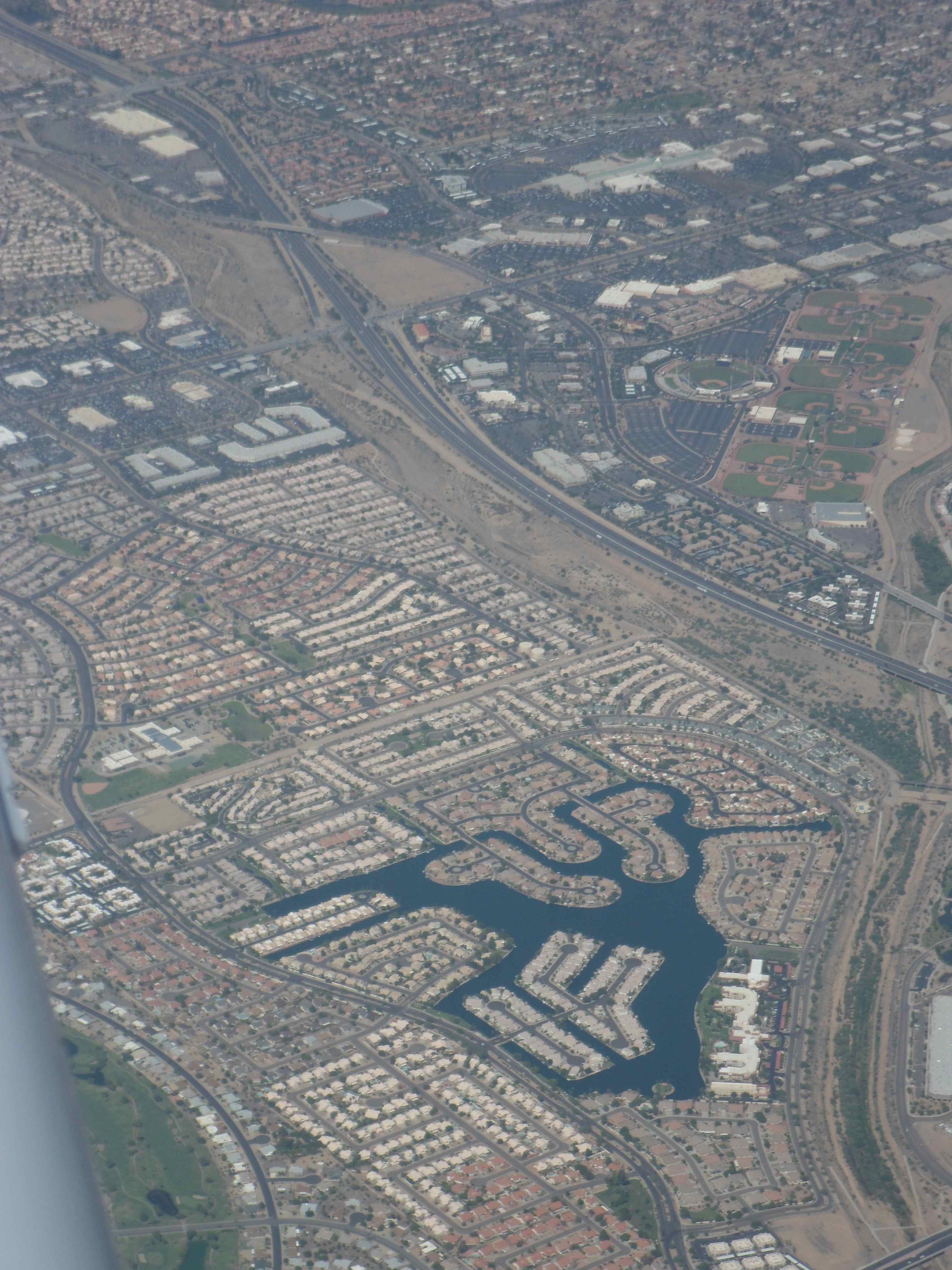
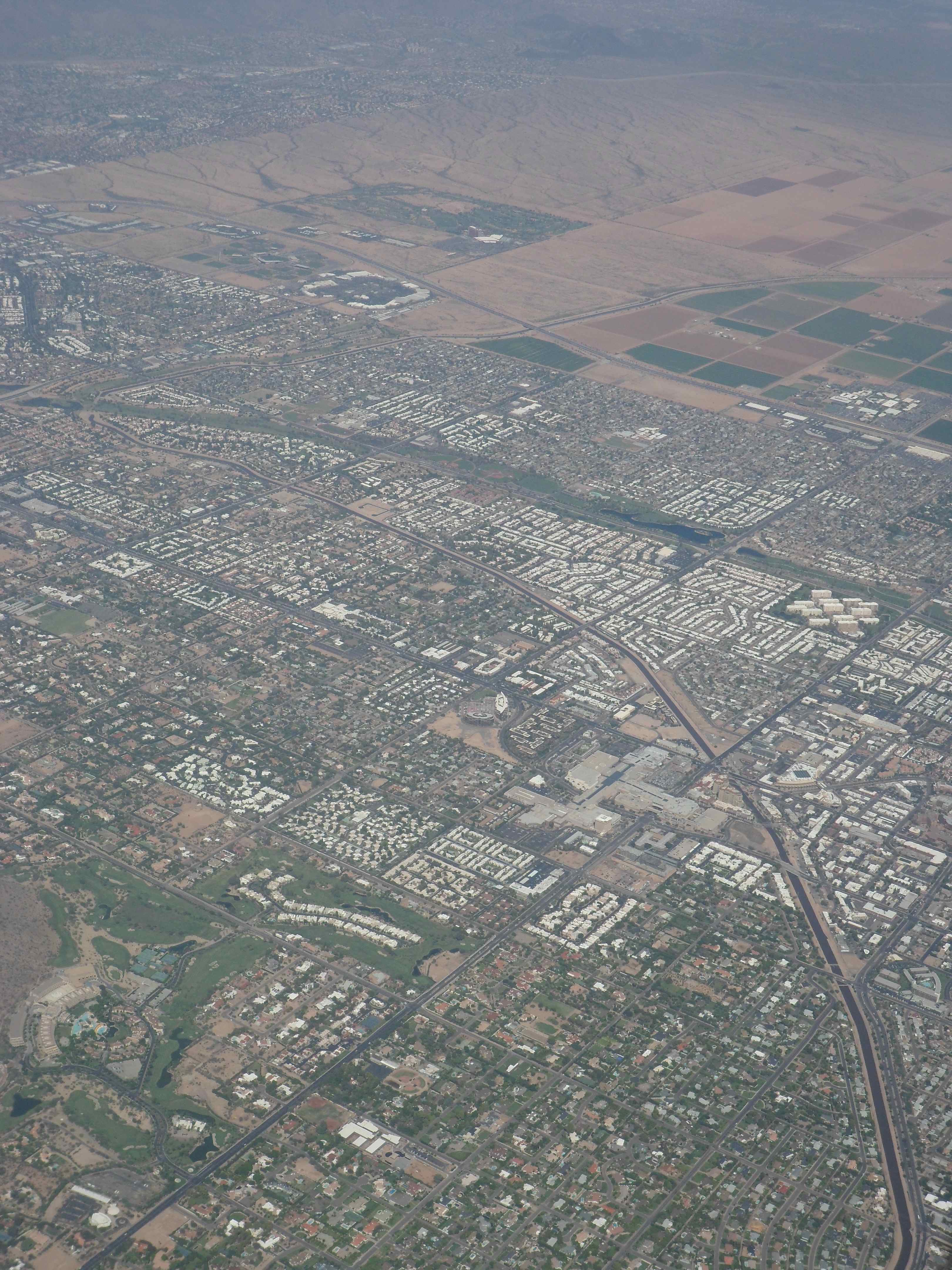
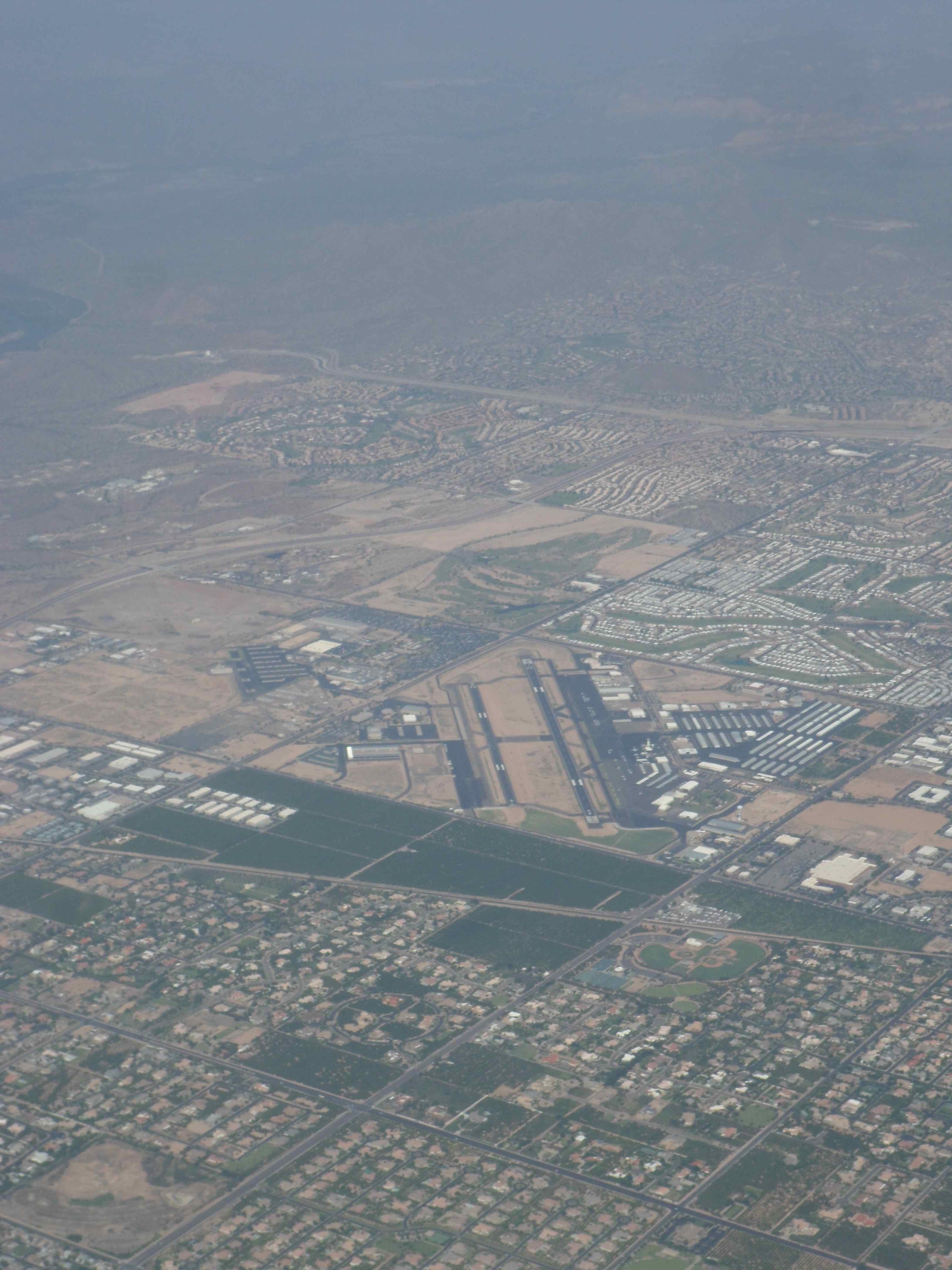
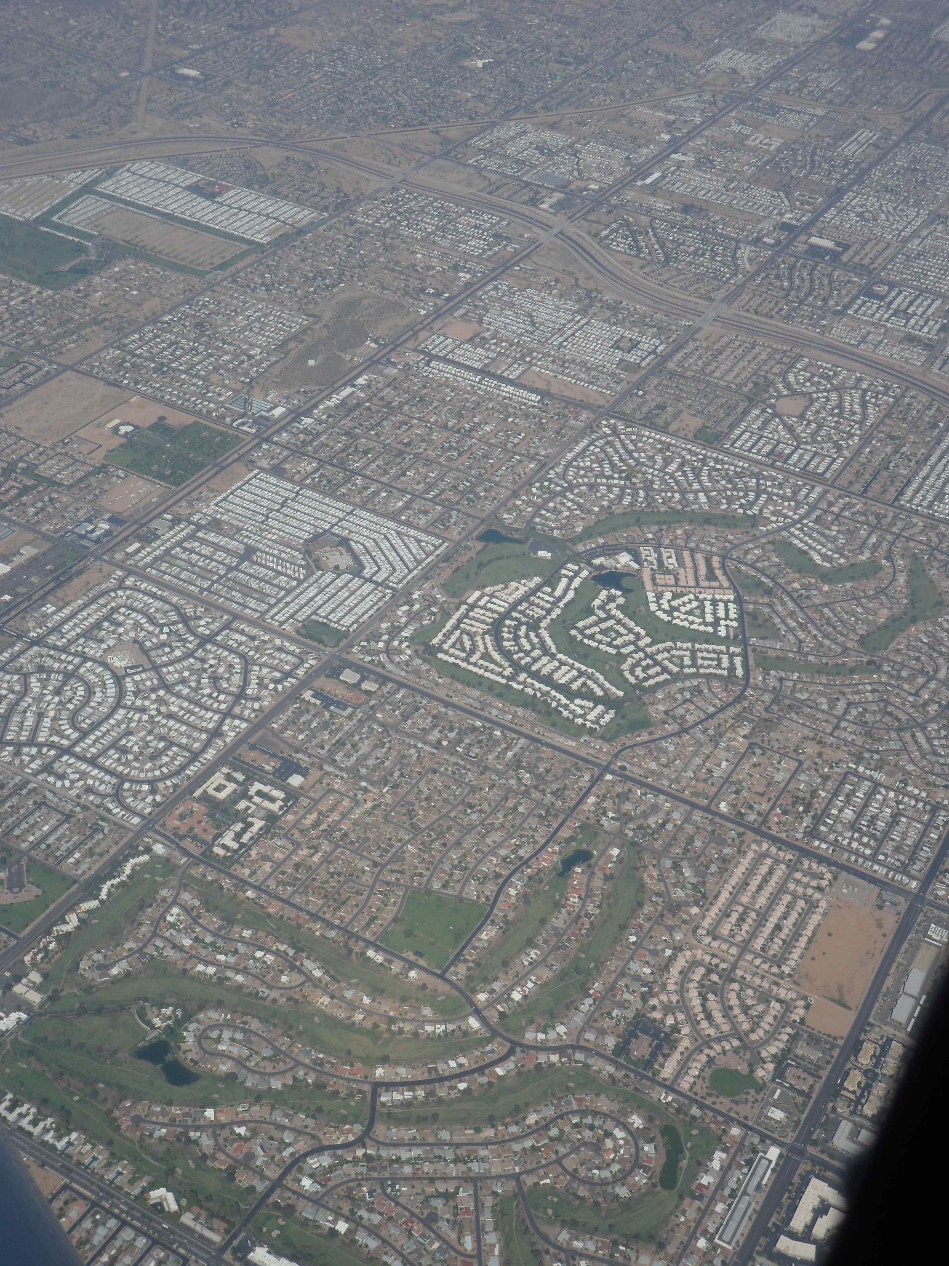
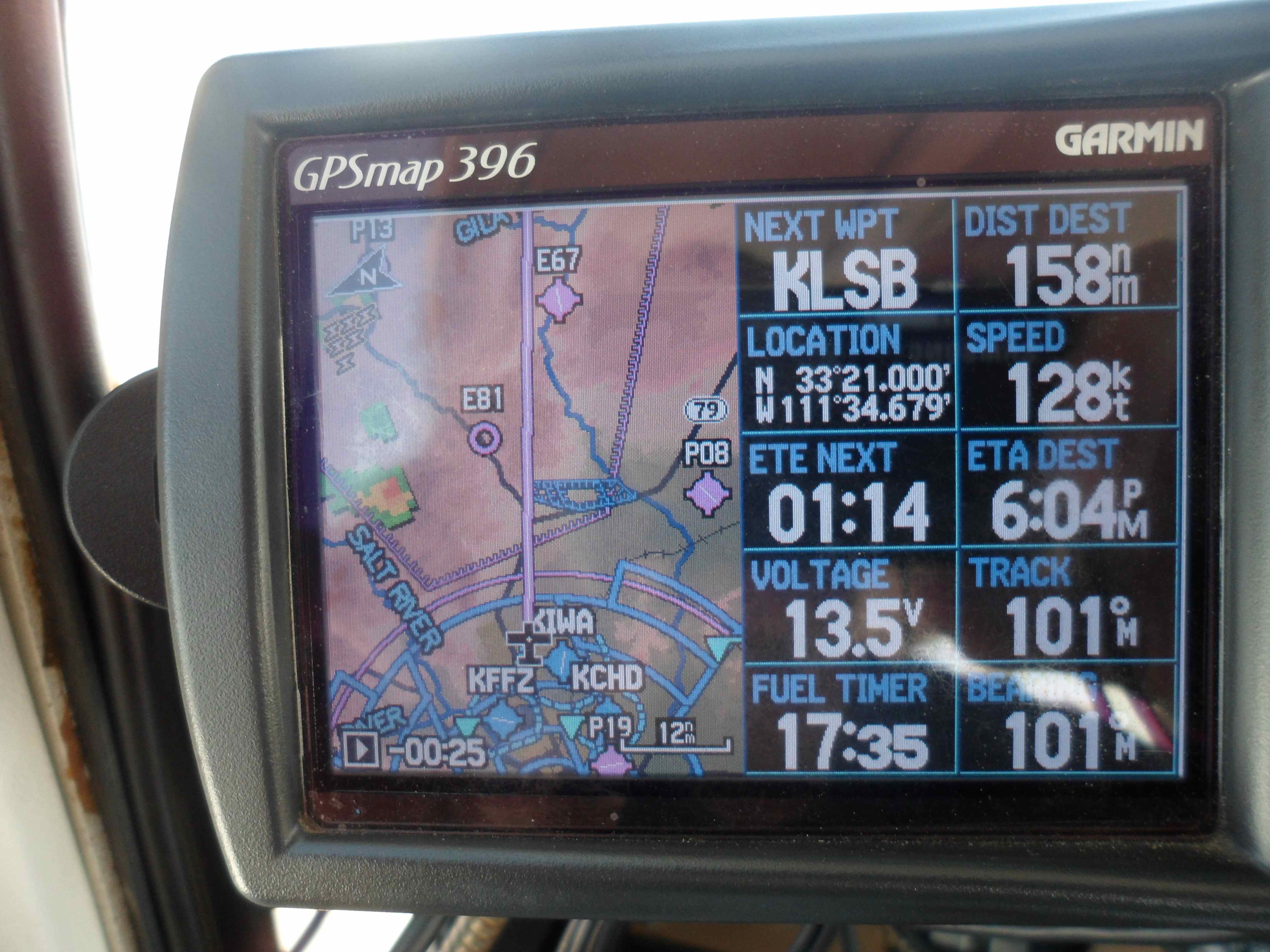
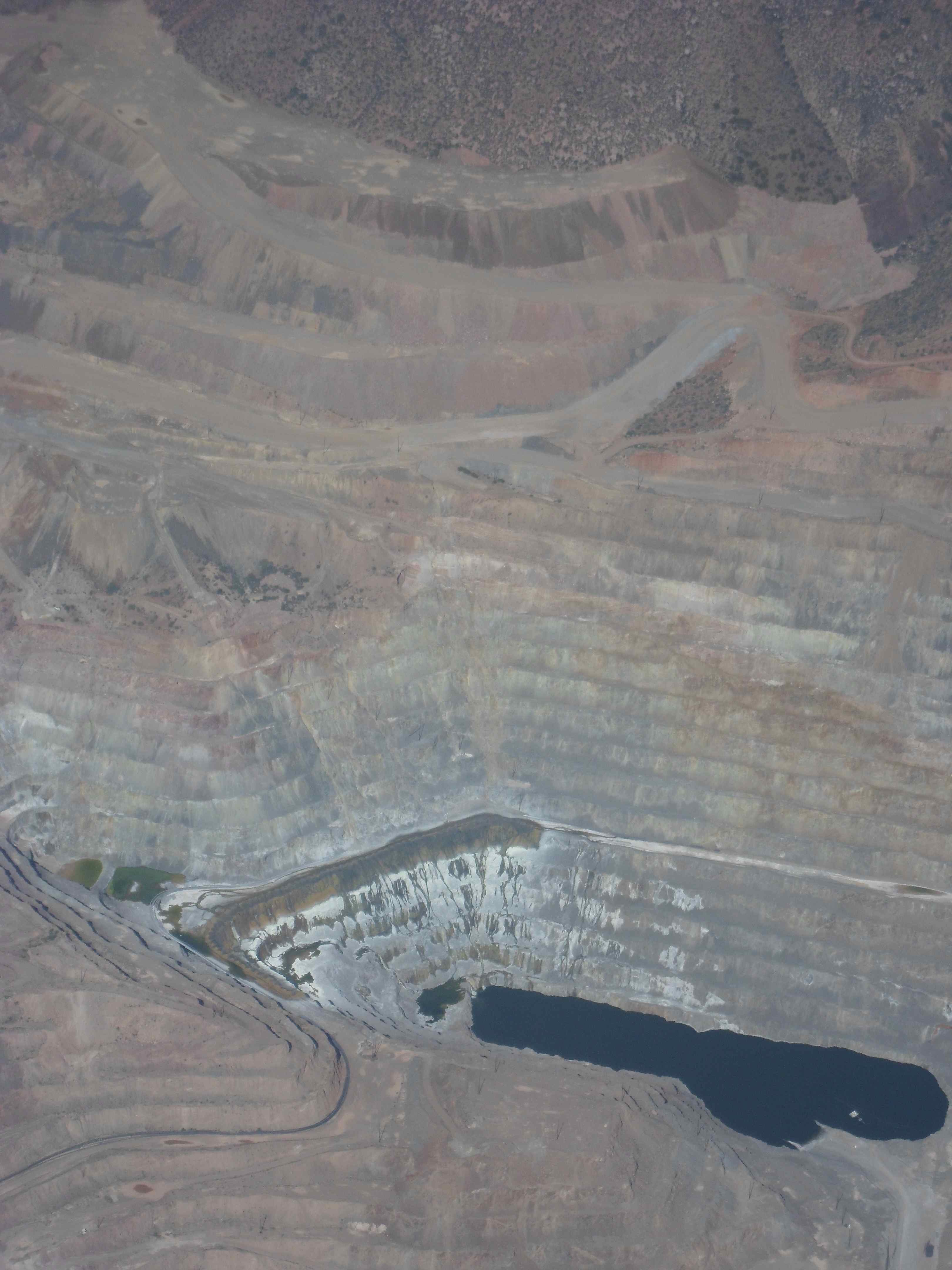
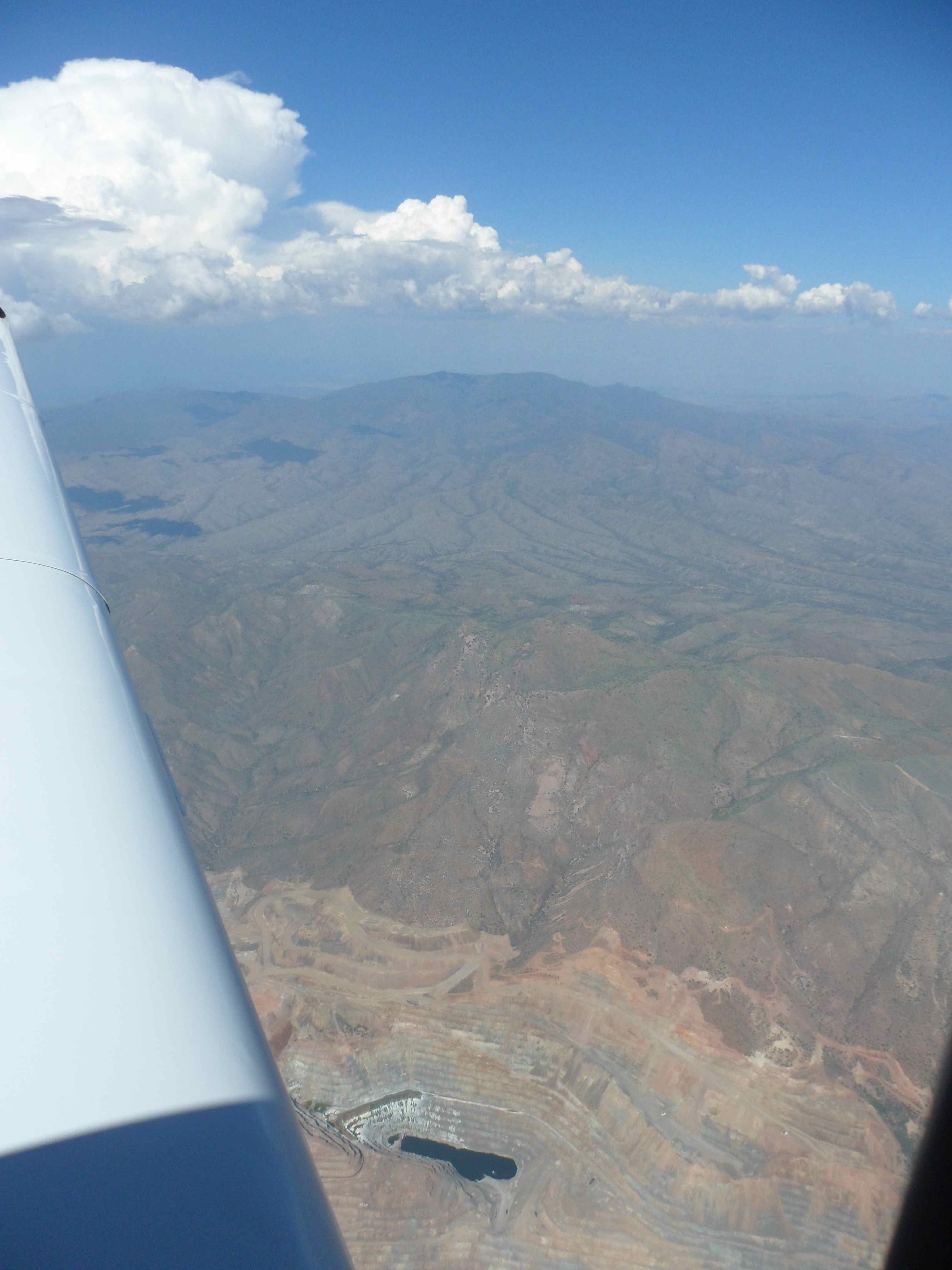
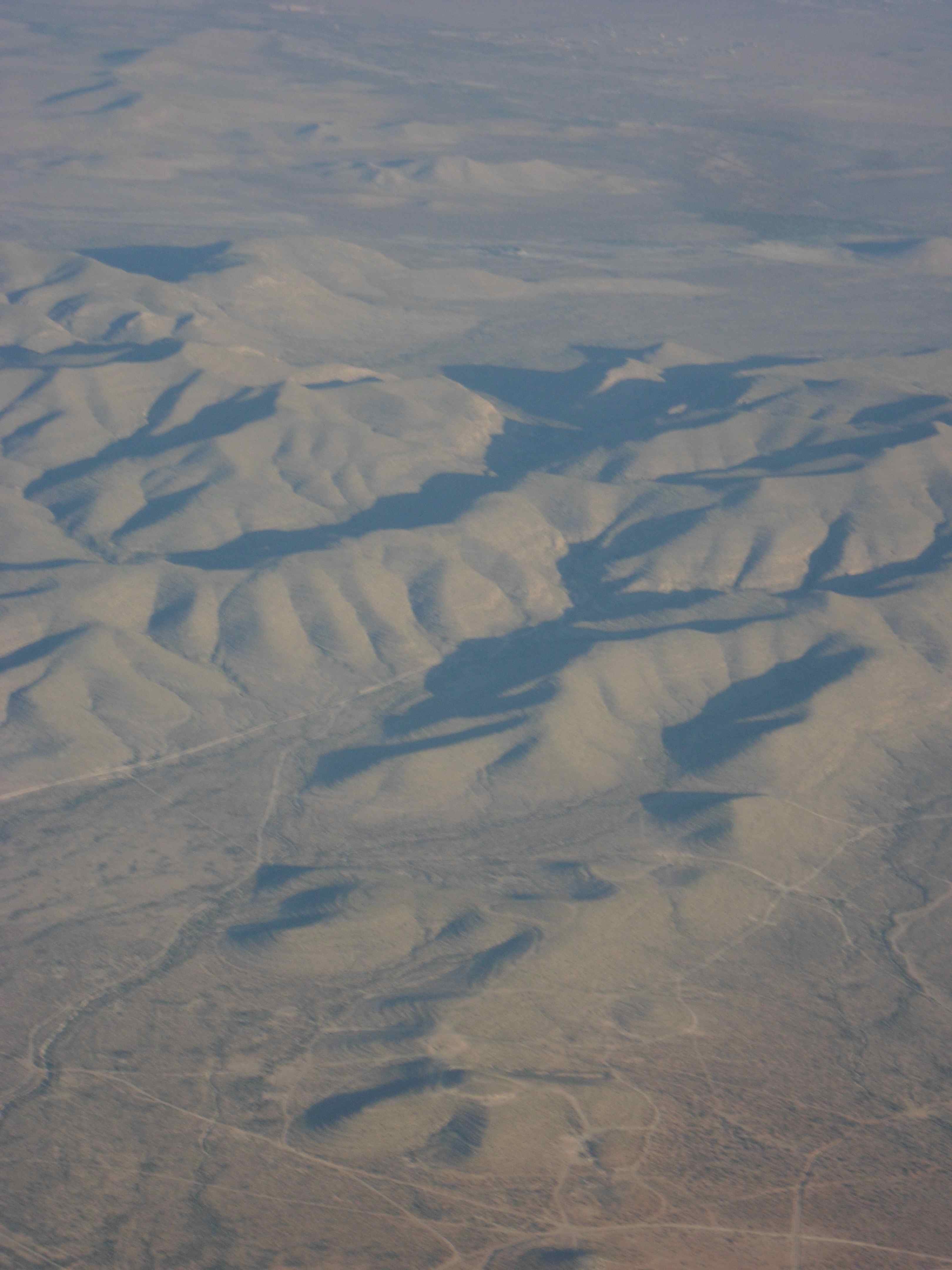
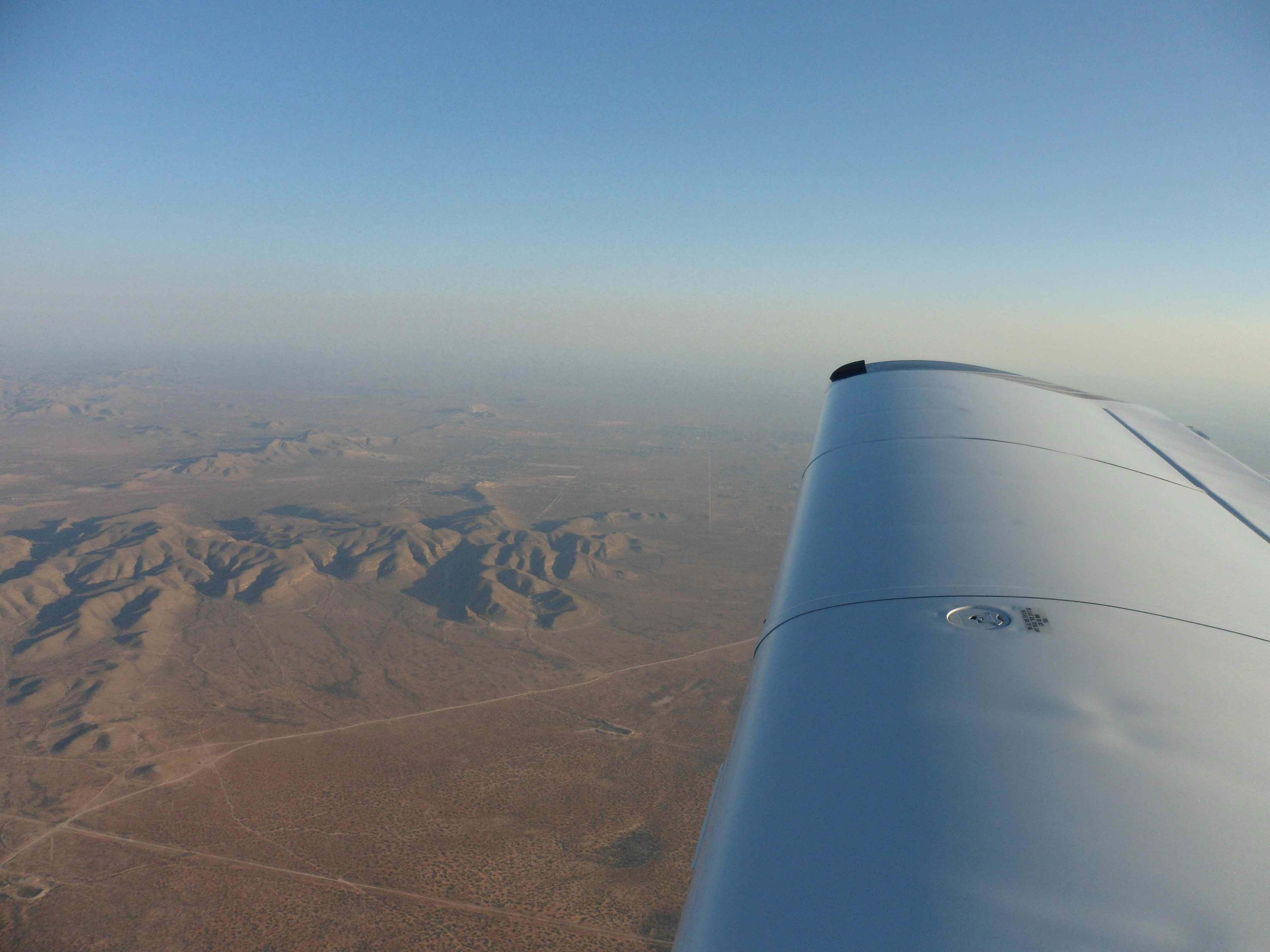
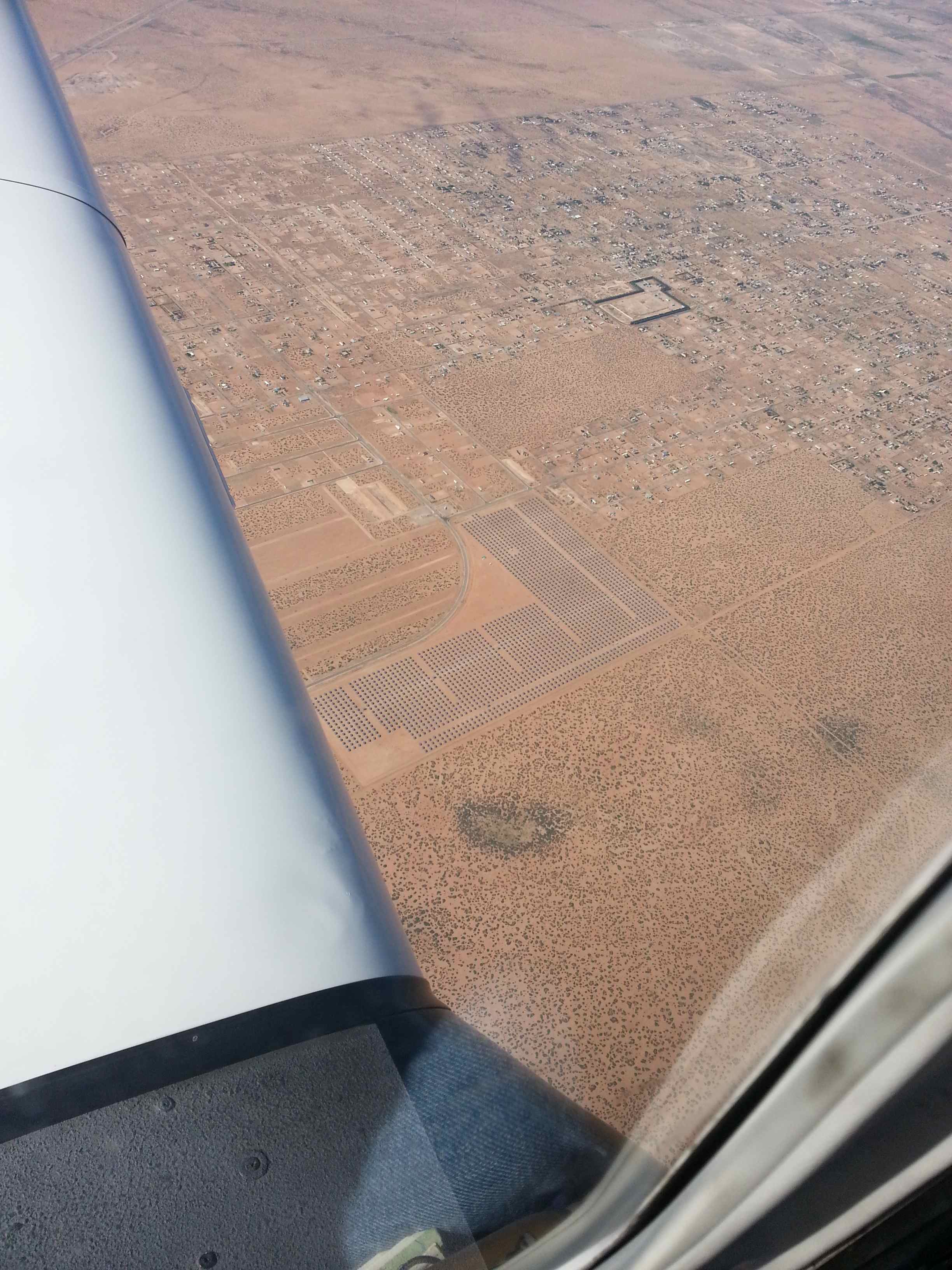
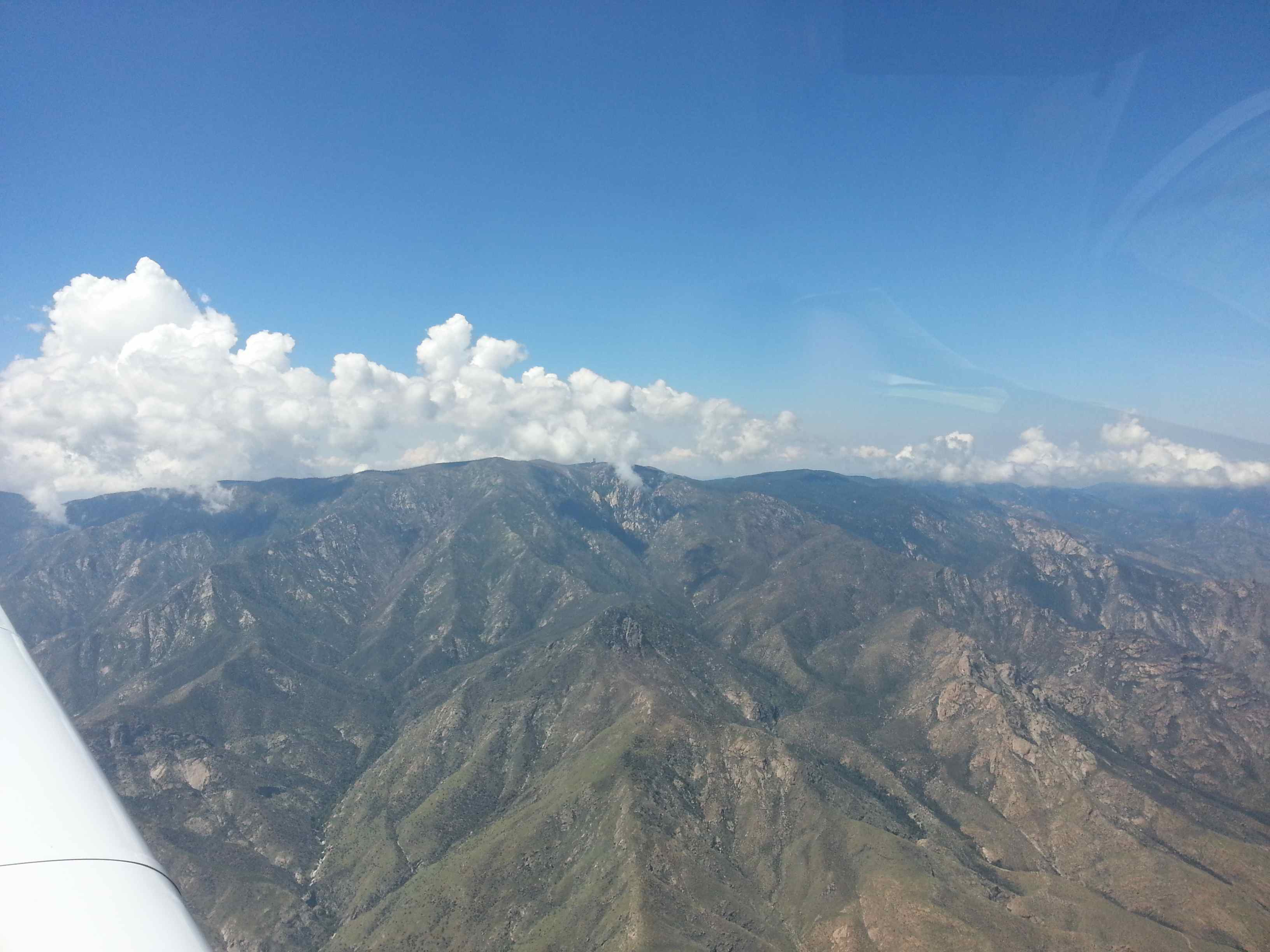
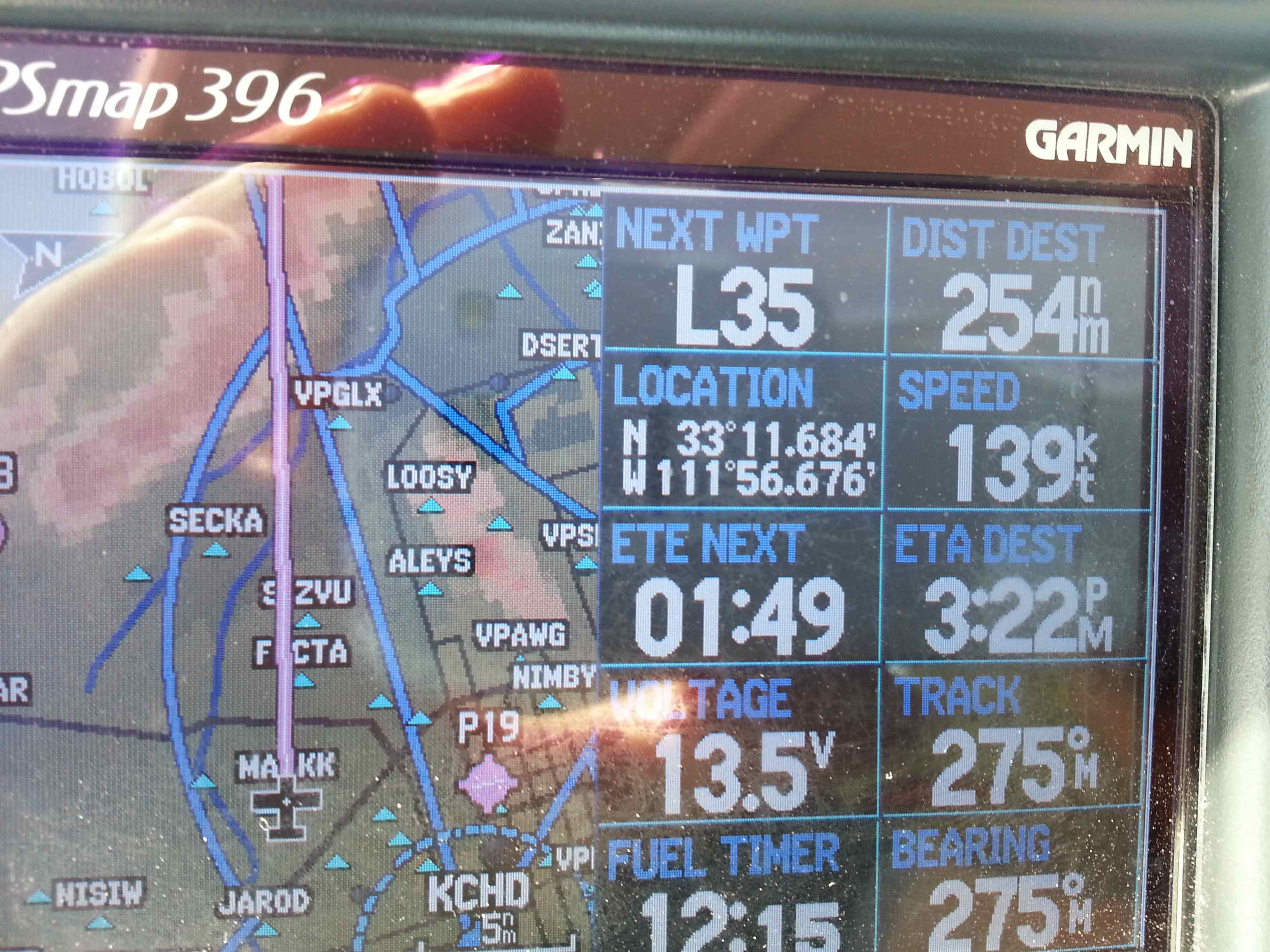
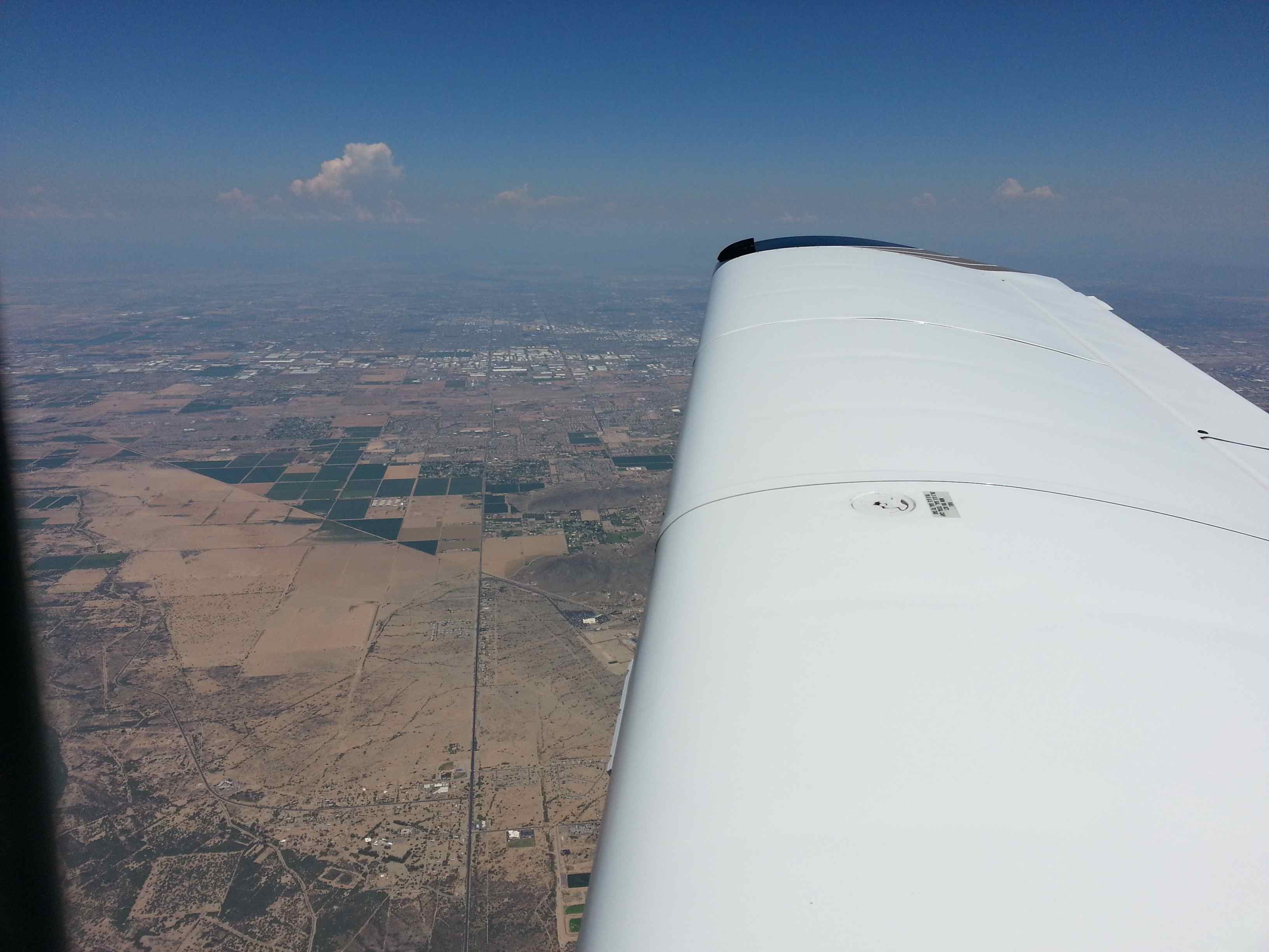
After a long lonely stretch I was approaching the Phoenix metropolitan complex from the northwest. There’s a large military jet training area depicted on the VFR terminal chart (the only Phoenix map remaining) warning of special FAR flight rules in effect. That got my attention. I was convinced these rules wouldn’t apply to me as I was flying higher than the restricted areas, but it wouldn’t hurt to ask. So I called the military approach if I needed to talk to them flying in 9.5k . They didn’t really answer. Instead they assigned me a squawk and asked me for my destination I was headed to. Friendliness military style. Nothing wrong with their answer but now I was stuck on their frequency… At least they handed me off to Phoenix approach as soon as I had passed the huge air force base. Phoenix approach was surprisingly quiet – maybe it had to do with the fact that I was passing the airspace to the north and not to the south, as I did earlier in the week. Approach was nice enough to warn me about the restricted area for UAVs towards the east of Phoenix Brave airspace – it extends all the way up to 18000ft. I was targeting the northern corner of it and I’m usually not very generous with horizontal clearance. 🙂 If they meant the area to be bigger they would have drawn a bigger box. But ATC was worried about me cutting into the edge so they gave me a recommended heading to satisfy their comfort level. I complied. After that I was back to flying into the unknown as I had not replenished the Phoenix sectional that was lost on the earlier flight (I tried at RHV but they were out of stock). But I remembered the terrain from the earlier flight and could fly by means of terrestic navigation and the support of my GPS and moving map.
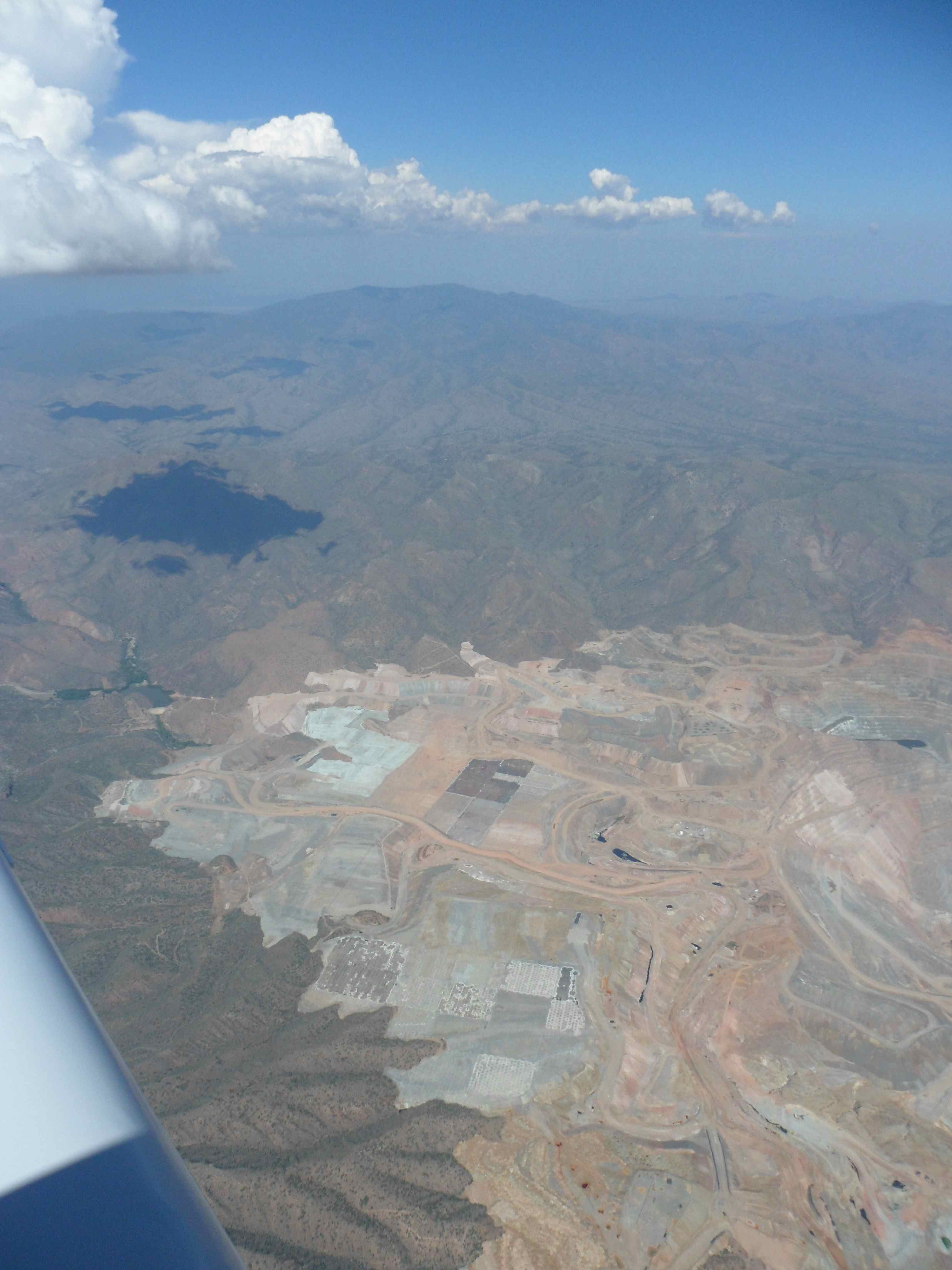
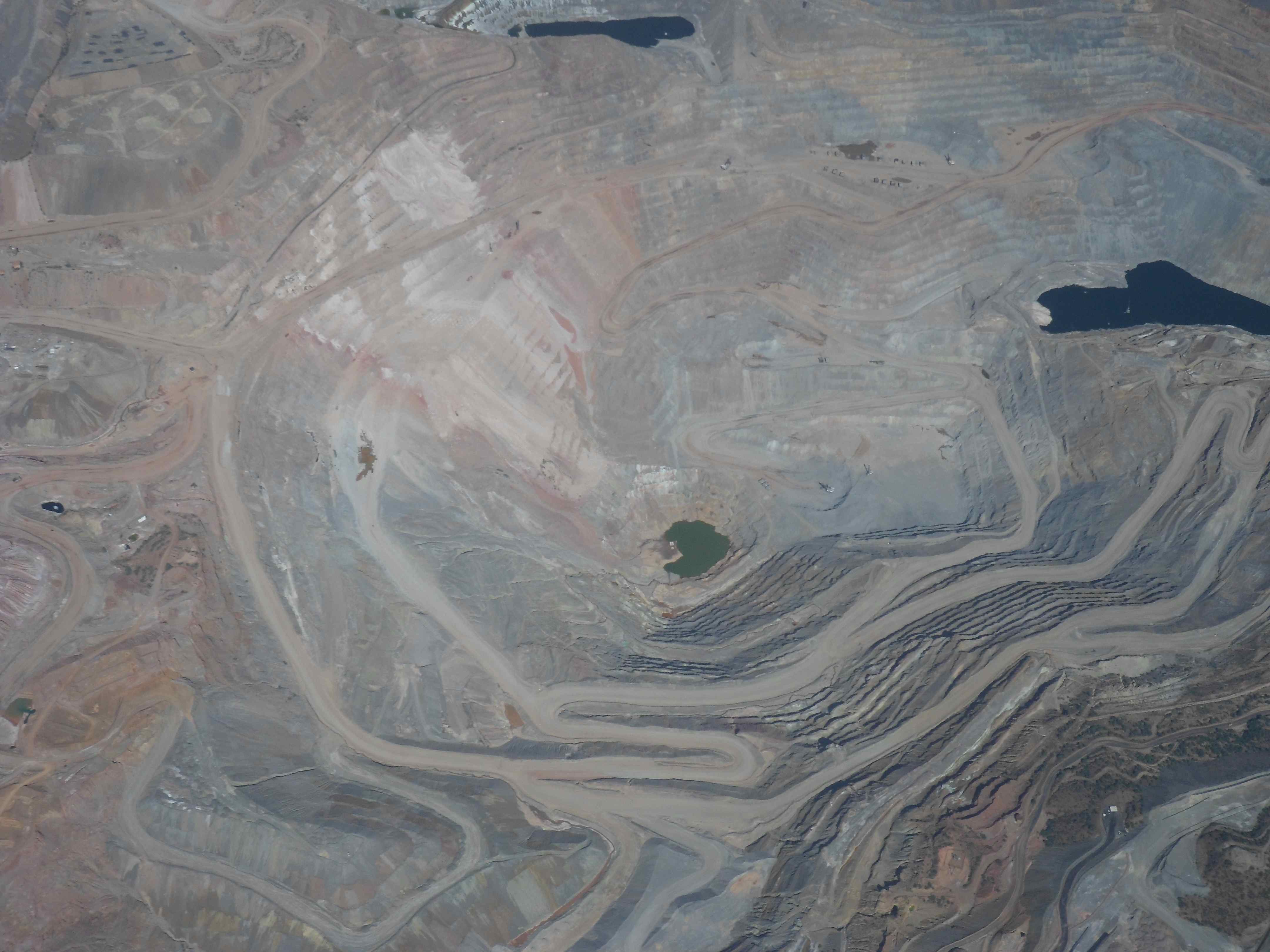
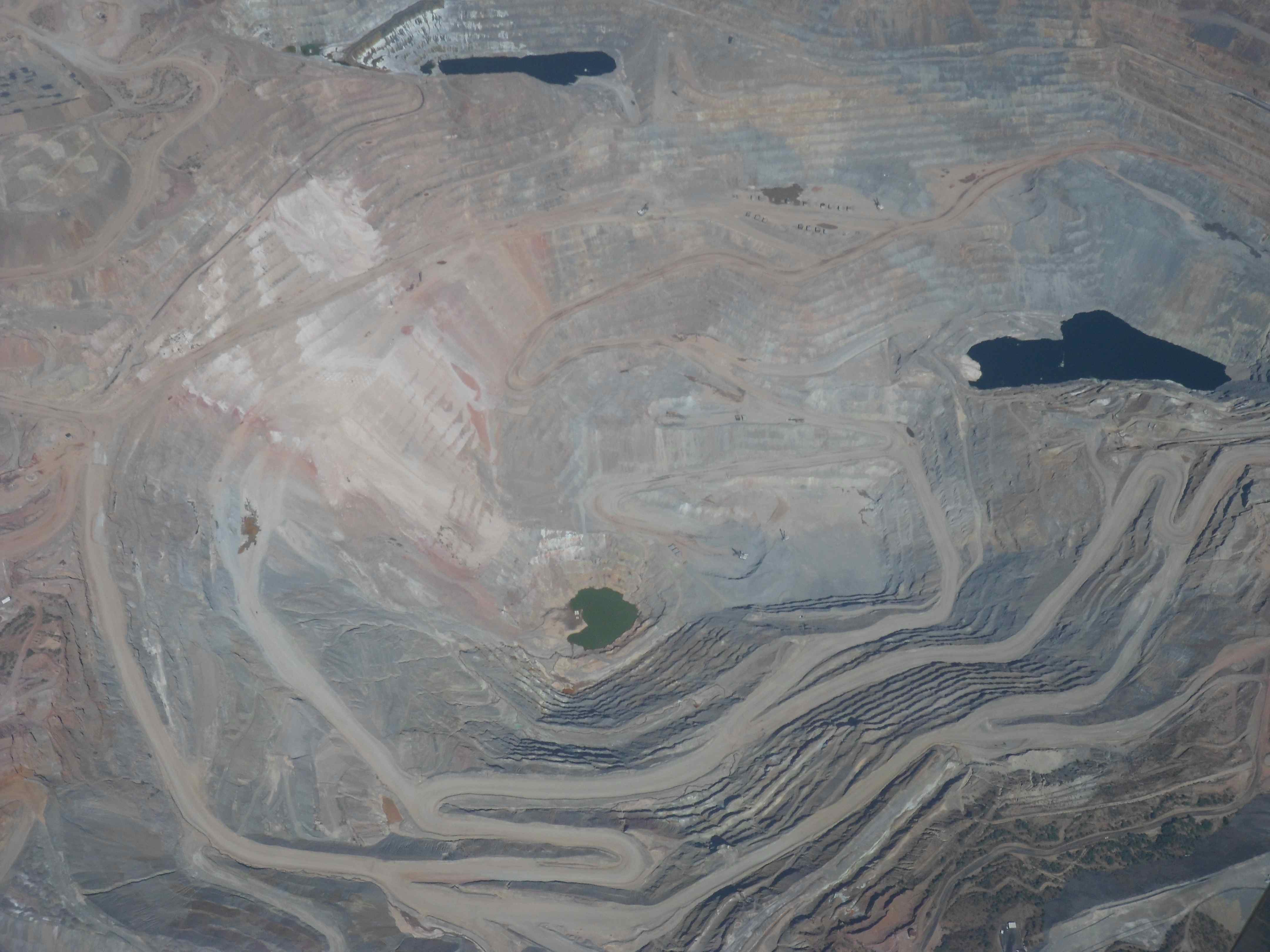
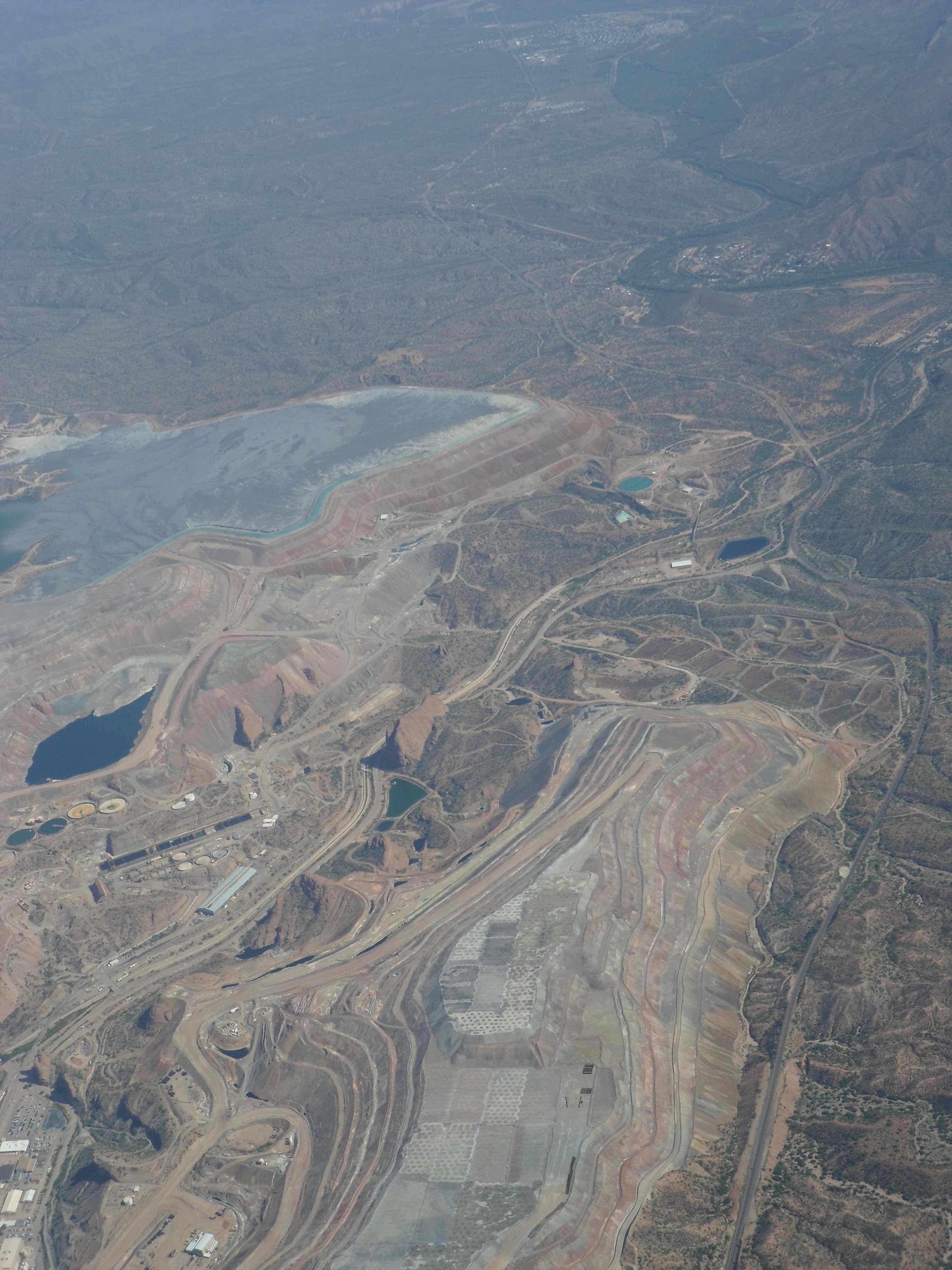
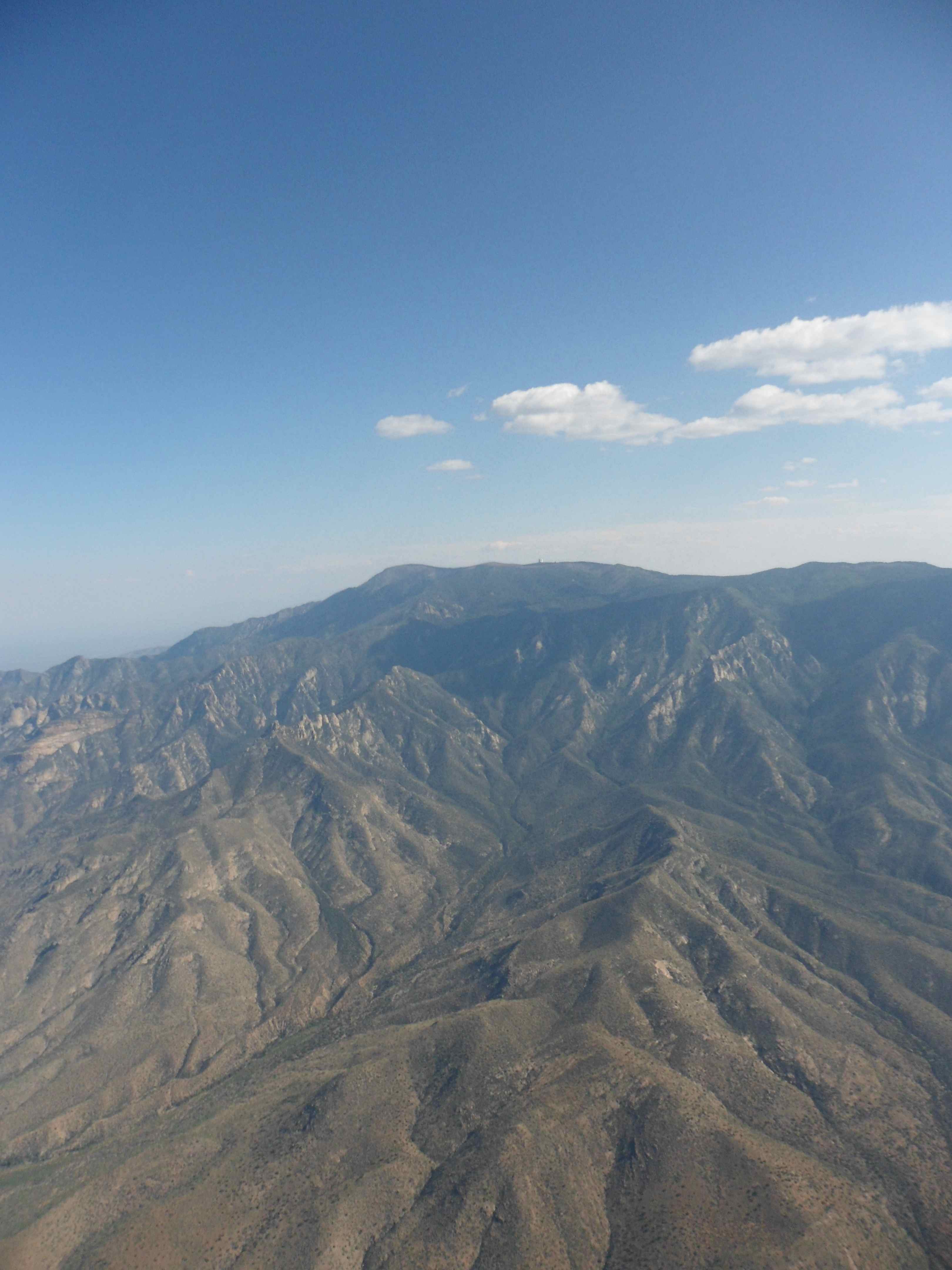
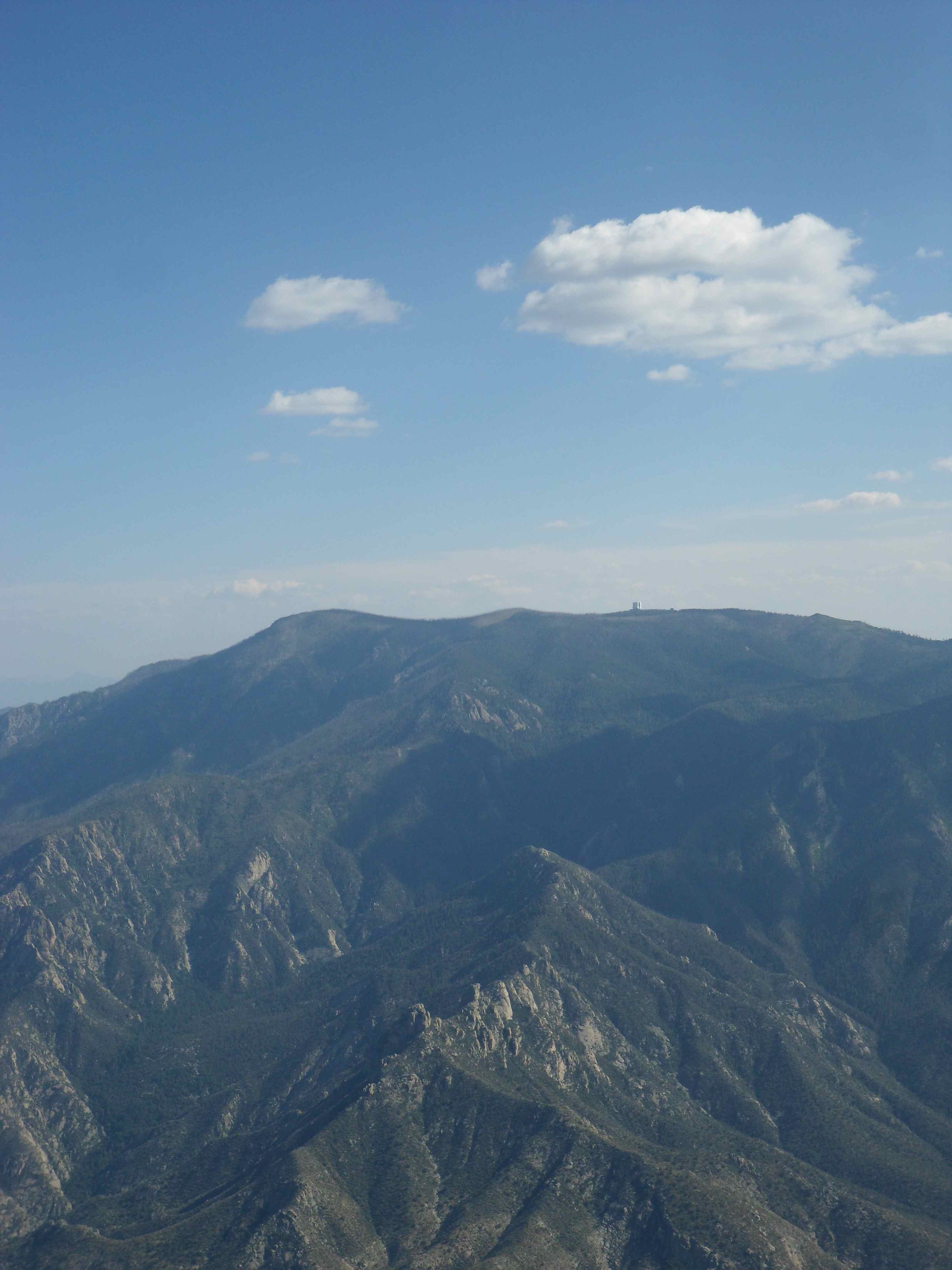
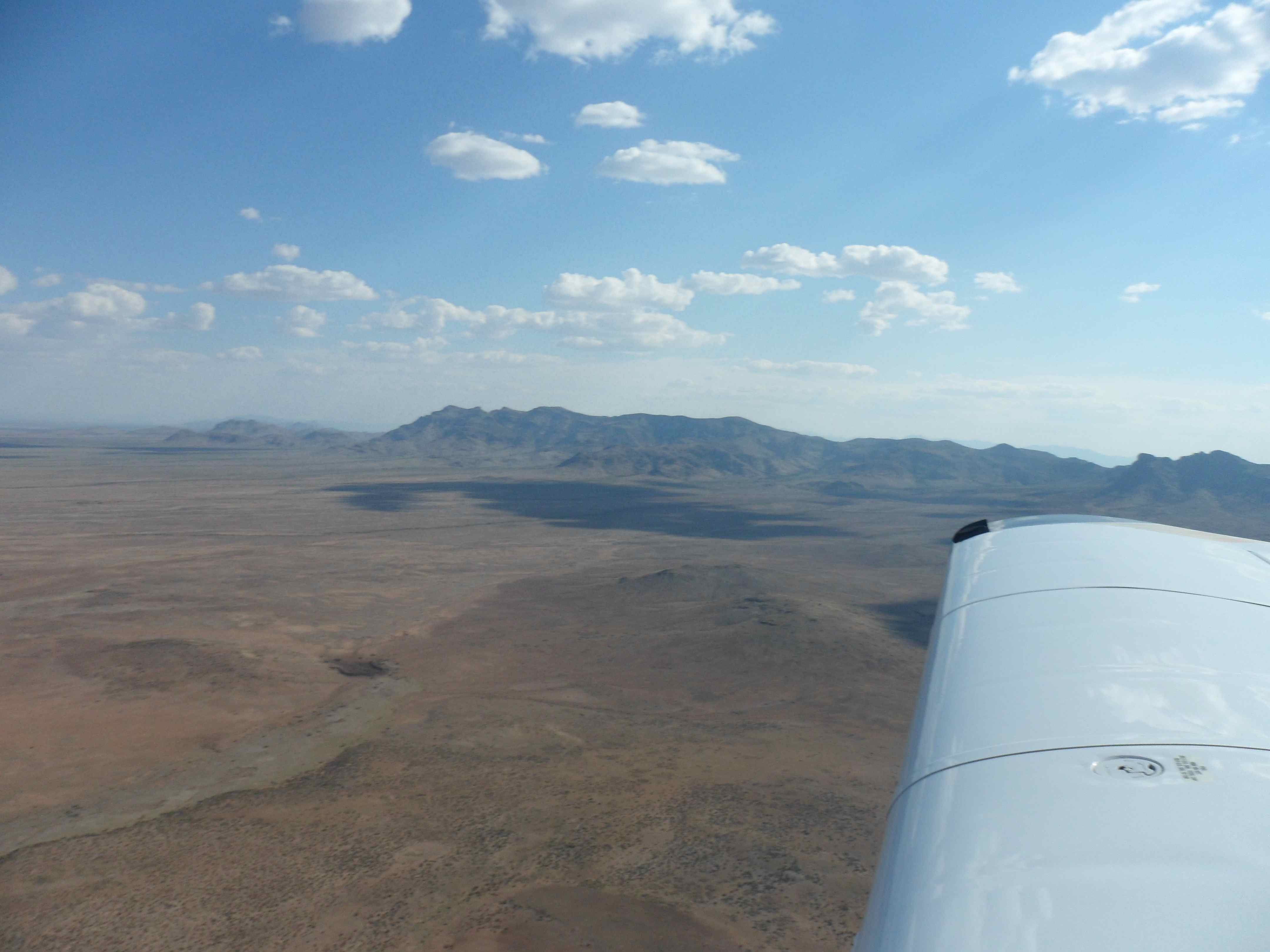
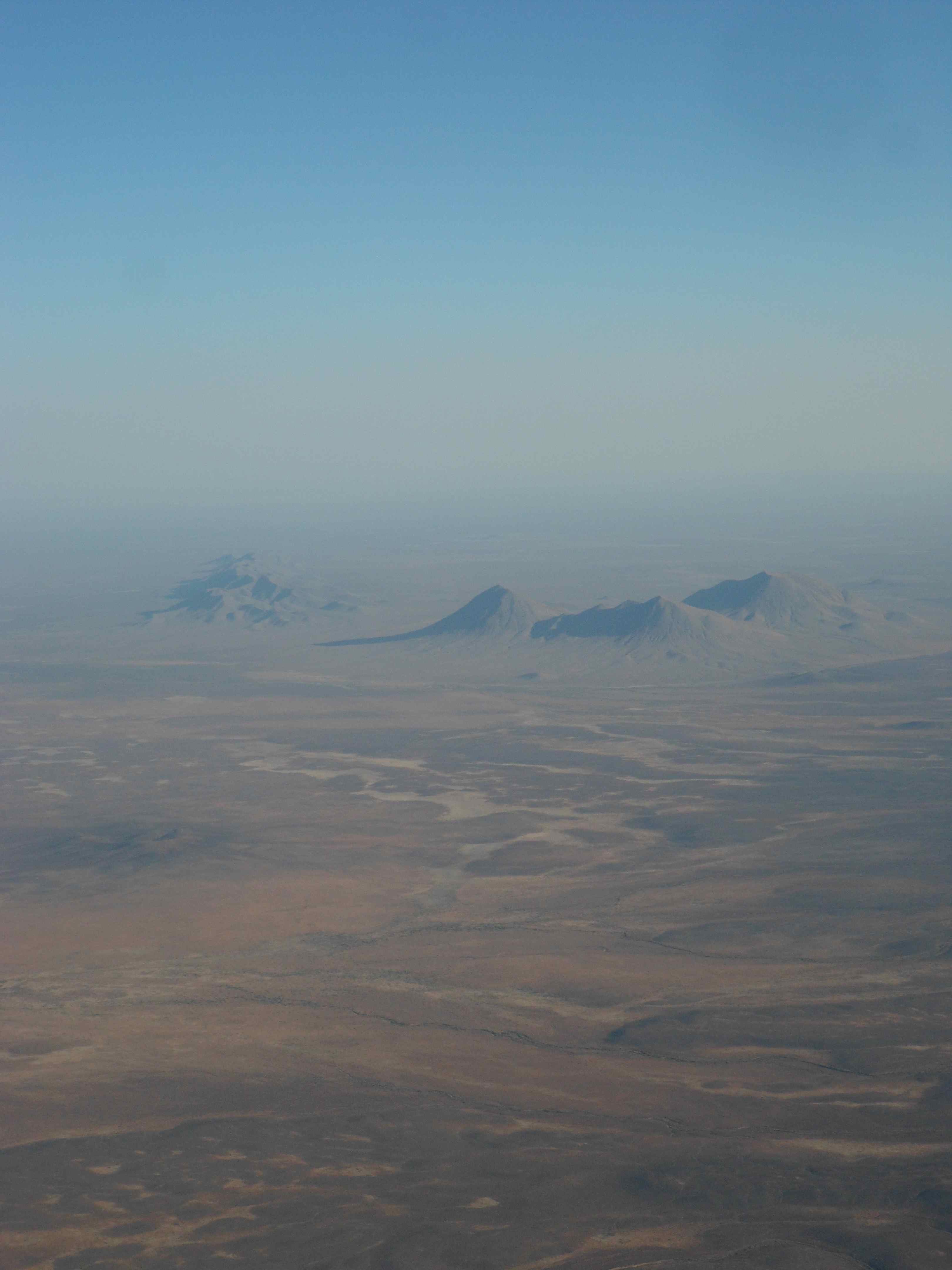
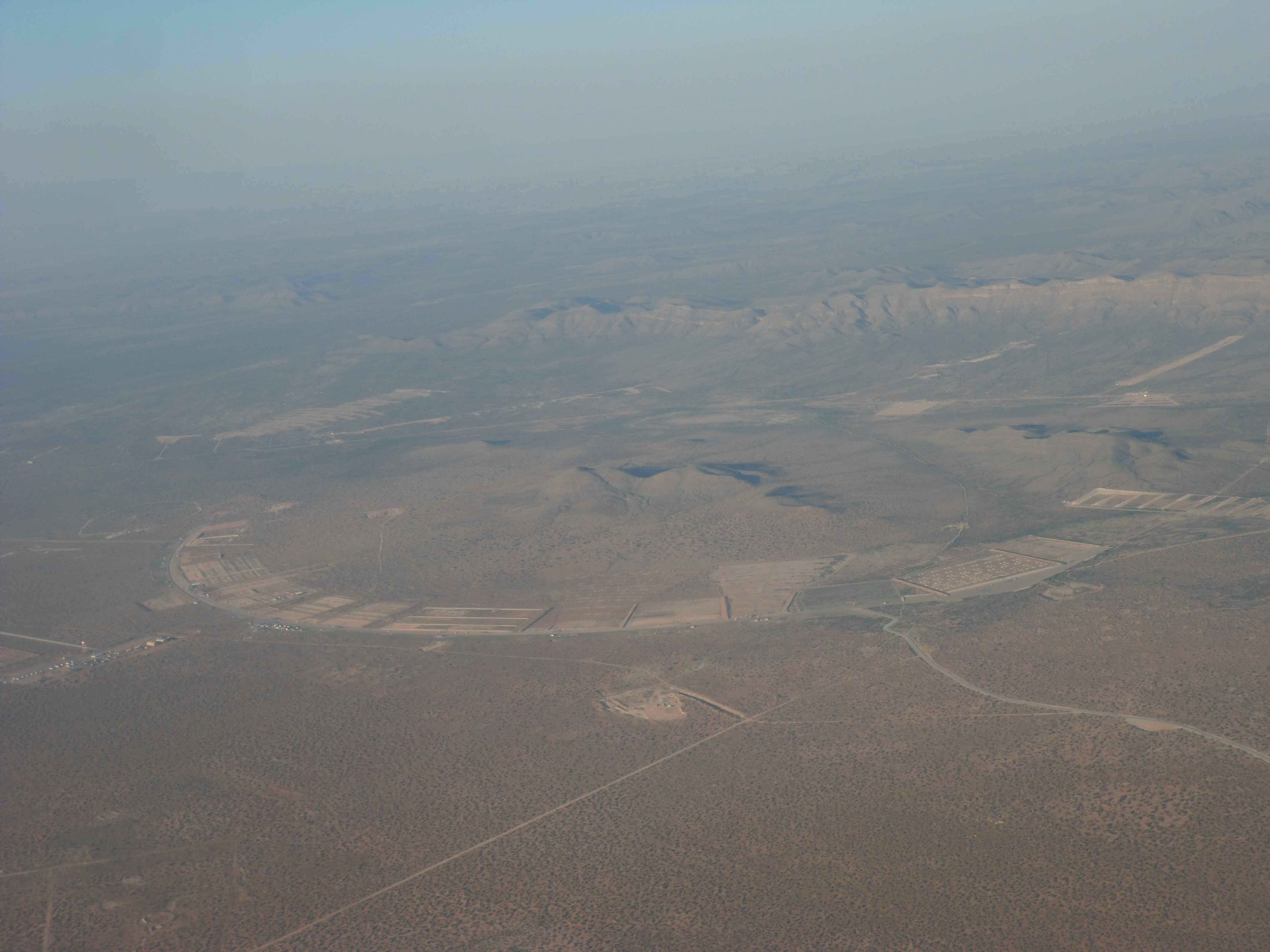
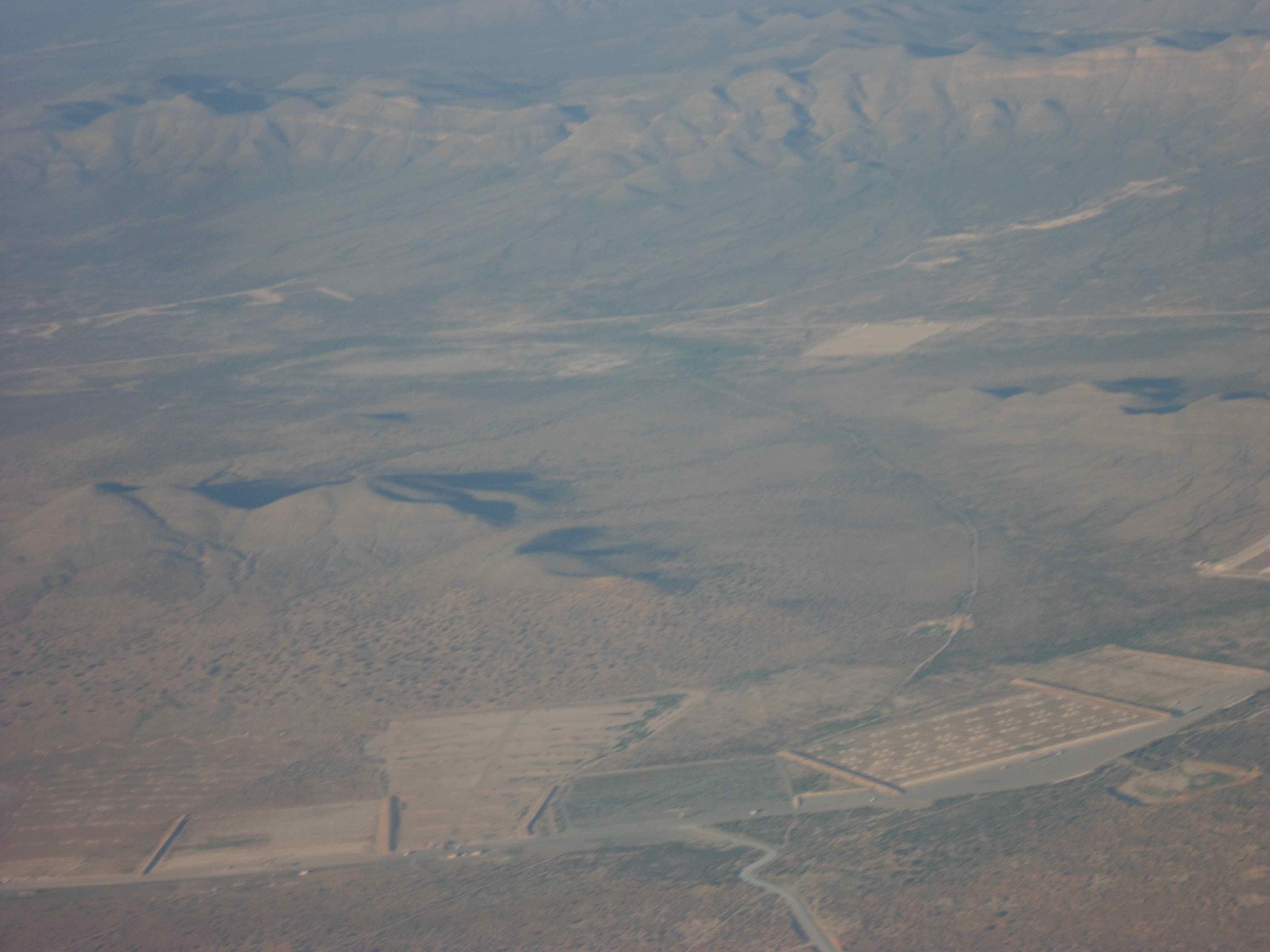
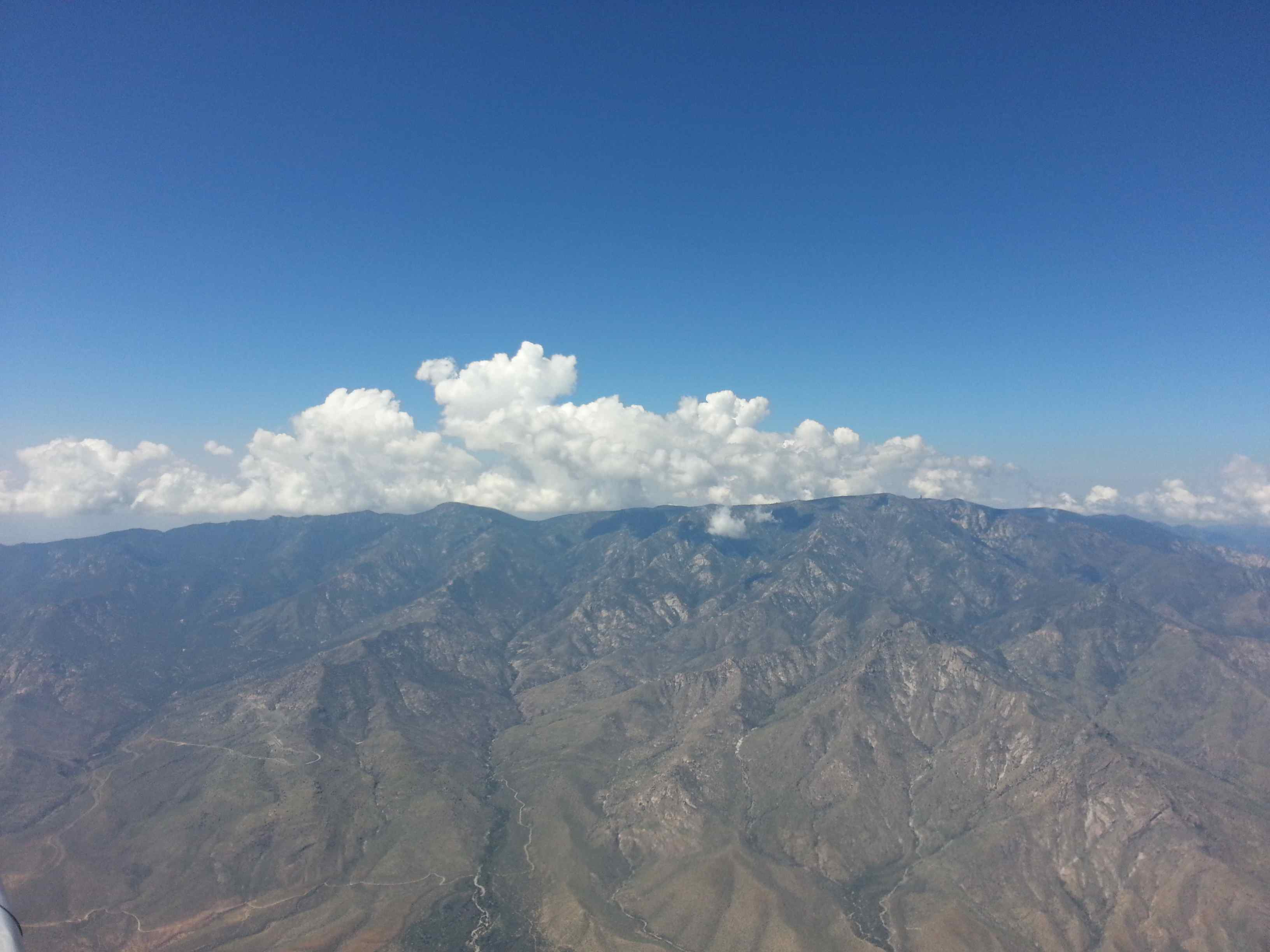
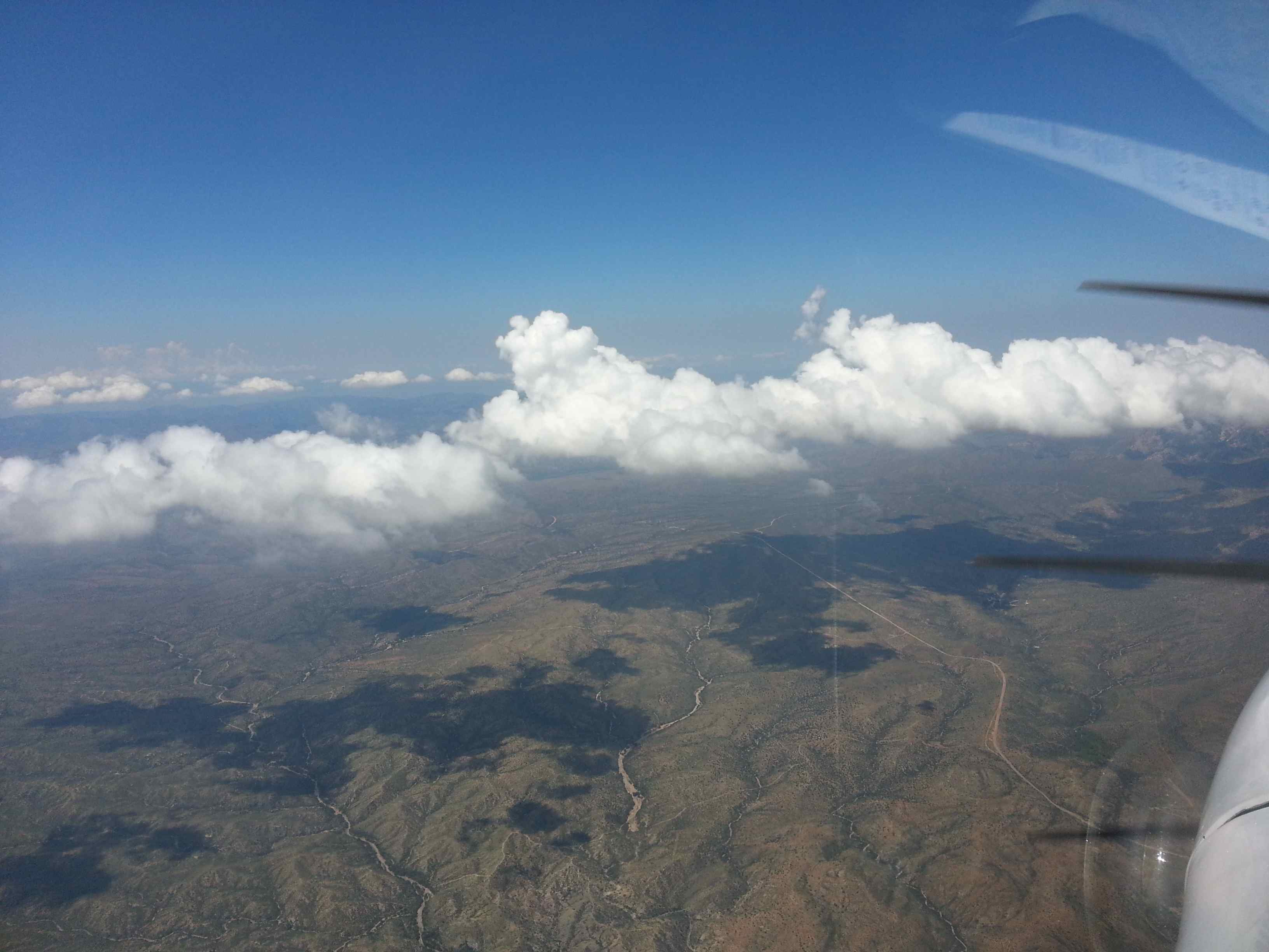
I again passed the same big open mine and the same tall 11k mountain range. By then there was also a large thunderstorm developing towards the north. XM weather also depicted it on the radar. No threat to my flight path, but great to watch from a distance.
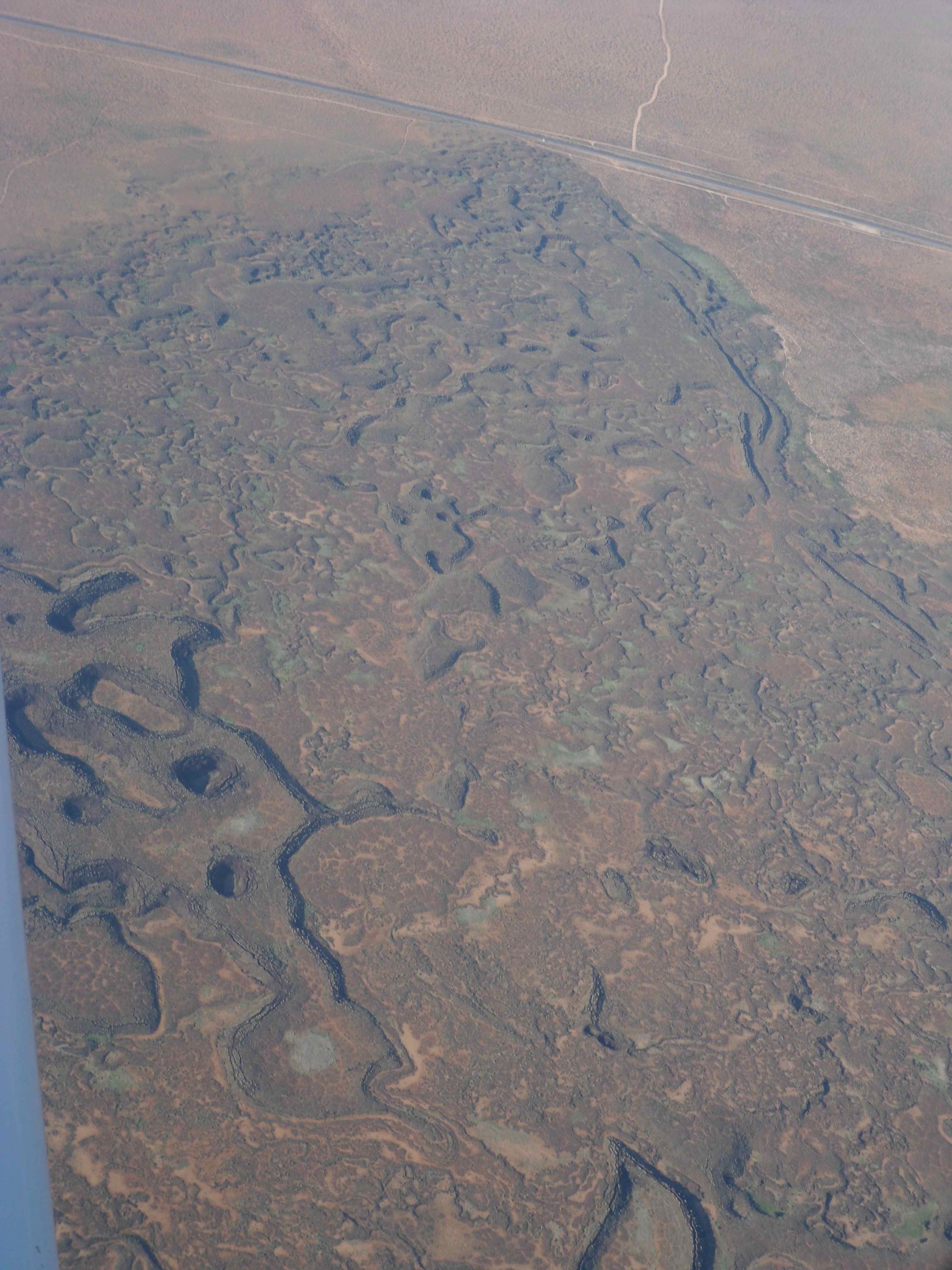
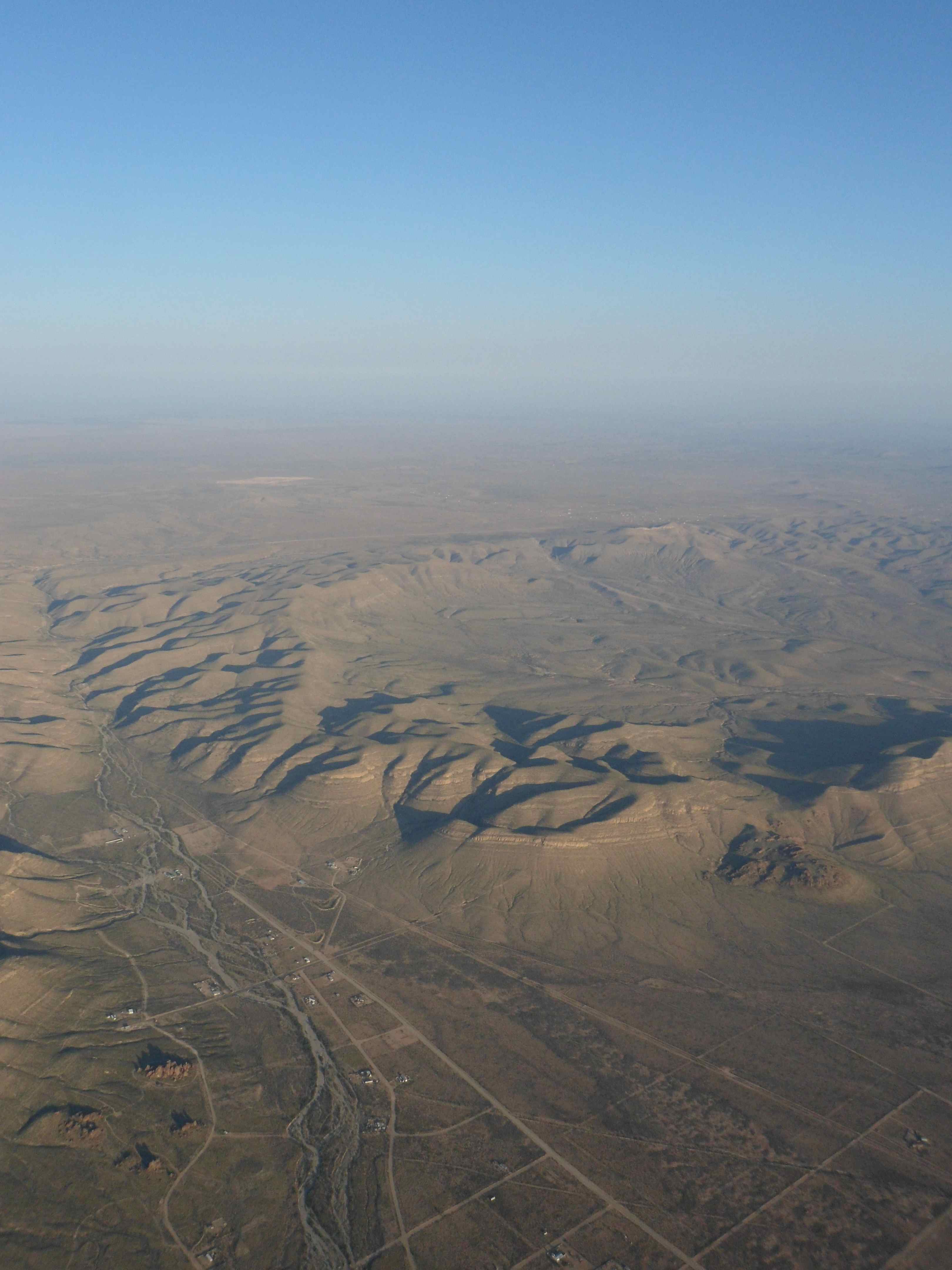
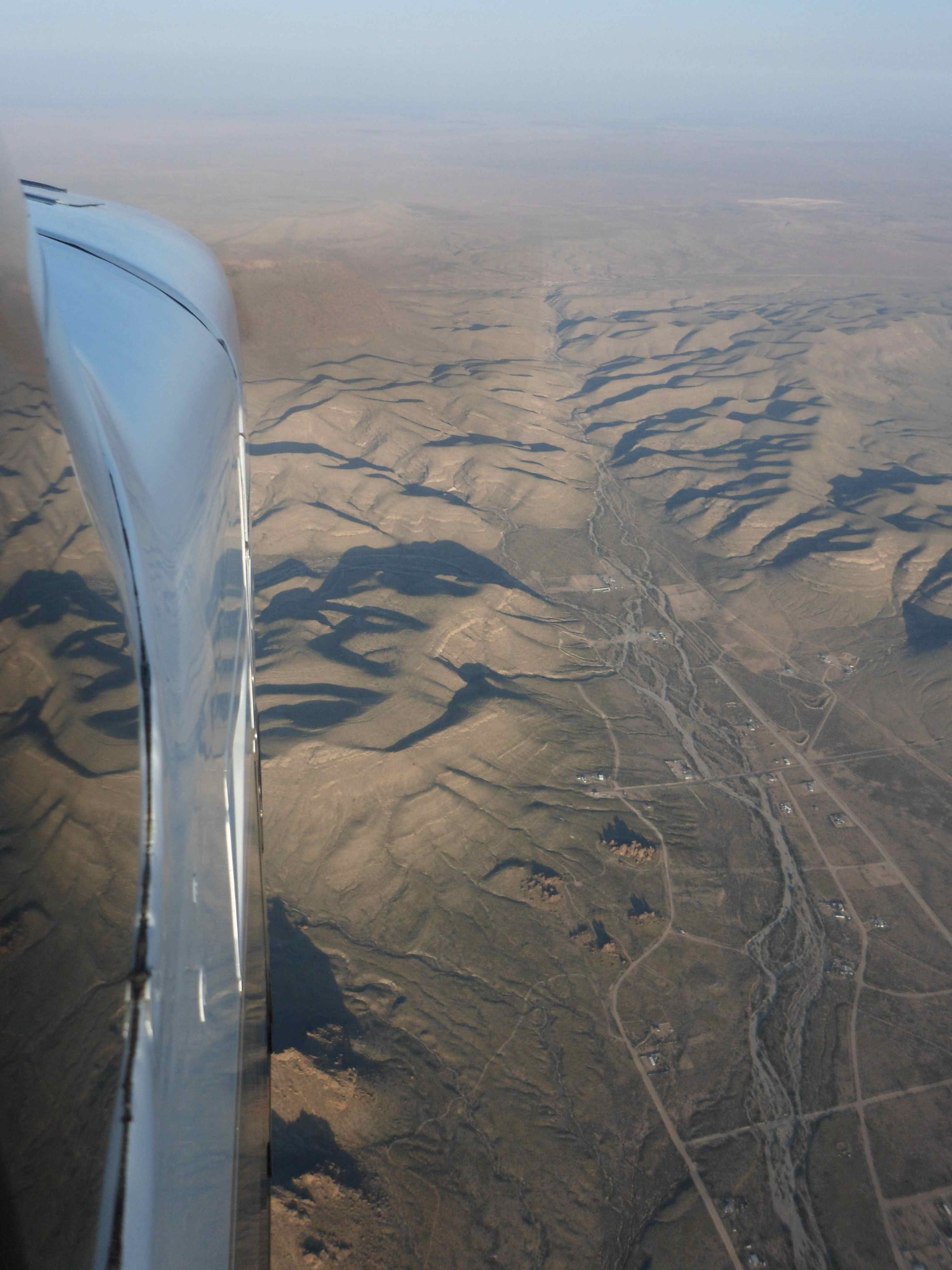
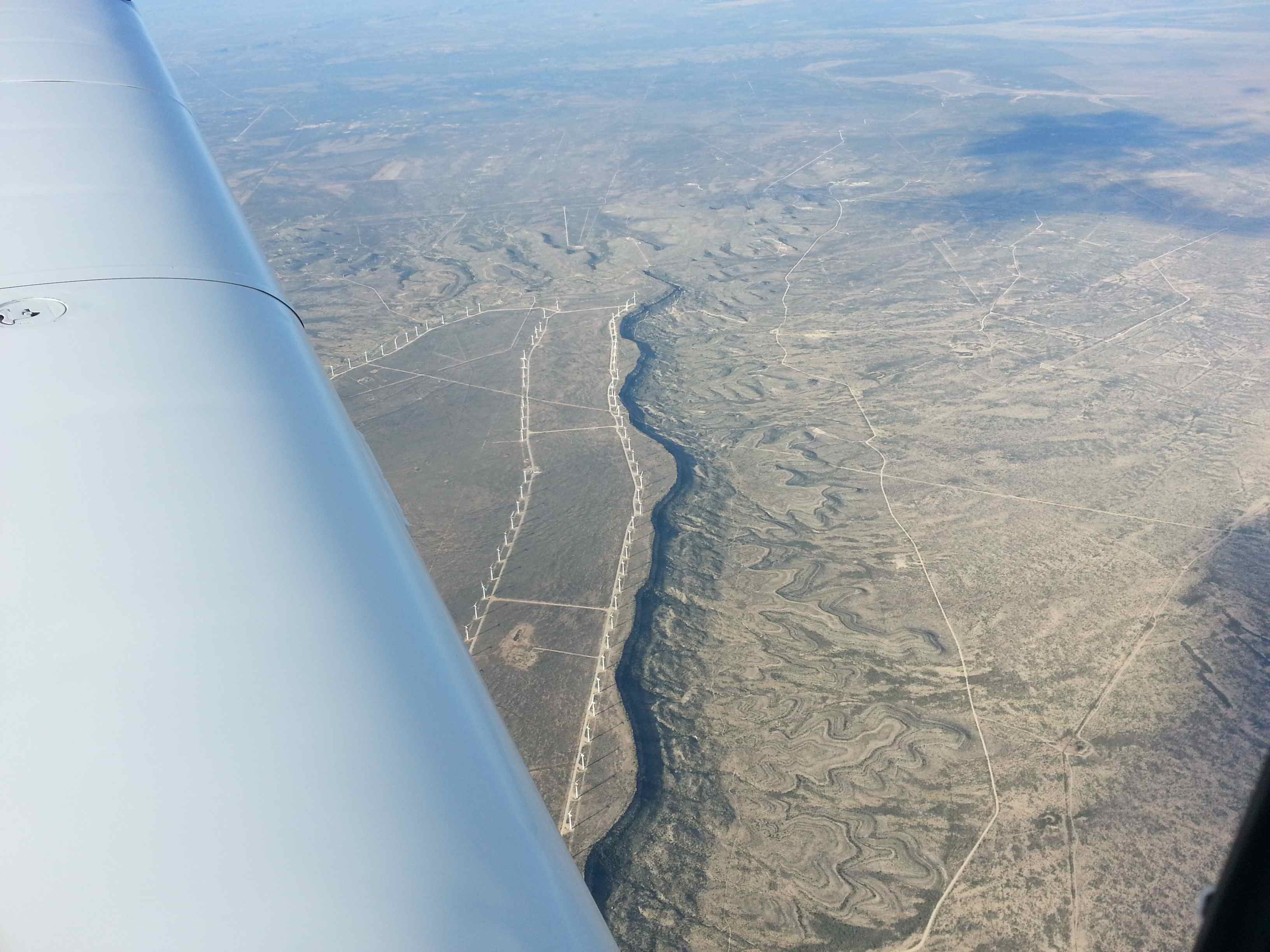
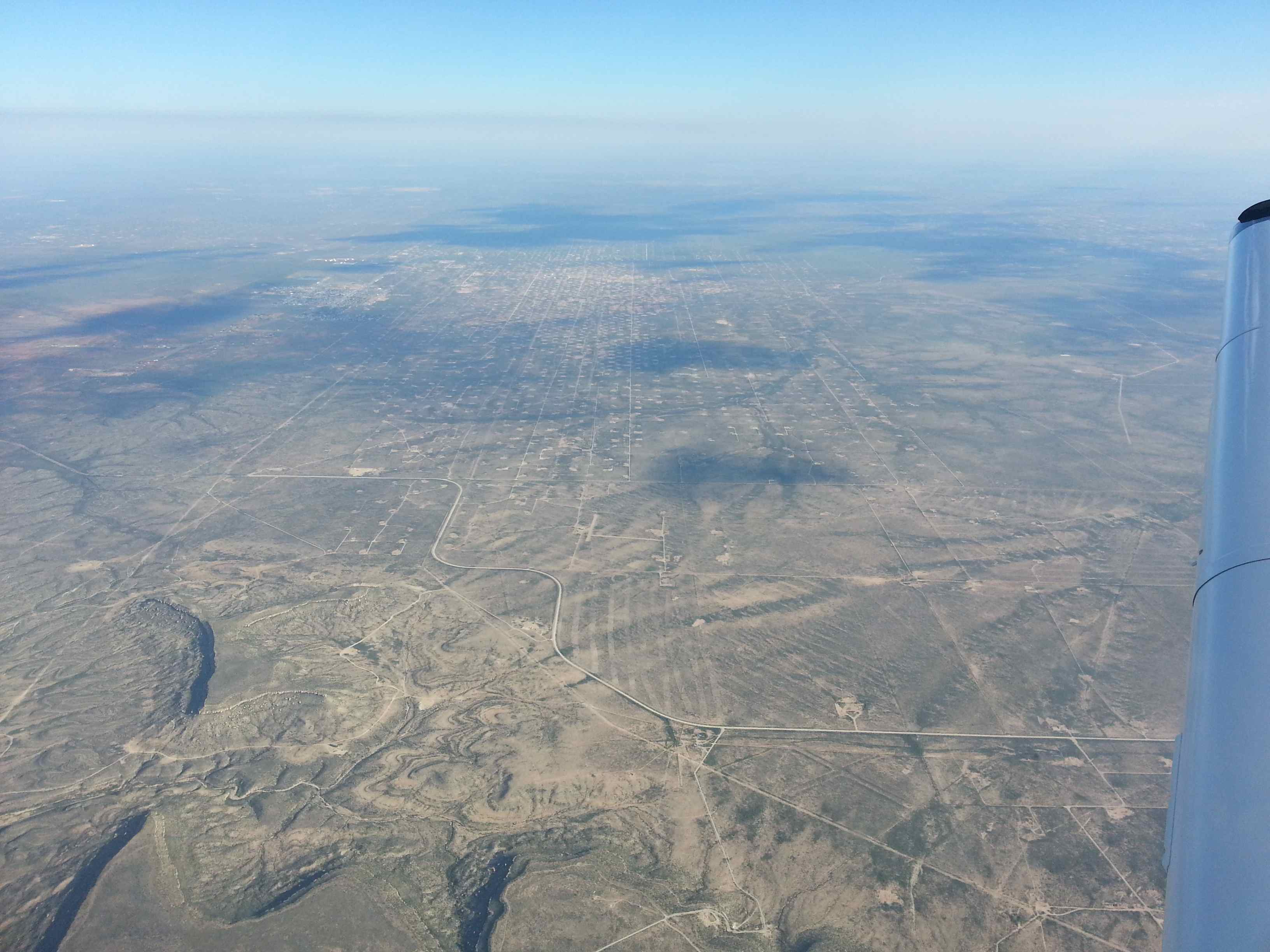
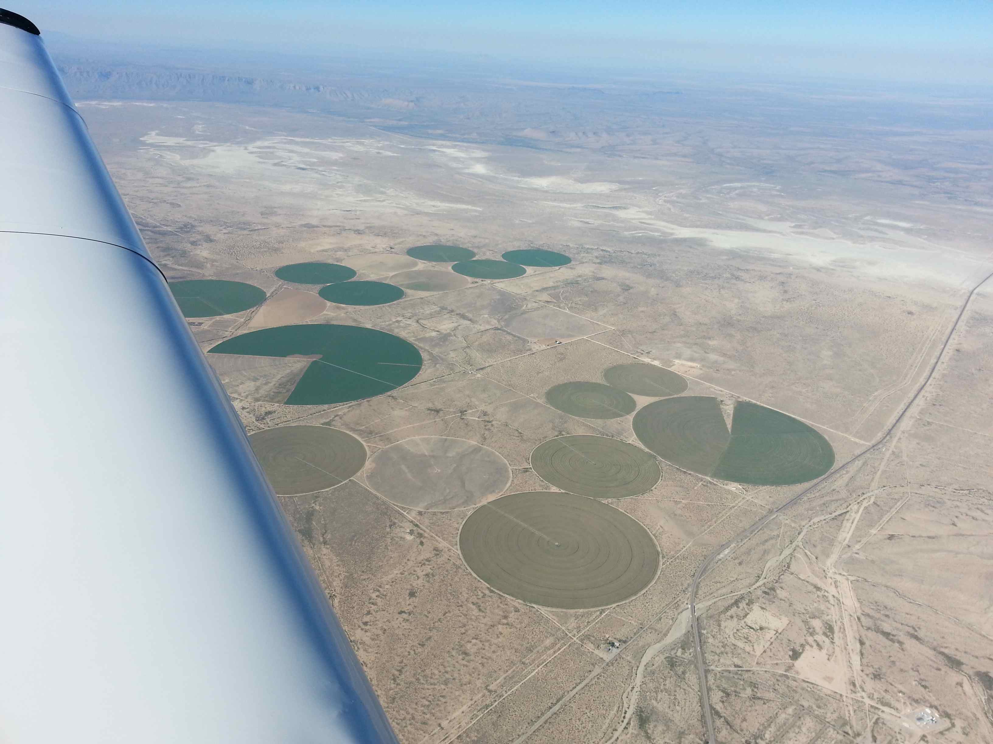
I marveled at the constantly changing scenery. There’s so much land and open space! I can hardly believe that I paid for owning land in Austin. Why pay? There’s plenty of land out there… I was getting into my philosophical phase of the flight and the chatter on the radio was distracting me. So I dropped flight following and turned the radio off completely to enjoy some classical music while staring out of the window. Perfectly legal by the way. Boy am I lucky! And I was born the right time, not 150 years ago, where flying was just a dream for mankind. How must it have been when the explorers where riding down there on horse towards the west coast, crossing that next valley, a prairie, just to the next mountain before setting up camp for the next night. And here we are, flying over it all at an unprecedented ease. I don’t even need to stay in my lane. All I need is a credit card and a dream machine. With that I can just sit there and marvel at the scenery. Every little ranch down there has its own story. I wonder who built that railroad and who operates that radio tower – where’s electricity coming from out here anyway? Questions.
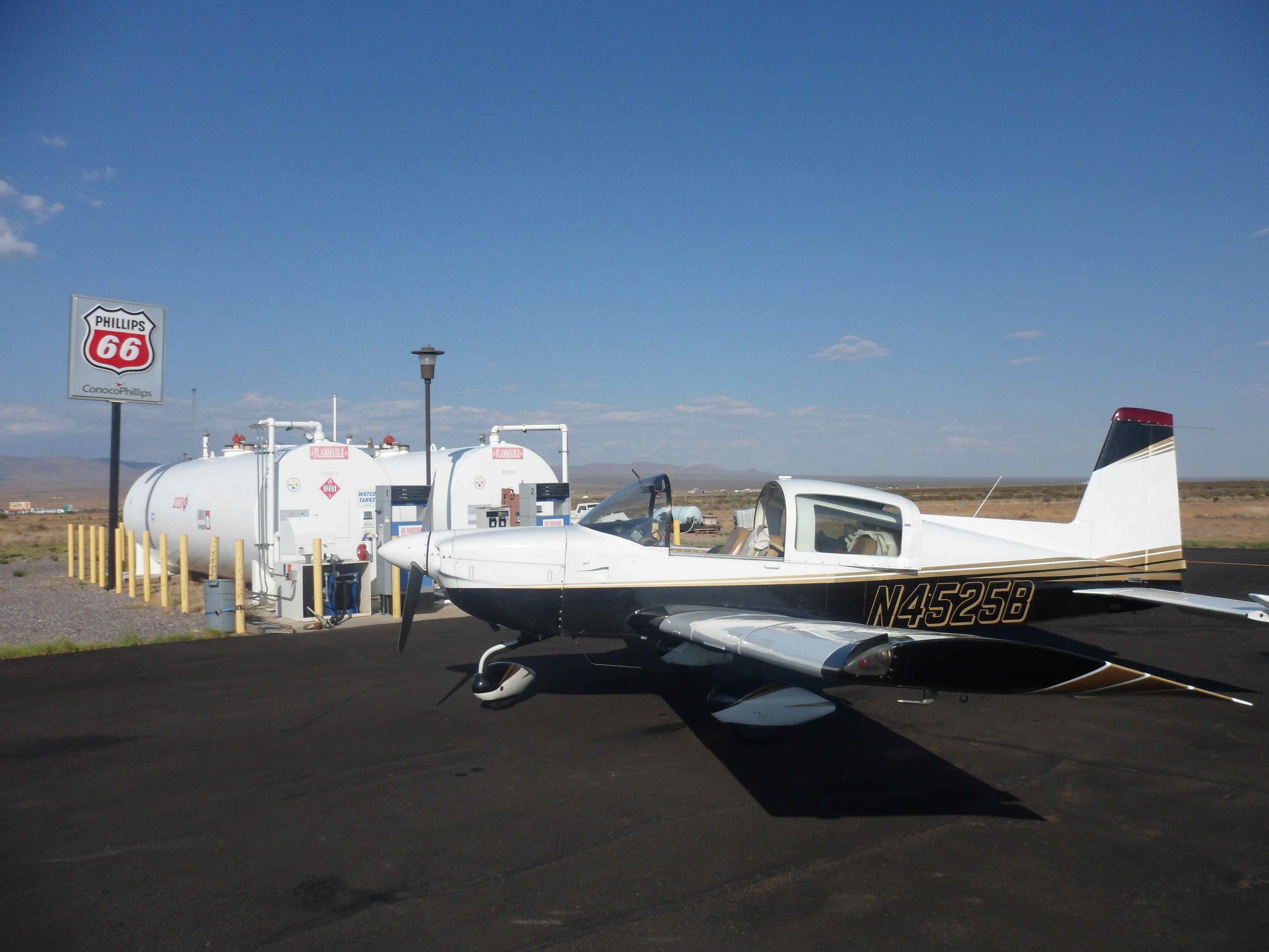
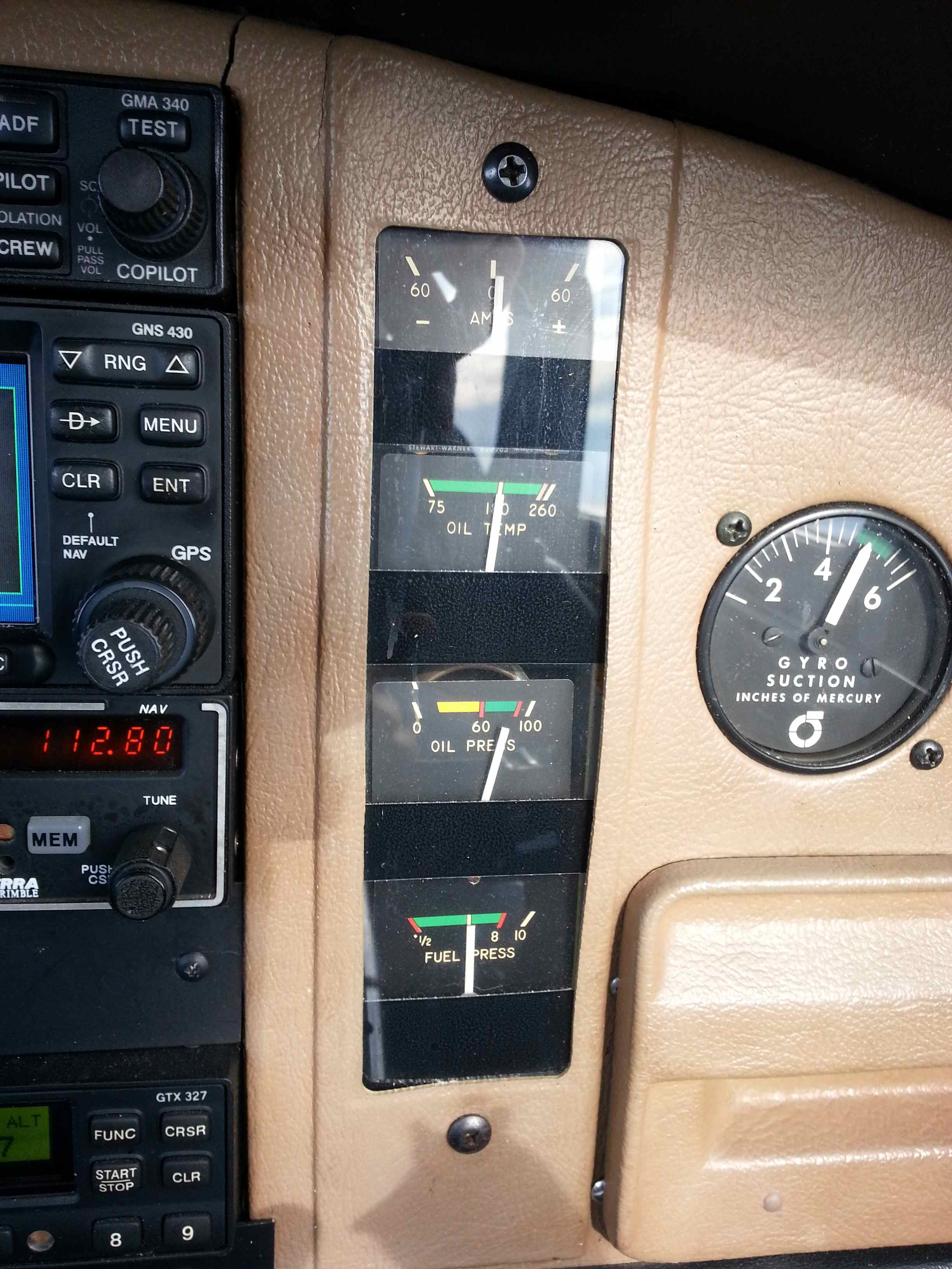
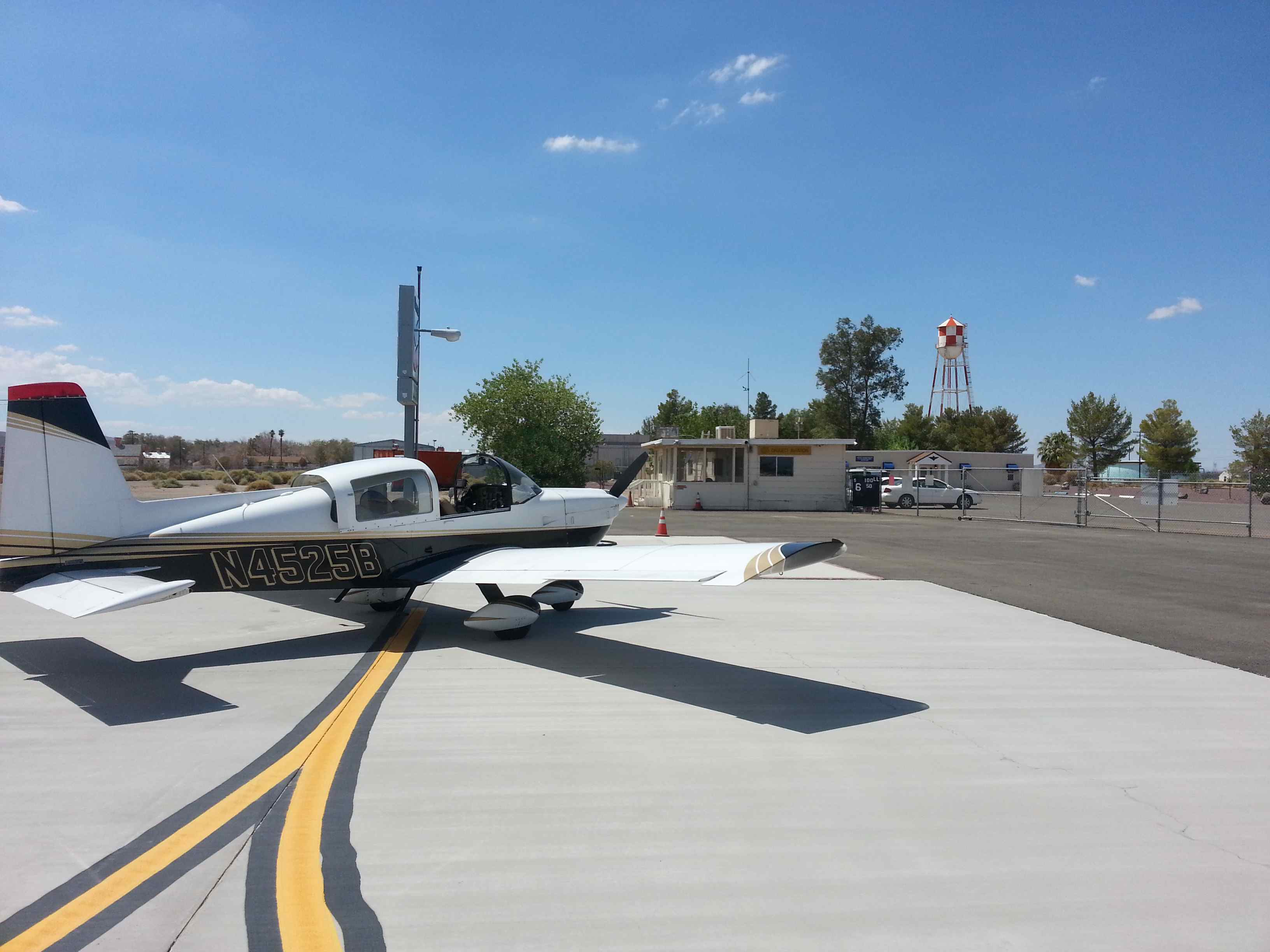
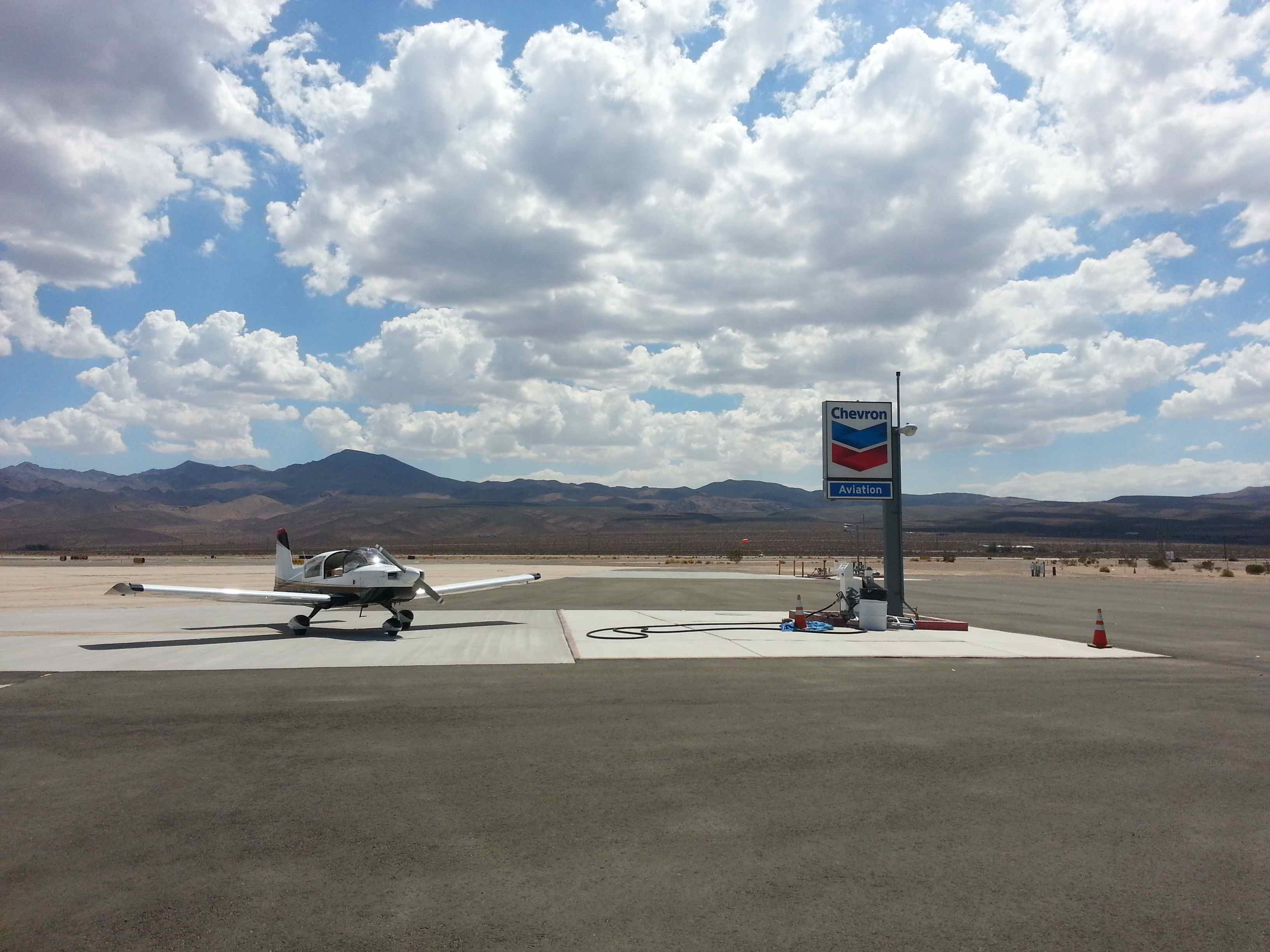
The engine continued to sing its song, not a hickup in 5 hours. As I was getting closer to Lordsburg, NM, my next fuel stop, I reintroduced myself to the role of pilot; I turned off my thoughts, I turned off the music and I prepared for the descent and landing. I was following I-10, the vein that cuts through this very challenging terrain. Trucks wer rolling along and I was passing over them at twice their speed. Lordsburg is a little hub, nothing more than a couple of houses, a water tower, lots of interstate franchises and an airport with cheap gas – all that in the middle of nowhere, literally. I announced five miles out for a straight in on runway 8. As I set flaps on final I could feel the heat entering the cockpit. It was 4p and the heat was on. Somewhere around 105F – calm winds though. I took the energy out by pulling up a little and set full flaps. I reminded myself to fly the plane all the way to the runway before flaring. It’s a common mistake after long flights to flare too high. As I settled softly onto the asphalt I opened the canopy and was welcomed by a blast of hot air. I back taxied on the runway to the gas tank. Nobody was here. The pump processed my credit card and I was ready to refuel. This must be the fastest pump west of the Mississipi, heck the fastest pump anywhere – the large diameter hose should have given it away! I got splattered by Avgas on my shirt everywhere! The fuel streamed out at greater rate than one gallon per second. This fuel stop was over before I knew it. I picked up my receipt and stretched my legs. As I got back into the cockpit I strapped on my parachute for the last leg – which would be 3.5 hours into the night. If I played it right I could make it home from here all the way to Austin, but a likely fuel stop at Llano, TX was the safe choice. Flying around with minimum fuel in the middle of the night isn’t smart. I also prepared my glasses, backup flashlights, backup pens, paper, maps, food and drinks for easy access. You want to limit head movements to the bare minimum at night to avoid disorientation. It was hard to believe that nightfall was so close, as the sun was still hot and bright. A last check confirmed that weather wouldn’t be a factor.
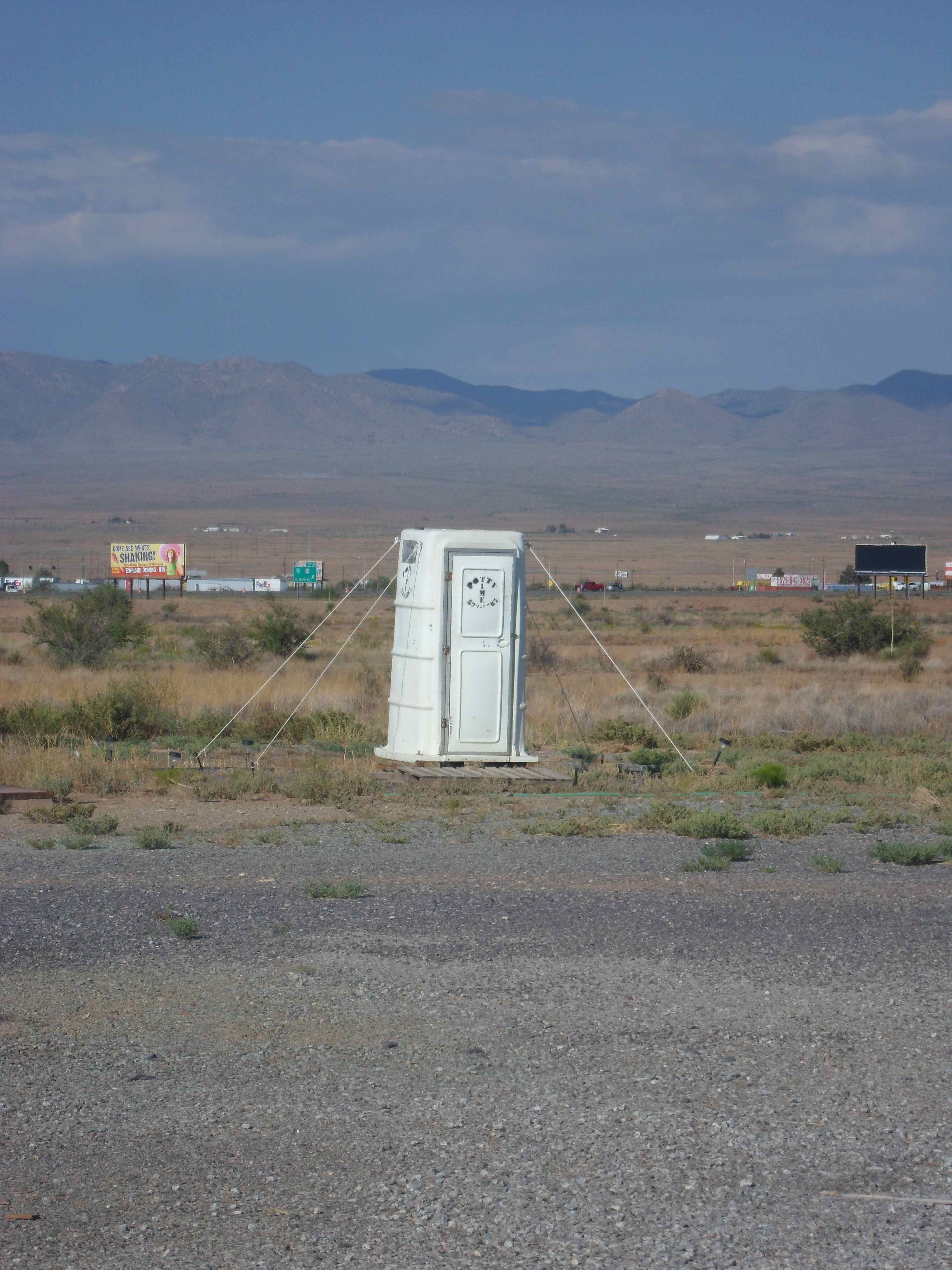
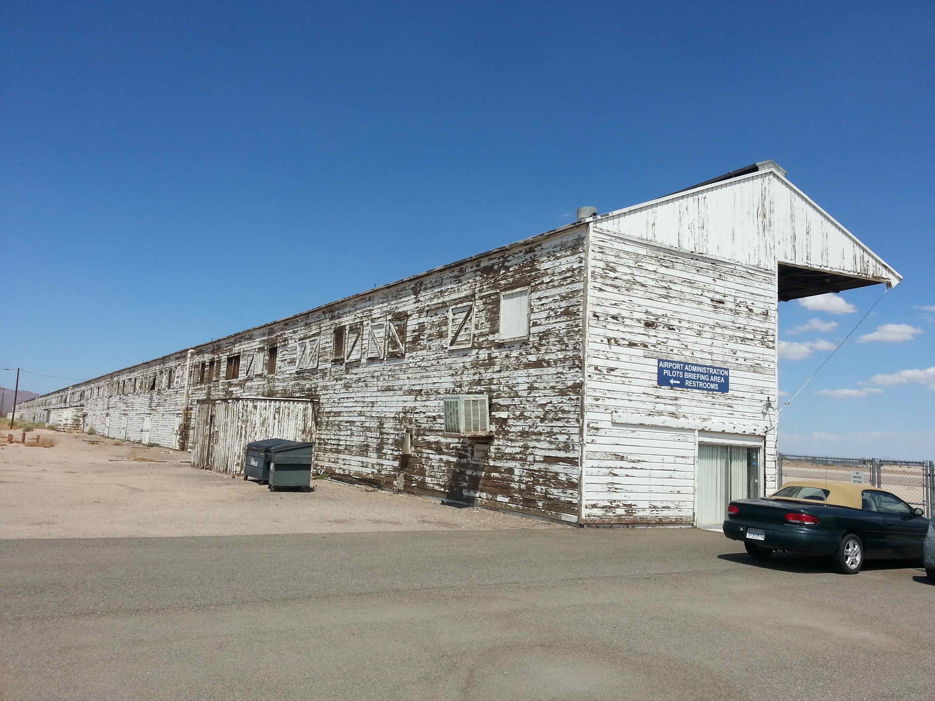
As I fired up the engine I called on the radio to announce my departure. This runway was too short for a midfield departure so I taxied to the threshold. It was hot. I was sweating. As I accelerated for take-off I heard a helicopter announcing its approach coming from the opposite direction. I let him know that I’d be looking for him. We saw each other while I was climbing through 1000ft – no factor. It was a slow climb out in the desert, but the gas was cheap: $5.15/gal. I highly recommend Lordsburg as a quick fuel stop. No facilities at the airport though (there’s a port-a-potty tied down by four ropes, which tells you how much wind they usually get), but a curtesy car is available.
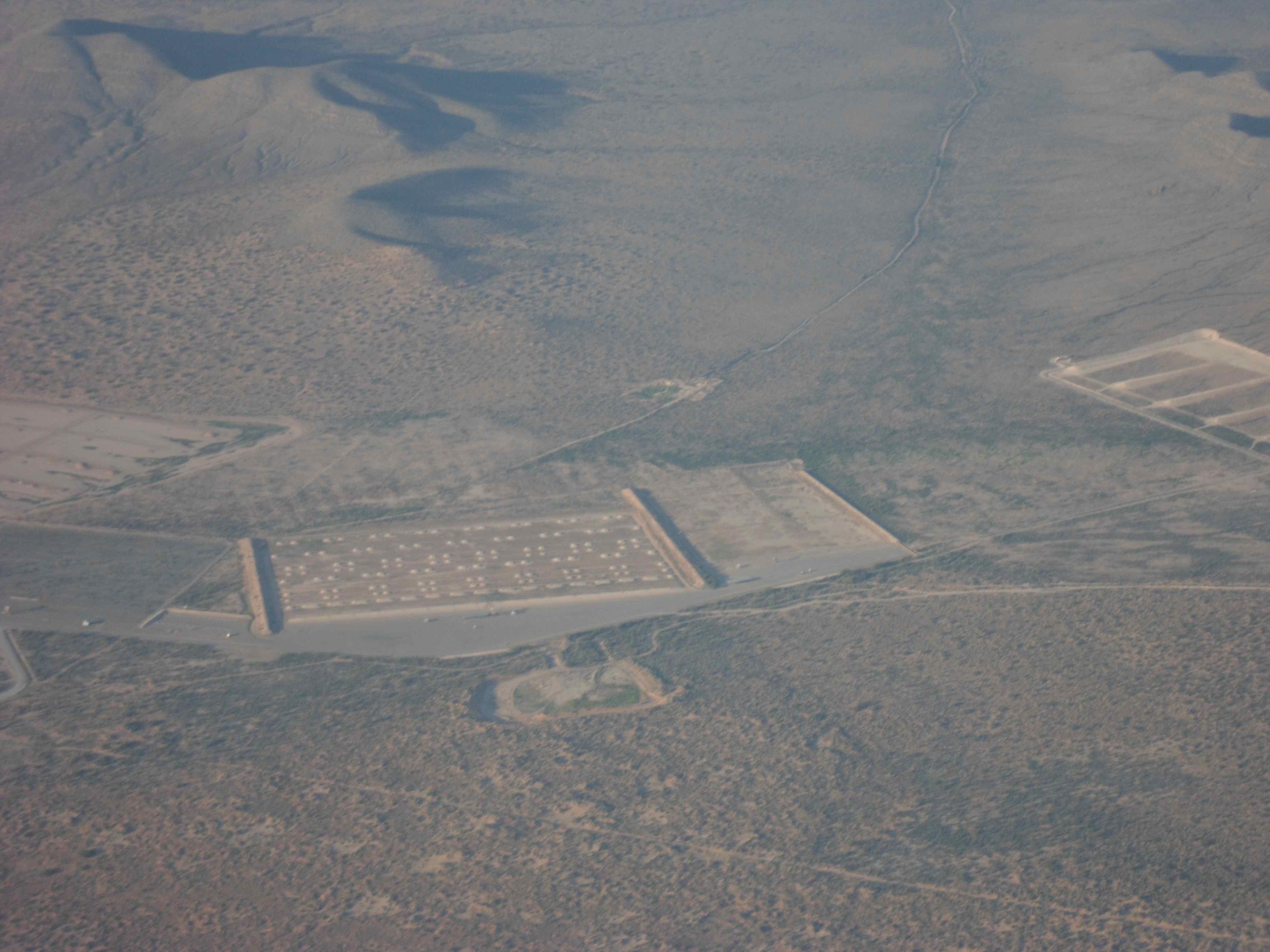
For the flight into the night I picked up VFR flight following again from Albuquerque Center. They assigned me a squawk and asked me (worriedly ?) if I was familiar with the terrain I was flying into? I said I was. Or wasn’t I? Boy ,that makes you think. They also warned me of a prohibited area for a balloon, just a couple of miles south of my route. A cross check with my database indeed confirmed the prohibited area. homeland security is operating a blimp on a rope hovering at 10000ft with sophisticated equipment on board to spot running Mexicans or drug trafficking airplanes from above (or other threats to national security). I got real close to the area to take a nice snap of the balloon – I was flying in 9.5k ft – so not too far off. I’m sure they also took a snap of me 😉 – I recommend a vacation to the Netherlands for everybody involved with the operation of the blimp.
ATC was again worried about getting too close to the prohibited area. But a line is a line is a line and GPS uncertainty was reported at 200ft … Nevertheless I appreciate ATC’s help. It’s lonely out there.
Next was my dinner as I didn’t want to eat in the dark. So I treated myself to supper on board before night fall. As I was crossing El Paso and talking to their approach, the controller requested me to climb to 11.5k to avoid conflicting departing traffic. Really? Apparently he wasn’t familiar with Tigers and their climb rates in summer. A simple “unable” settled that. I did offer to turn 30 degrees though – hey, I tried to be nice. Instead he opted to turn his departing Southwest jet a little earlier and let him climb past me 2 miles to the South. Thanks.
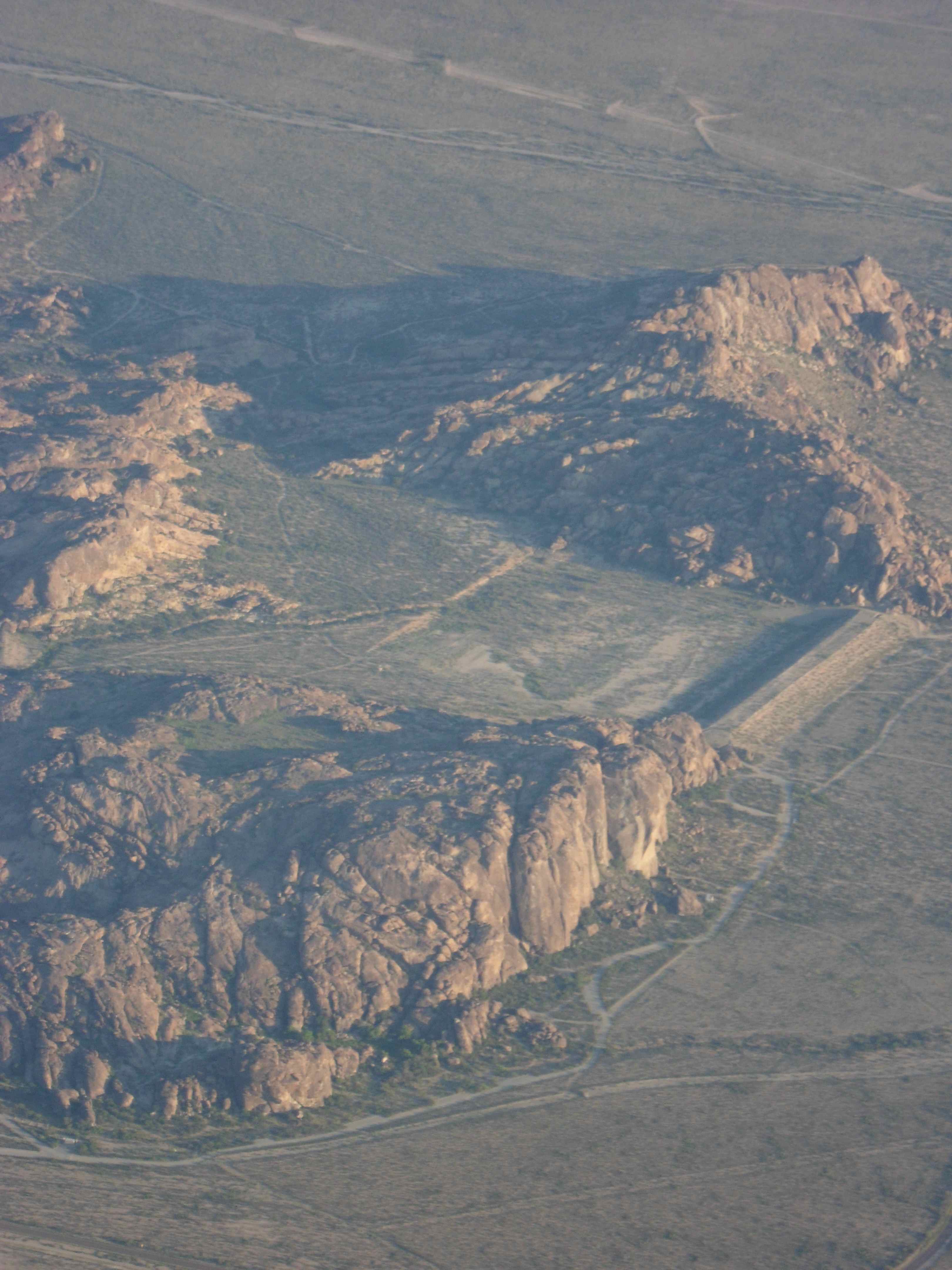
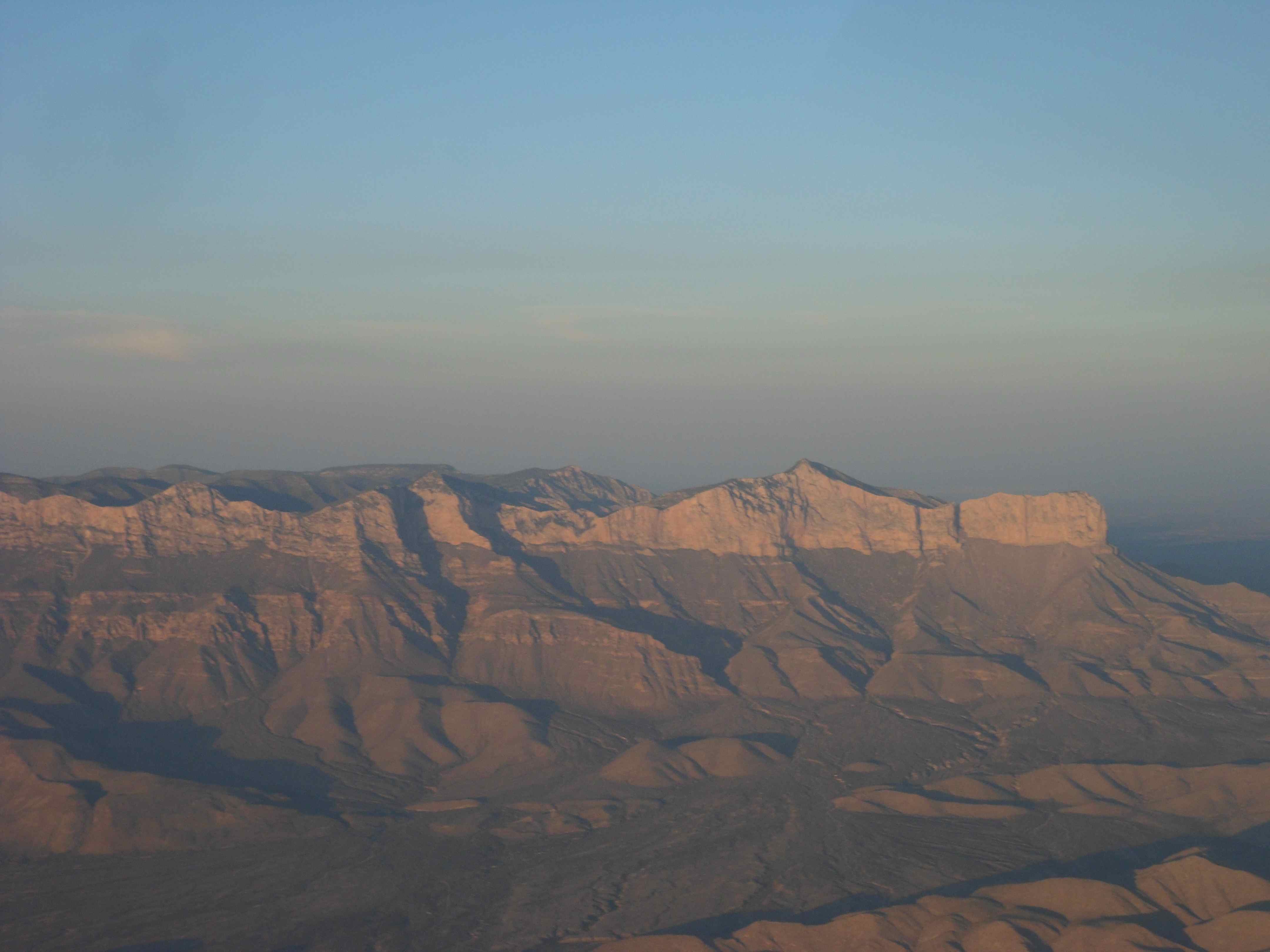
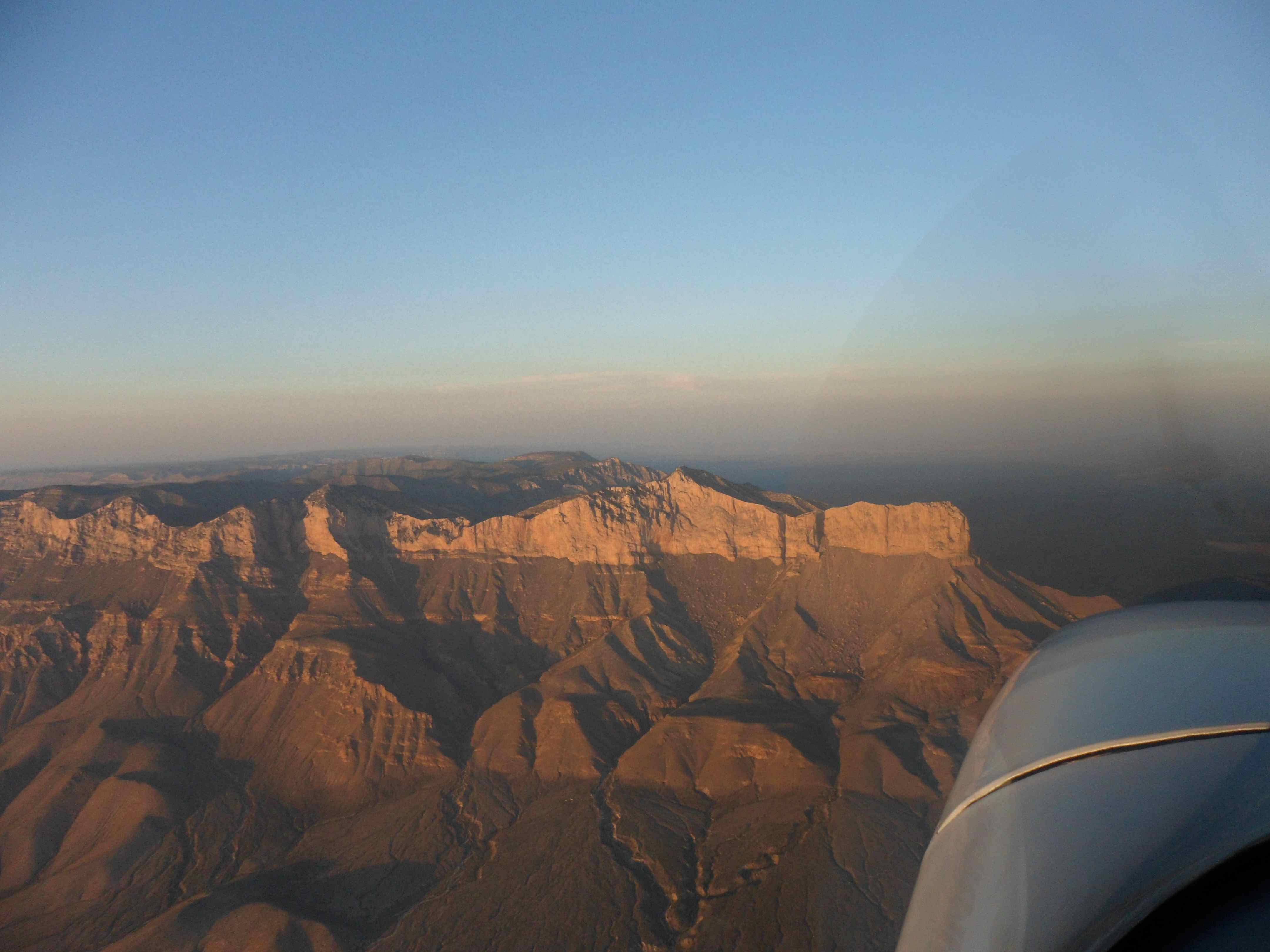
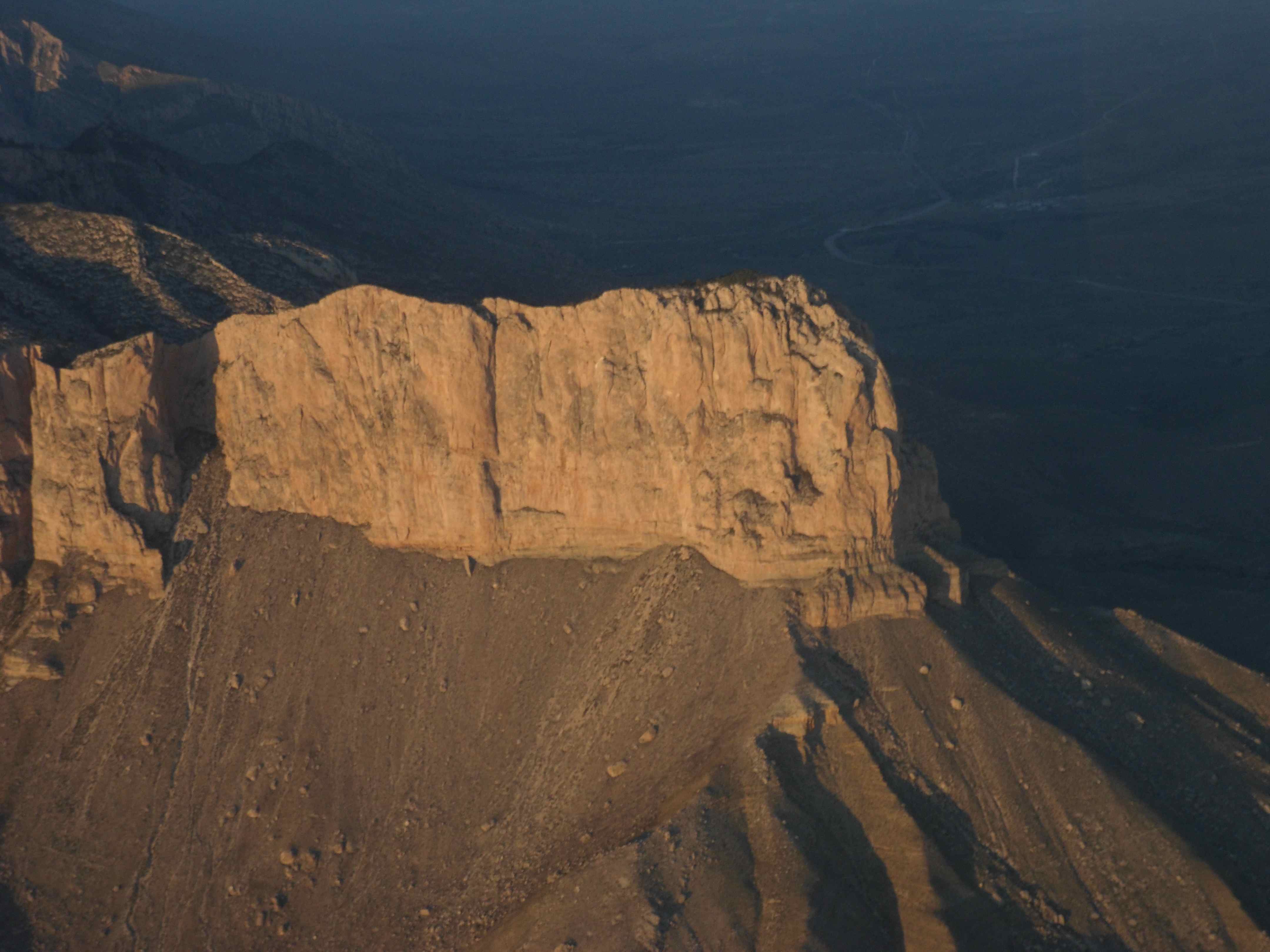
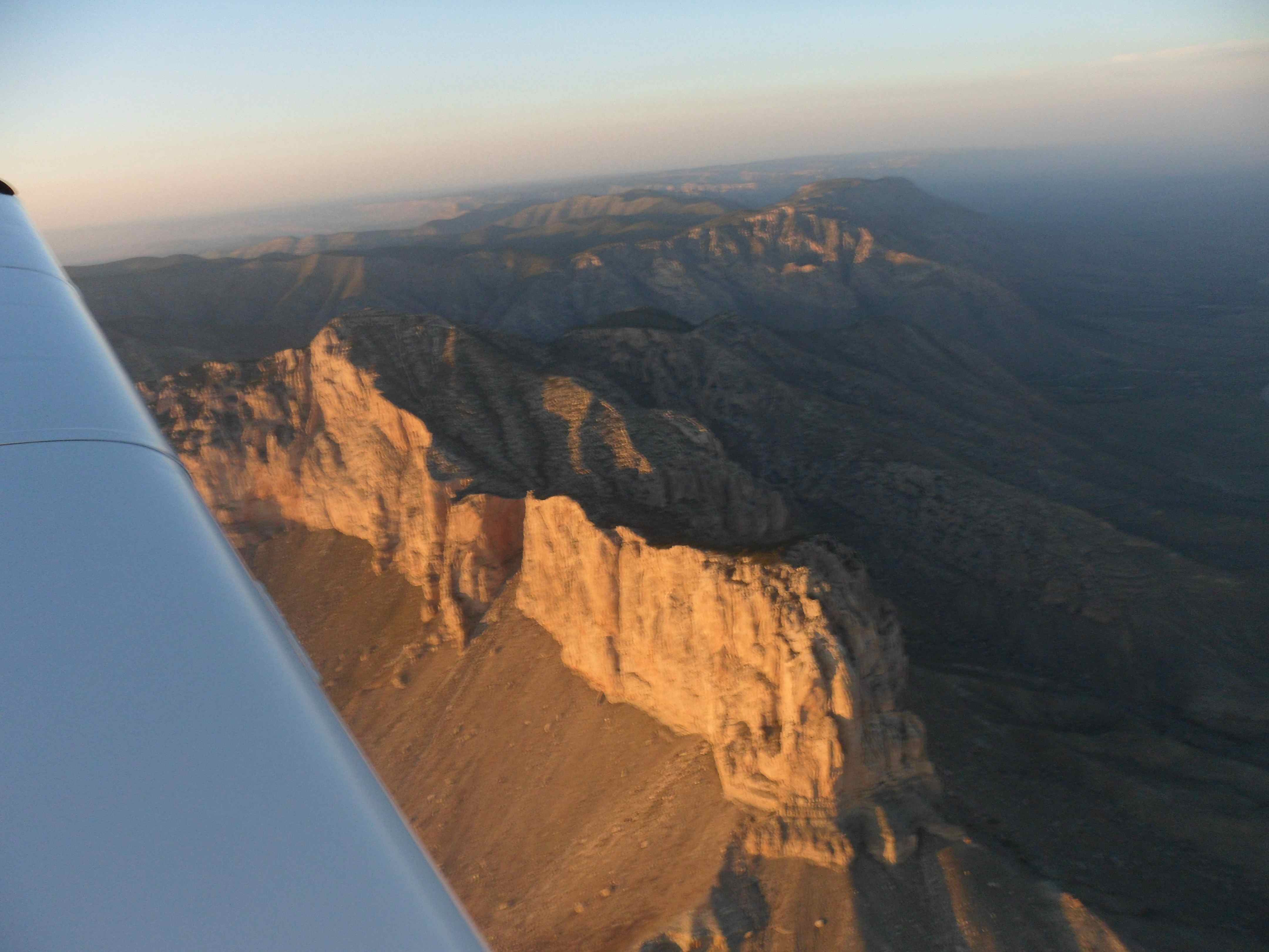
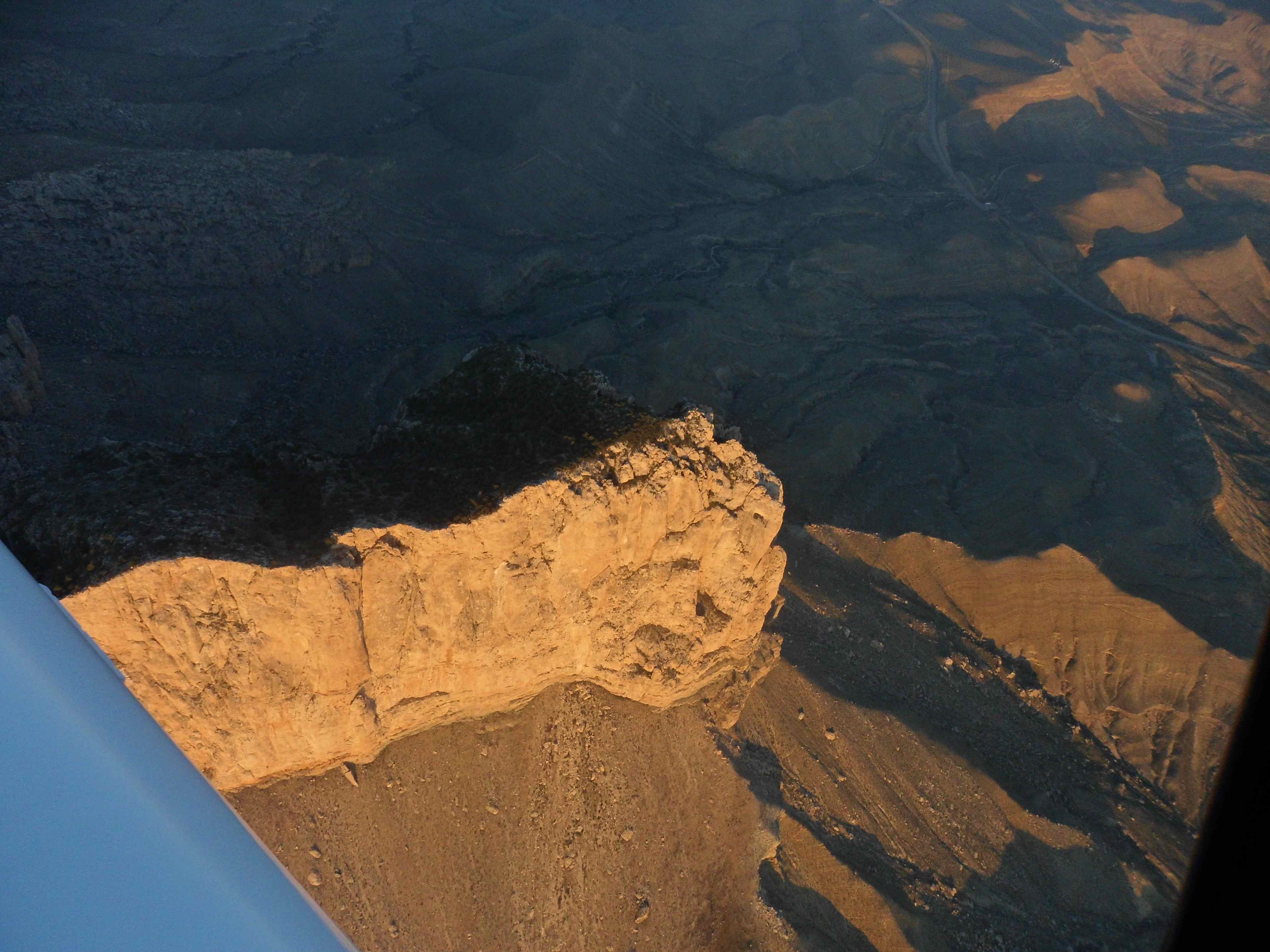
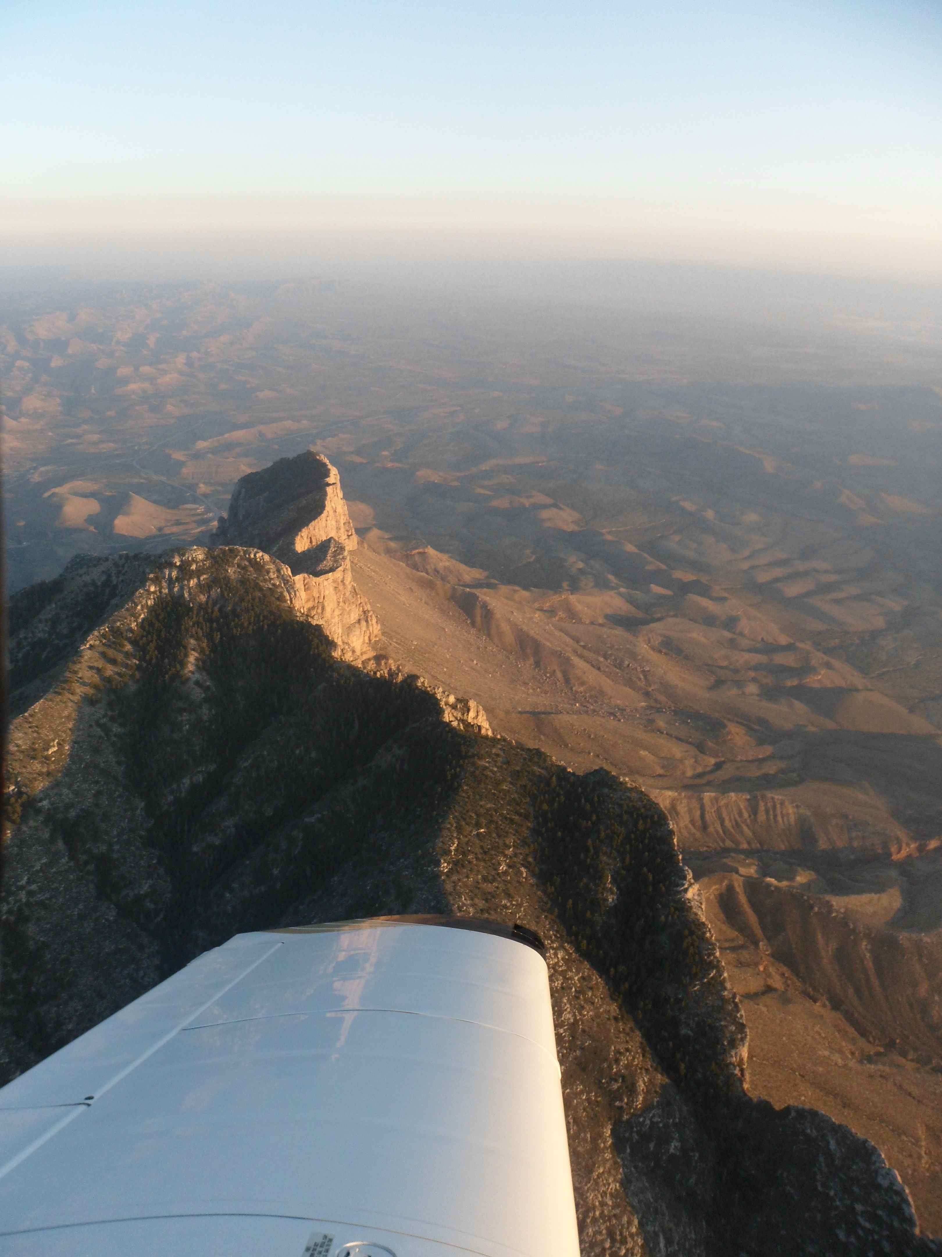
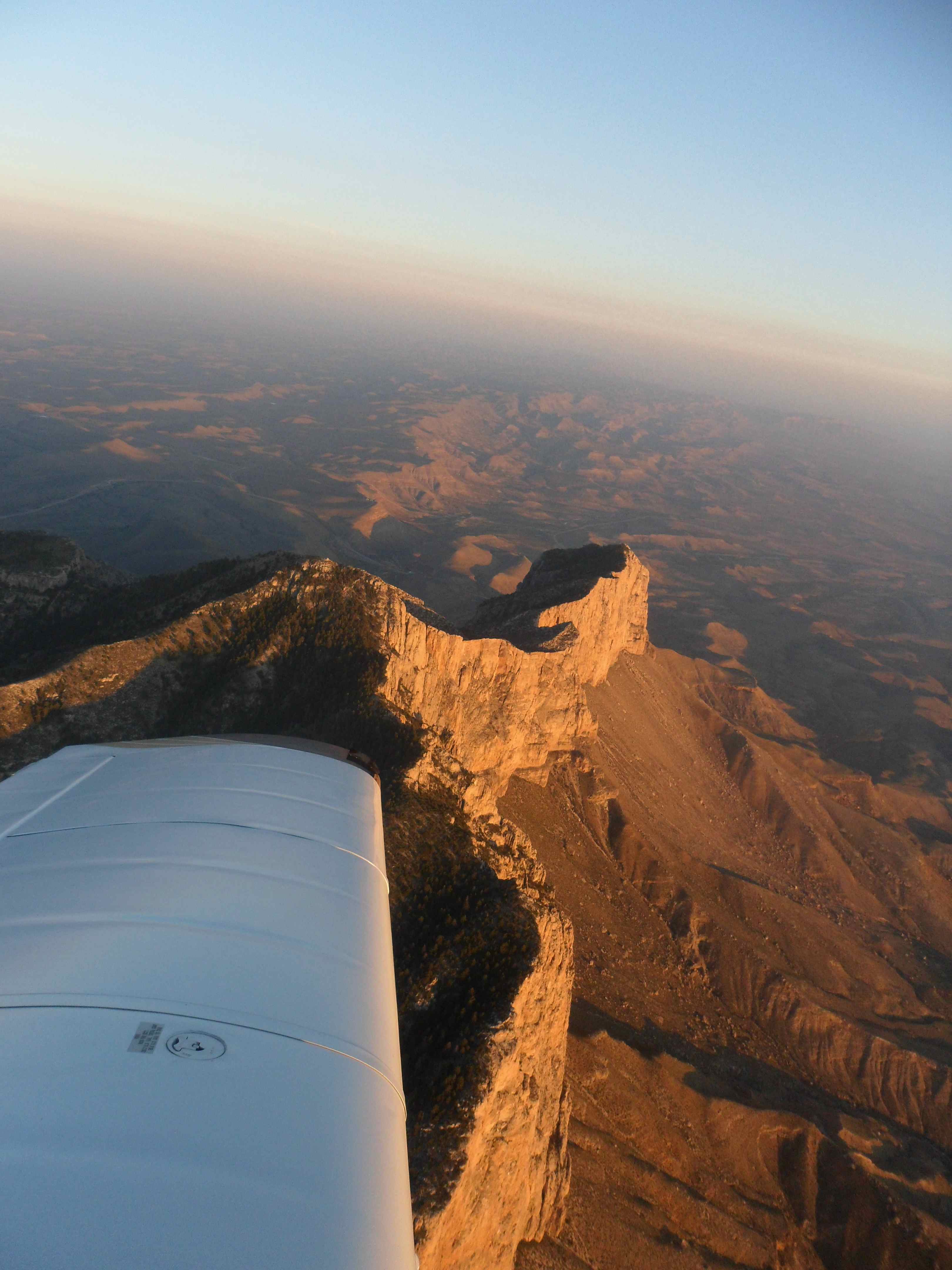
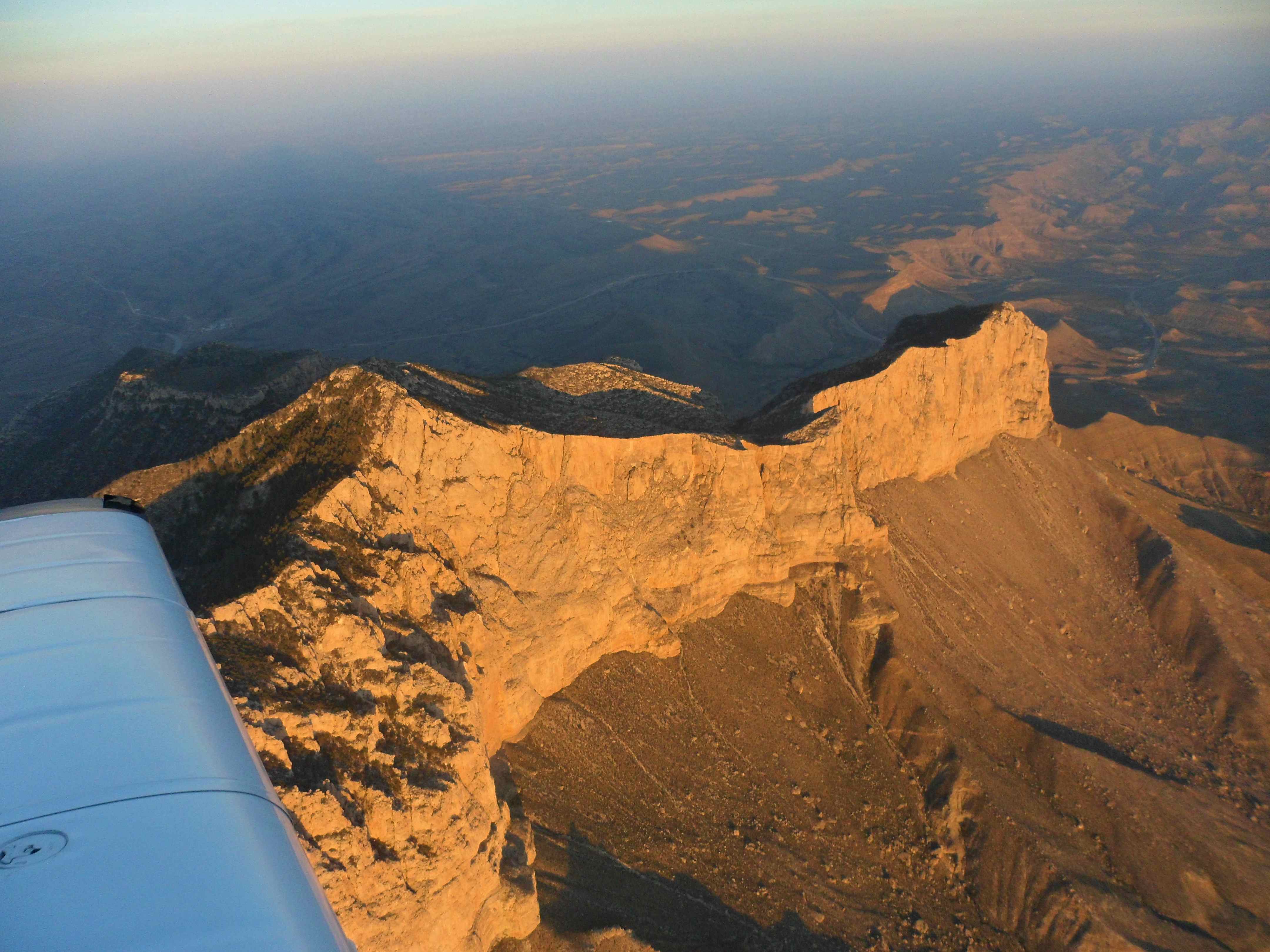
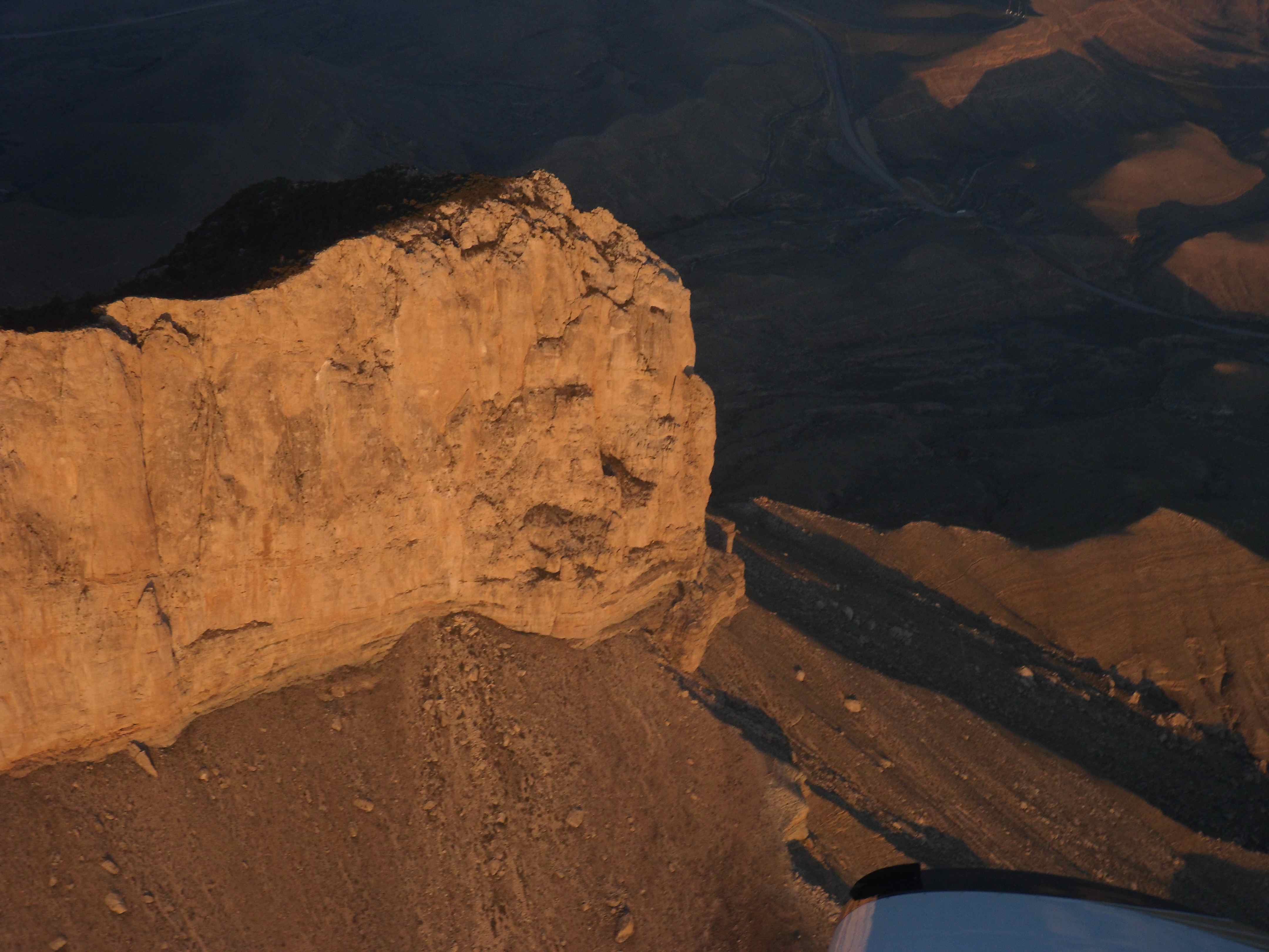
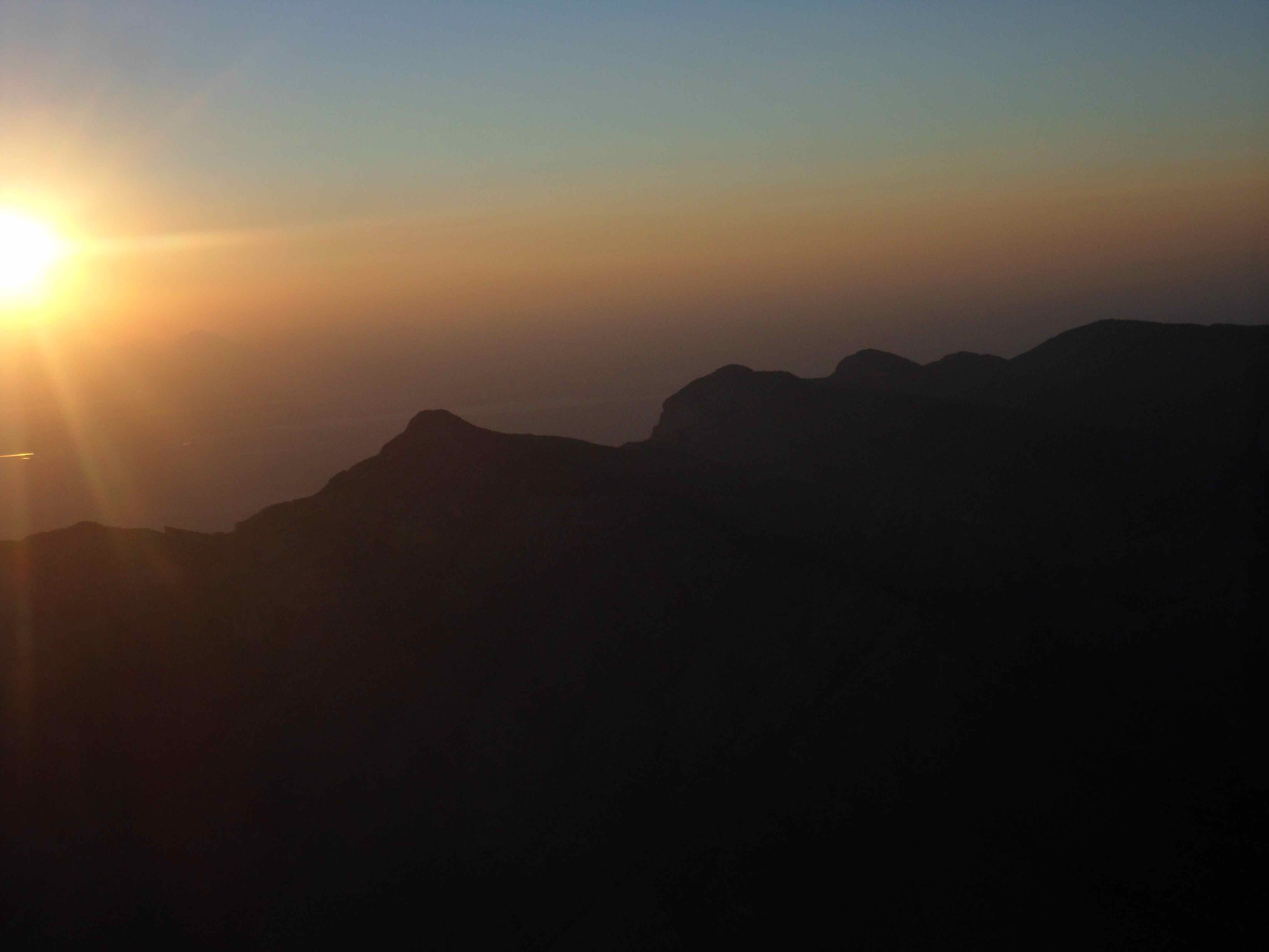
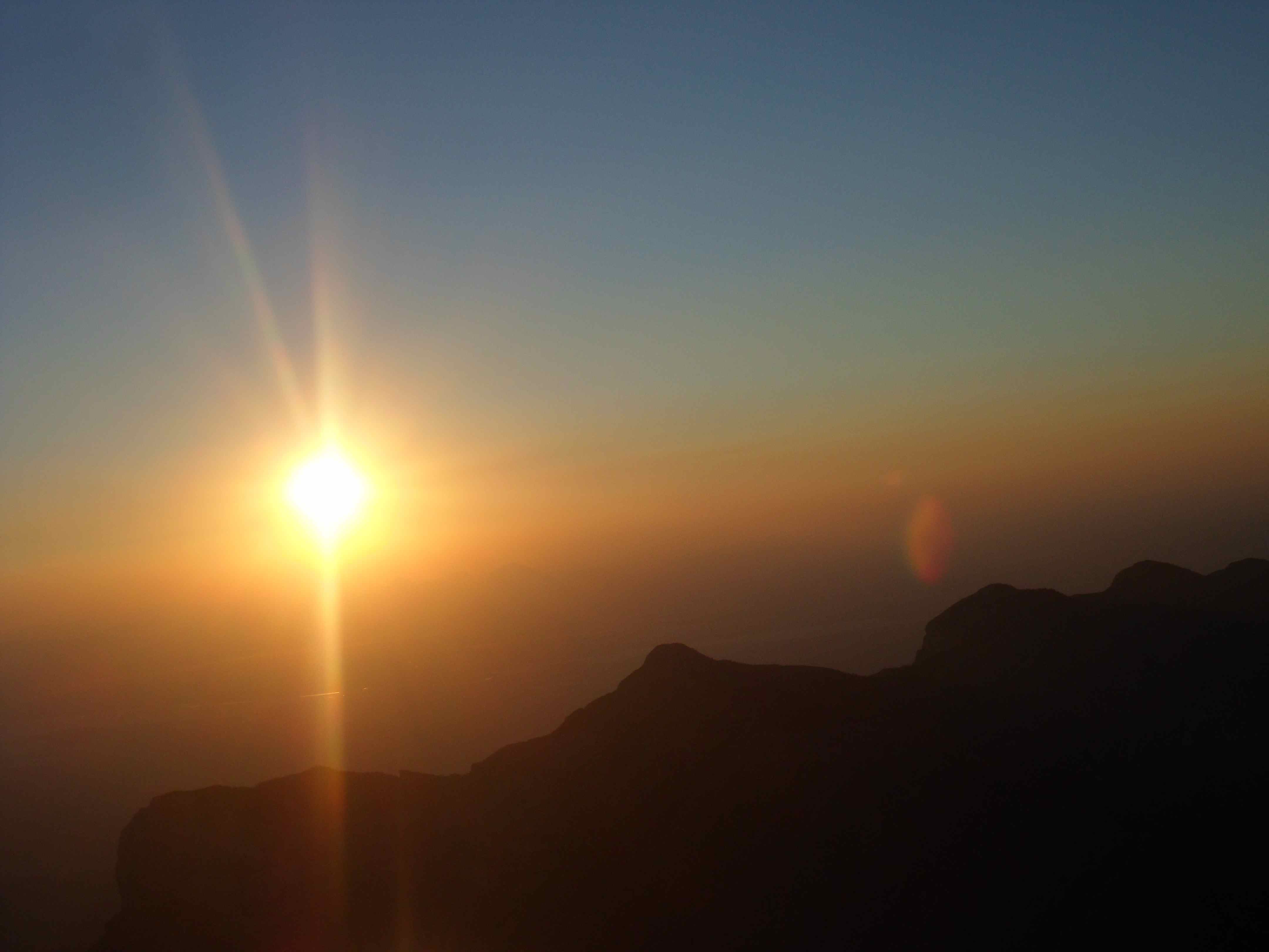
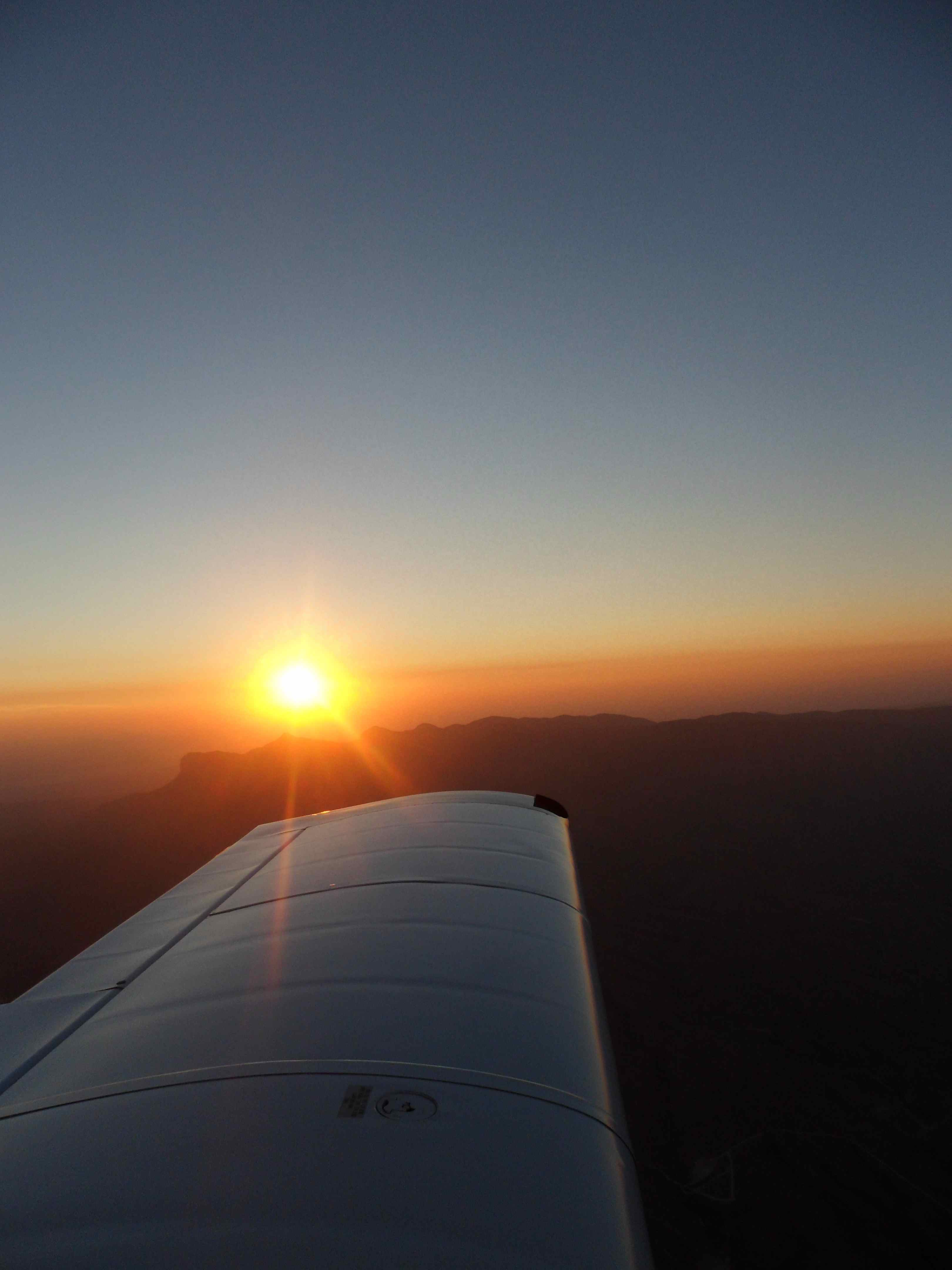
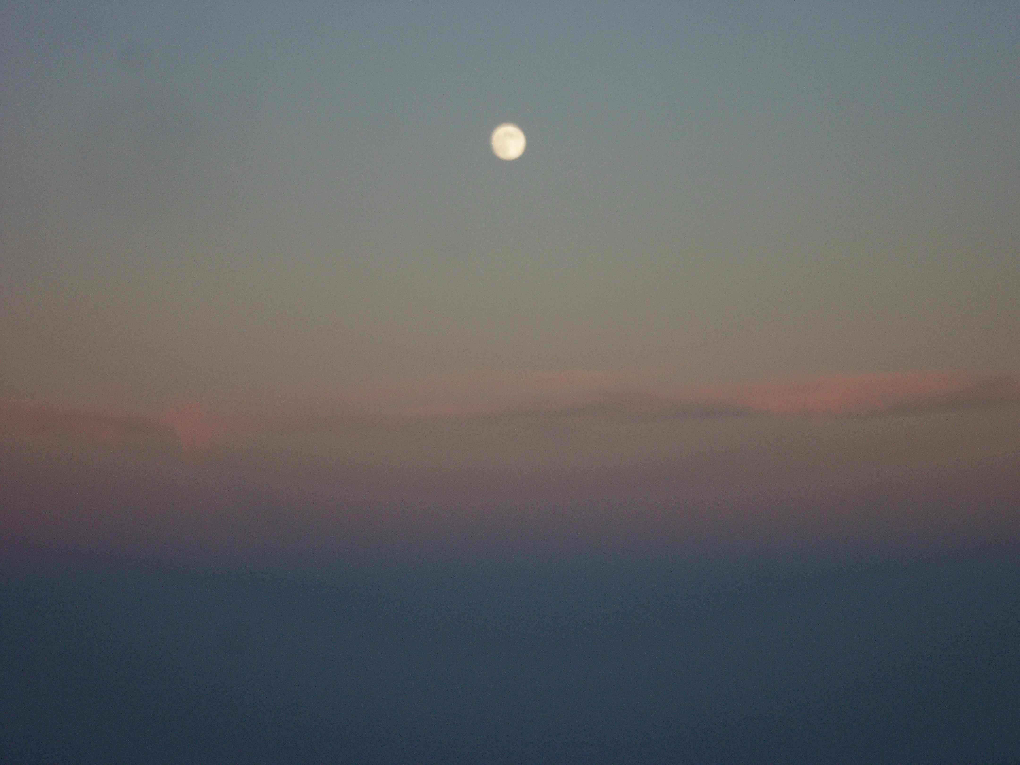
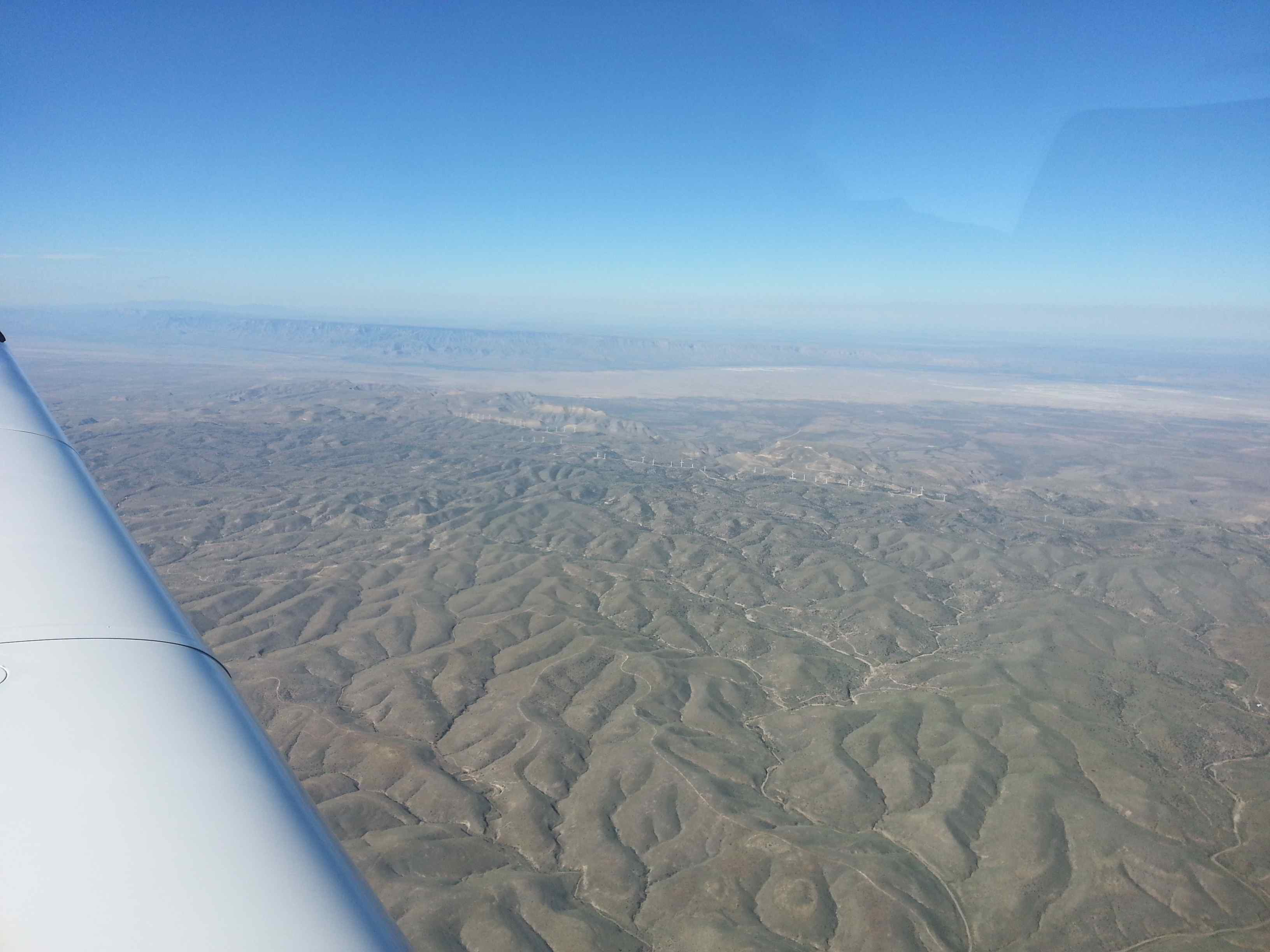
As the shadows got longer, the scenery became spectacular. Hues of pink mixed with blue skies and golden yellow earth made for a great iMAX show. Timing was perfect for approaching the Guadalupe mountains in NM right at sunset. I opted to circle over “El Capitan” and the “Guadalupe Peak” mountain a couple of times for my personal “Marlboro Country” moment. What a sight! This couldn’t have been any better. ATC was worried about my erratic maneuvering over the high terrain but I assured them that “I was familiar” – I’m sure their automatic alarm went nuts. I spent 10 minutes of time and gas over this spectacular scene, before pressing on into the night. When I called ATC back to report that I was back on track the full moon had risen and the sun had set. It became cool in the cockpit. I had an extra hour of fuel on board to my next stop Llano, TX. According to my GPS I would reach Llano exactly at 10:45p. I hoped that all deer would be asleep by then. The very calm part of the flight began with the sun now fully gone and the sky ruled by the moon and the stars. Light on the ground is very sparse over west Texas. I flew past Midland, Menard, Mason and finally came into the vicinity of Llano. Unable to reach flight following, I descended into Llano and announced my arrival on their local frequency. I had to land on runway 35 without a visual glide path due to winds from the north – remember the hurricane? I wish I could have landed 17 instead since there was no vertical guidance going into Llano on 35, but on 17 there was. I kept my approach high, and was ready to go around any time, should it turn out to be too high of an approach or if I encountered wildlife on the runway. The memory of the fatal accident 1 mile south of the field just a week earlier sent a shudder through my body. Concentrate on the landing now! The runway kept steady in my windscreen view at full flaps – so my rate of descent looked right. Double check fuel, fuel pump, carb heat, landing light – fly it to the ground! Flare, …. hold it, hold it, itzzz, itzzz. The main wheels found the ground and the cone shone from the landing light showed a clear runway all the way to the end – no deer. I intentionally used the brakes to slow down immediately should a suicidal deer have come running towards me.
Almost home. I got out of the cockpit to refuel for $4.90/gal -Texas gas prices are the best!
After I picked up my receipt I climbed back into the cockpit to fire up again. The last leg. Don’t rush. Be thorough. After completing the checklist a second time I advanced power and departed Llano to climb into the darkness of the night. I stayed close to the airport for the climb out. Minimize risk at night.
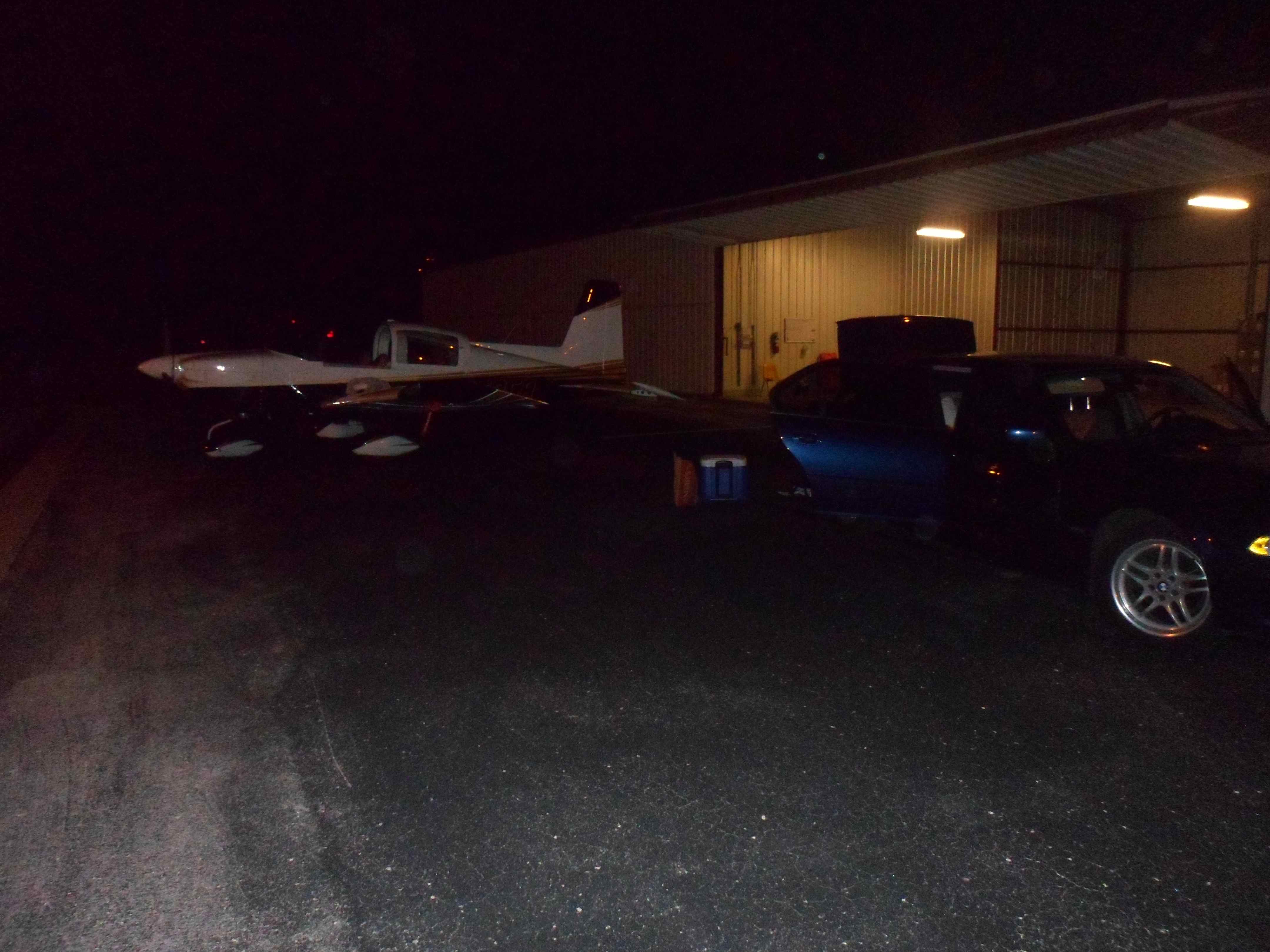
I opted to fly the last leg at 7.5k. As I called San Antonio approach to pick up flight following, I explained that I didn’t properly sign off during my descent into Llano earlier, since I was out of reach of their frequency. They confirmed that they tracked me to the landing spot and knew things were OK. Glad somebody was watching. The system is working. It’s especially important at night. After a short flight eastwards, they handed me off to Austin Approach. Austin’s eastern runway was closed with construction vehicles on it and all traffic had to land on runway 35L. They had two American Airlines jets approaching from the East but far enough out to let me go in first direct from the west. Since we usually land 35R I told them that I was unfamiliar with the taxi ways and the tower instructed me to turn off at the second taxiway on the right – at “Golf”. Despite the pressure to expedite for the airliners I told myself to slow down and give myself at least a 1 mile final to stabilize the approach at night. And that’s what I did. On final I slowed down to 70 kts and from there it was textbook. After I turned off the runway at Golf towner instructed me to taxi via Golf and Bravo to the Signature parking location. Since I was alone out there I chose an accelerated taxi mode, pulling the front wheel all the way back into the air while taxiing under power. Shortly after I arrived at our T-hangar where I shut down. It was 11:45p local after 12 hours travel time. I did it. The Tiger did it. Flying is a beautiful thing.
Return Flight RHV-AUS via Barstow-Dagget (CA), Lordsburg (NM), Llano (TX)
Picture Gallery of my Tiger flight to CA
Flying the Tiger to CA
Last week I had to go to the bay area and instead of flying the airlines I decided to try something new: to fly my own plane across the southwestern states for a 1280NM trip each way.
I didn’t mind the the 10+ hours of flight time and I was looking forward to a little bit of adventure. I might add, that I was going VFR, as I’m not rated IFR. But you can do amazing things VFR when you’re careful and thoughtful but adventurous. All you need to remember is that you’re in charge and you decide. So don’t be stupid.
The day before the trip I packed all the stuff I might need and got a 30min personal weather briefing. VFR was not recommended – it never is: they were expecting MVFR in the morning and scattered Thunderstorms enroute. Since I was traveling by myself, luggage was not a problem. In addition to the regular bag, I brought tools, food and a cooler with drinks.
The weather looked good enough enroute for the flight, but we had a marine layer early on in AUS, which made a timely departure with the first ray of light at 7:15 questionable. I wasn’t worried with XM weather onboard and a good understanding of the Cb’s in the mountains.
After preparing the plane in the dark and getting comfortable in the cockpit I called up clearance delivery under an overcast low cloud sky. I requested a special VFR departure in the hope to find a hole in the clouds where I could punch through. They replied that the airport just went VMC and I could get a regular departure which I took. Lined up on 17L and cleared for departure I commenced the power and lifted the wheels off the ground. Almost immediately I rolled into a right turn, gunning for a hole in the low overcast towards the west. I climbed through the hole of the 1000ft thin cloud layer in short time and was welcomed by blue skies above.
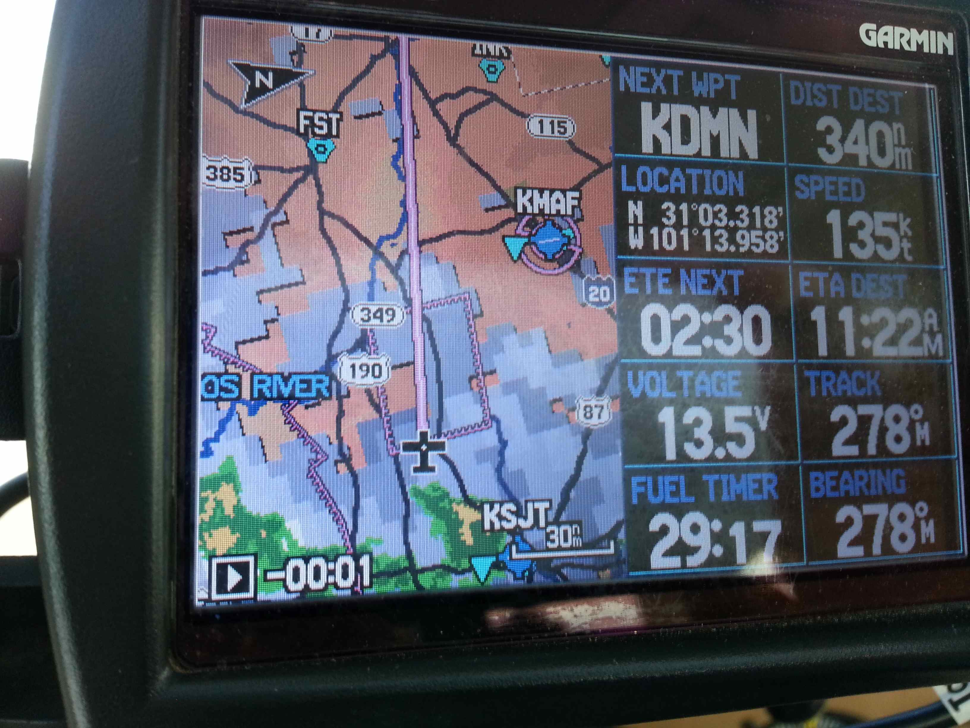
The first two hours were uneventful as I tracked my progress on the moving map. Winds weren’t strong and I made good time going 135kts ground speed. Shortly after Eldorado I got rained on a little bit – the plane needed a wash anyway. I was on flight following and heard regular updates about traffic in the area, which wasn’t much. There was a C210 chasing me from behind, making ground at a rate of 7-10kts from behind, but burning 15 GPH versus my meagerly 10GPH I got from our four banger. It took him 45 minutes to finally catch up with me since he got the traffic advisory from ATC. That made me smile. The Tiger is a fast plane in its class.
My first fuel stop was Deming, NM after some 430NM. Getting out of Texas takes a full load of gas! So I was timing my fuel and knew I was down to VFR reserves when I touched down. The line man helped me to fill up and I was back climbing a short 20 minutes and $245 afterwards. Back at 10500ft I was planning to overfly Phoenix Airspace Bravo while in contact with ATC. They sent airliners left and right over and under me – Phoenix is busy! I got to inspect a 737s gear doors 1000ft above me, the plane immediately diving after crossing my path – what a show! But the best was yet to come: ATC was calling out traffic 7miles ahead opposite direction 12o’clock. I was looking hard, scanning the sky with my trained eyes. After a long minute I finally could make out something that looked like an airplane and it was pointing right at me!! He was flying in 10000ft, merely 500ft below my altitude and gunning at me. I banked hard to the right and as we were passing I saw it was my most favorite aircraft: a Piaggio pusher going 400kts in the opposite direction (I was going 135kts myself, so we passed at greater than the speed of sound!). I swear I could have touched it, it was that close. It was awesome! Maybe a little too close for comfort, but still awesome! Wow was that fast!
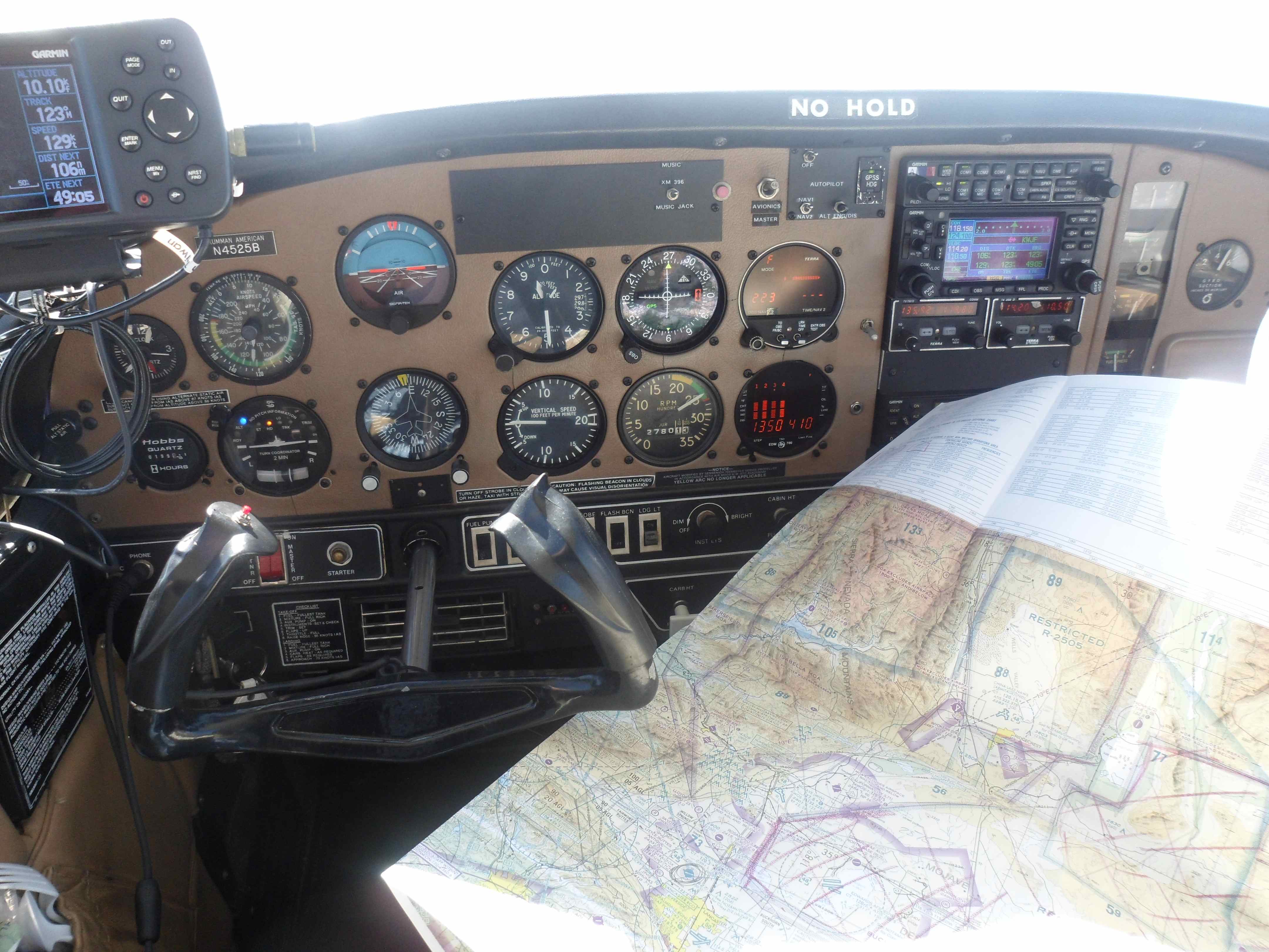
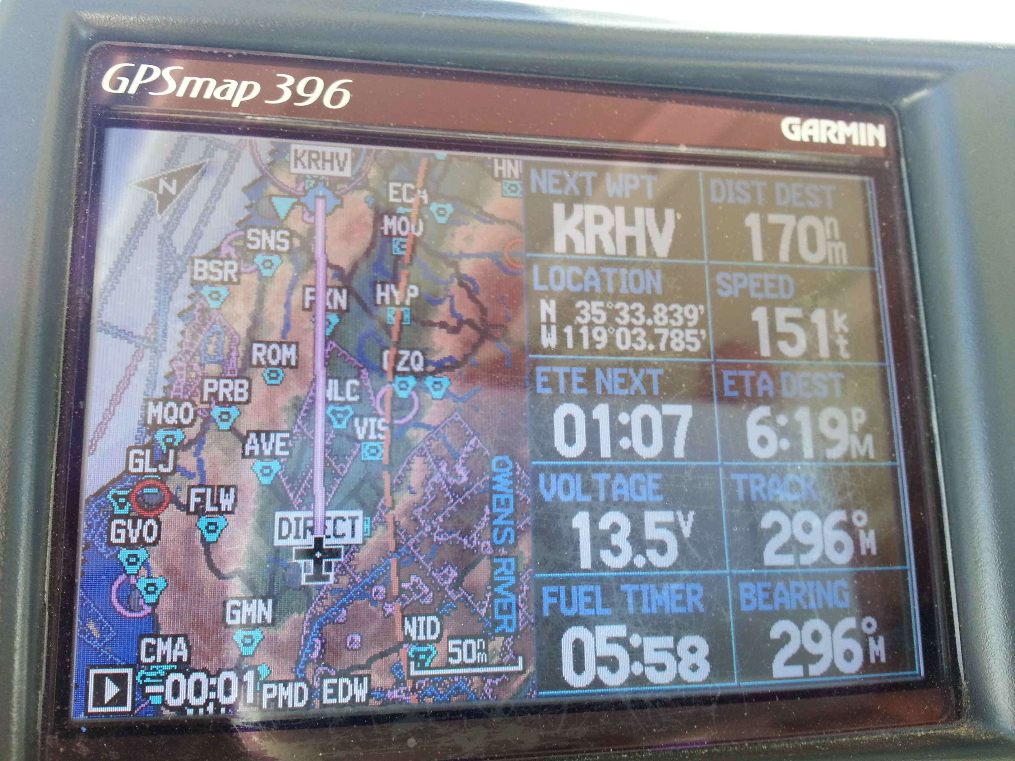
As I was trying to take picture through a partially opened canopy later on the wind sucked my map – a complete Phoenix sectional through the open canopy – Gone! – Ooops. Now I had to rely on the GPS and its moving map for navigation until I was on the next sectional – about 200NM away. A whiskey compass is a thing of beauty during these moments. Very reassuring to have.
I passed through some very high terrain with peaks close to 11k, so I flew next to them instead of over them. Some really big rocks out there! My plan was to stop at a high altitude airport for some cheap gas in the LA basin area. It would save me the decent and climb to altitude as well some serious money. Only problem was that at 16:00 local time it was reporting 9300ft density altitude on its AWOS. 15 miles out I decided to pass up on that fun – the POH still said it was survivable and I would get off the ground and climb with 200fpm but I wasn’t going to try after 8 hours in the cockpit. Dying for having saved $45 in gas didn’t seem to be the right trade-off. Instead I made my way to a desert floor airport that I had landed at some 15 years before: Barstow-Daggat was selling the flying juice for a whooping $6.50/Gal – oh well. When I arrived nothing had changed. It was spooky. And it was still hot – 44C. But they took my plastic card and I was back in the air 20minutes later.
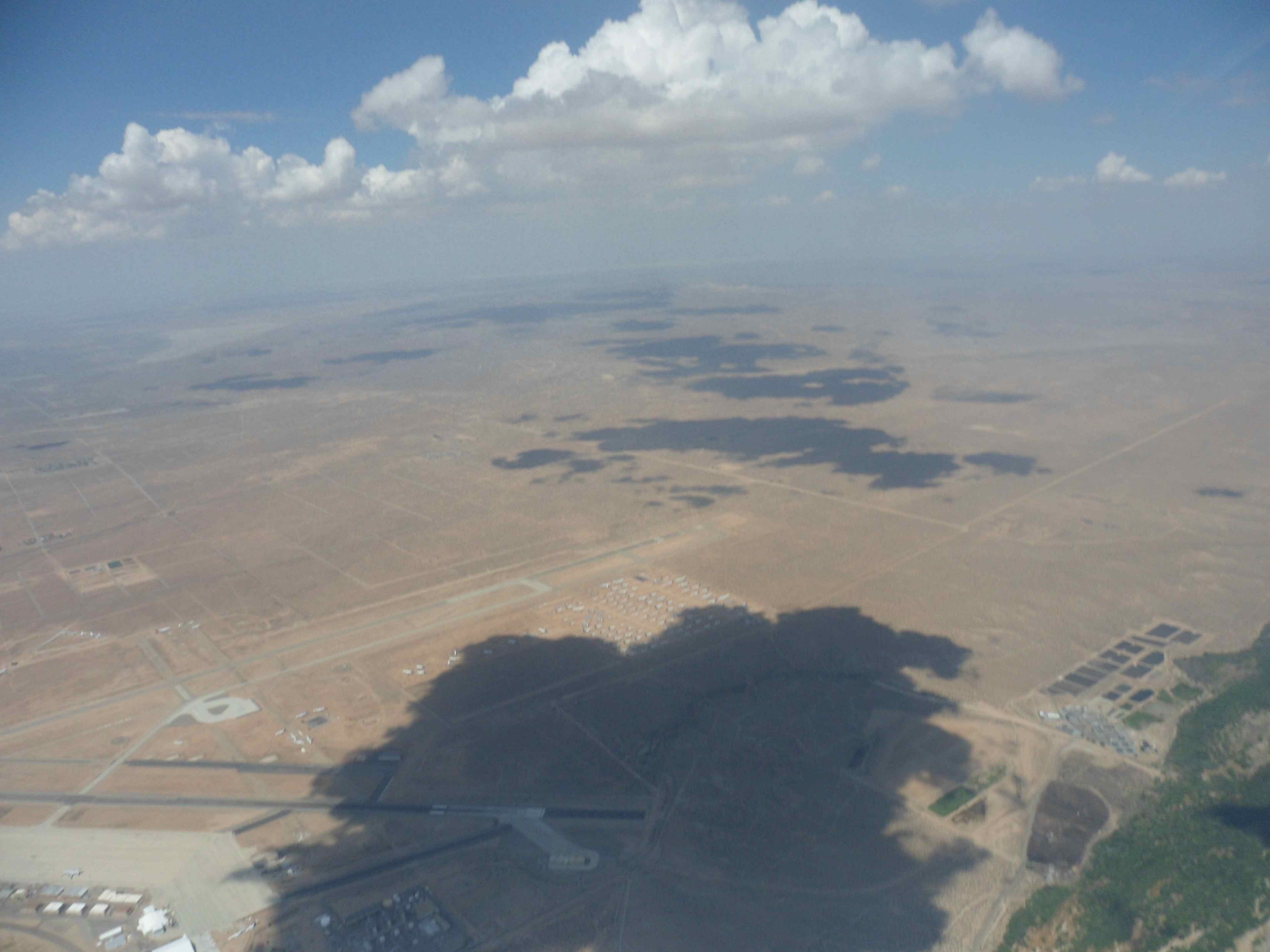
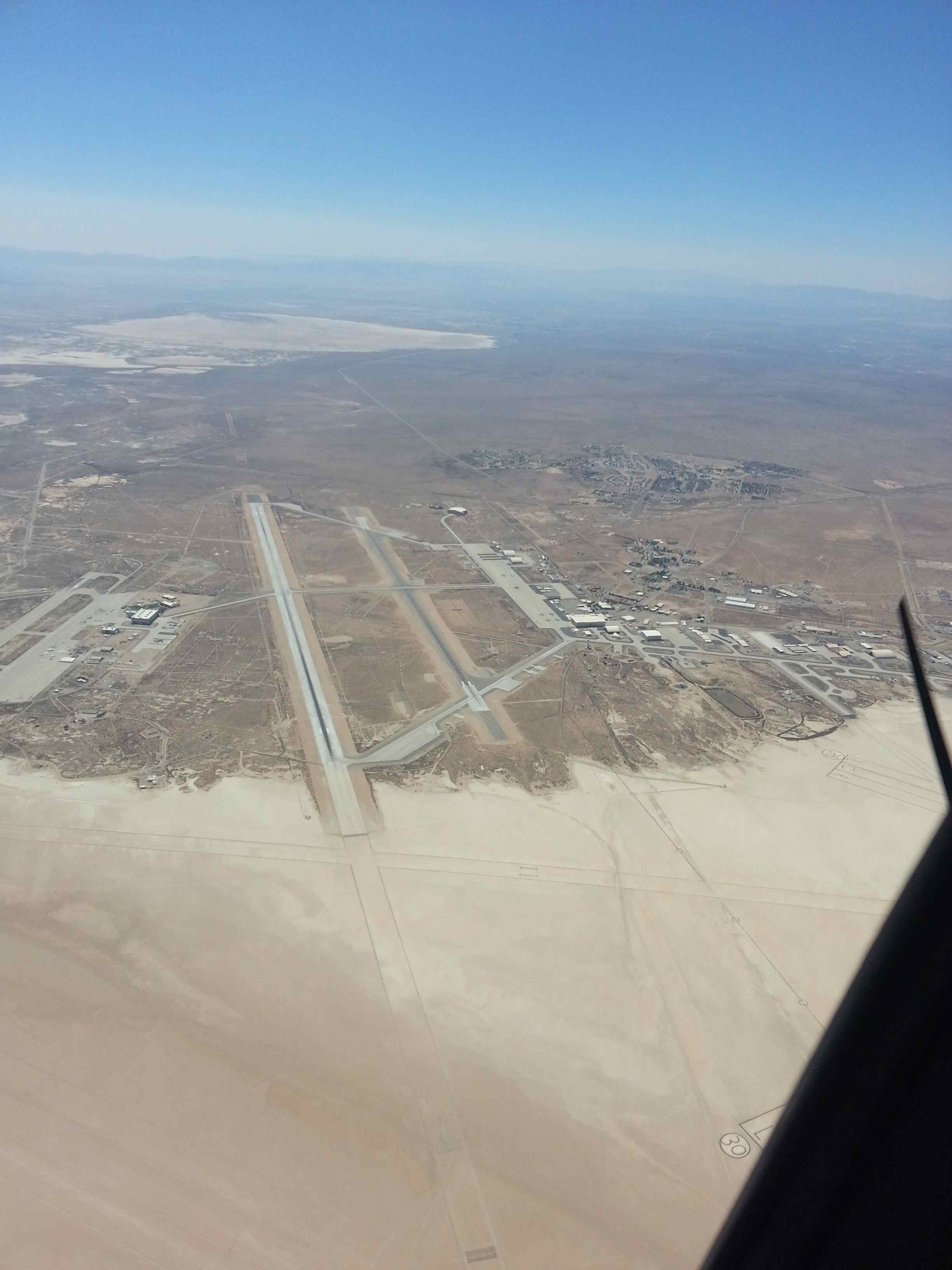
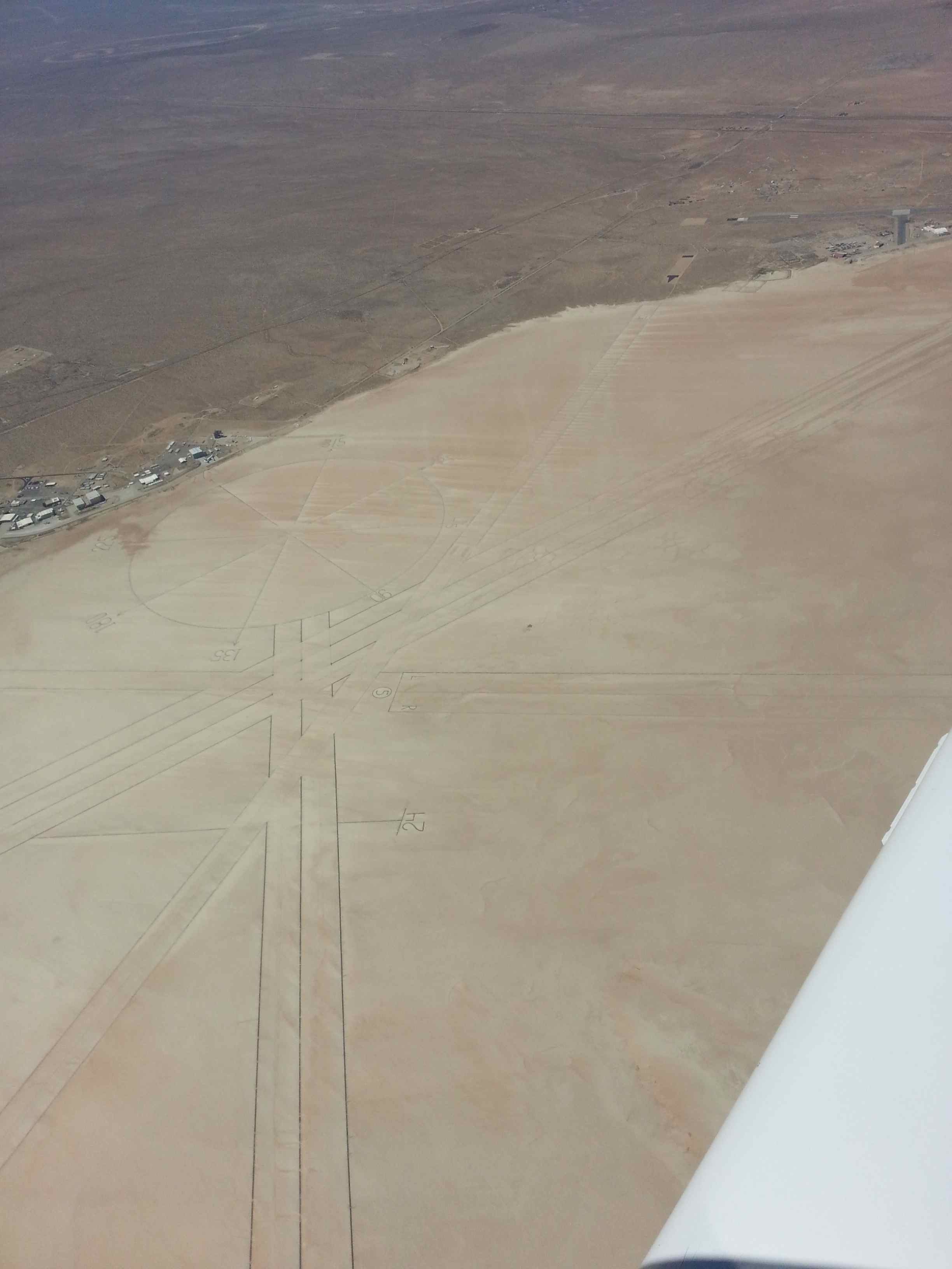
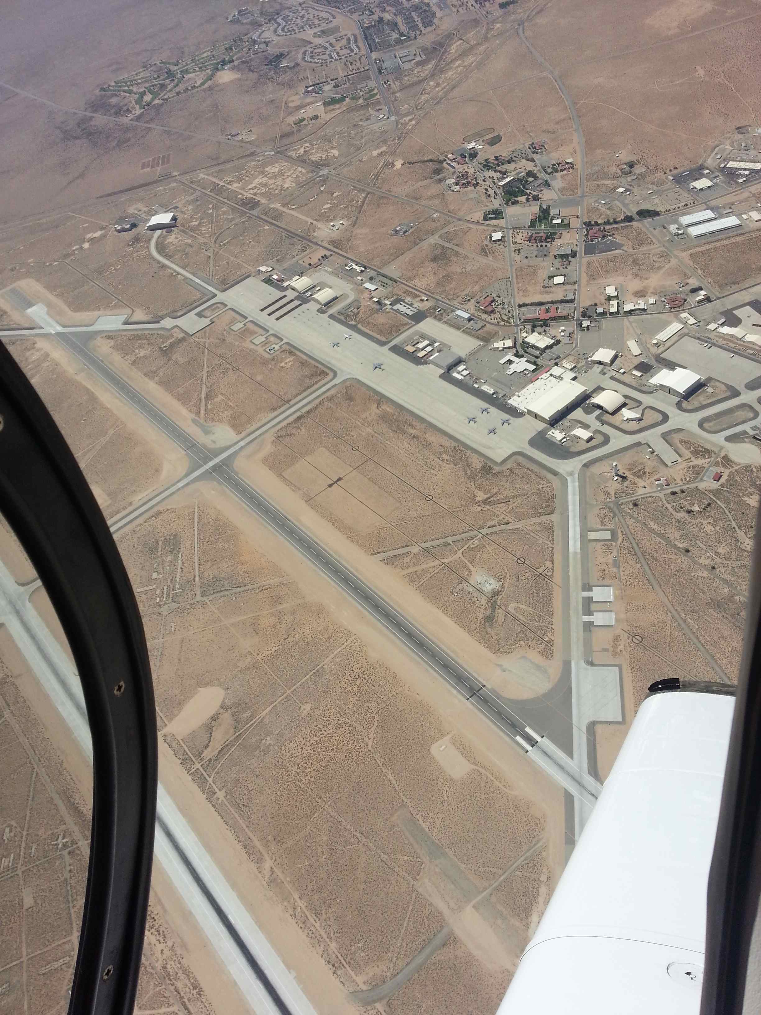
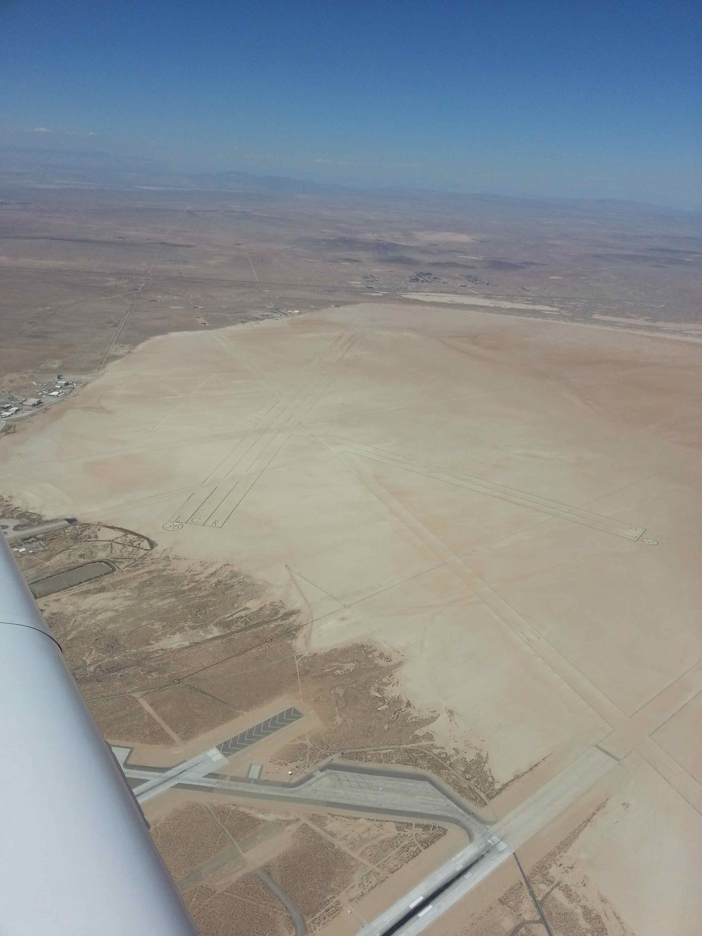
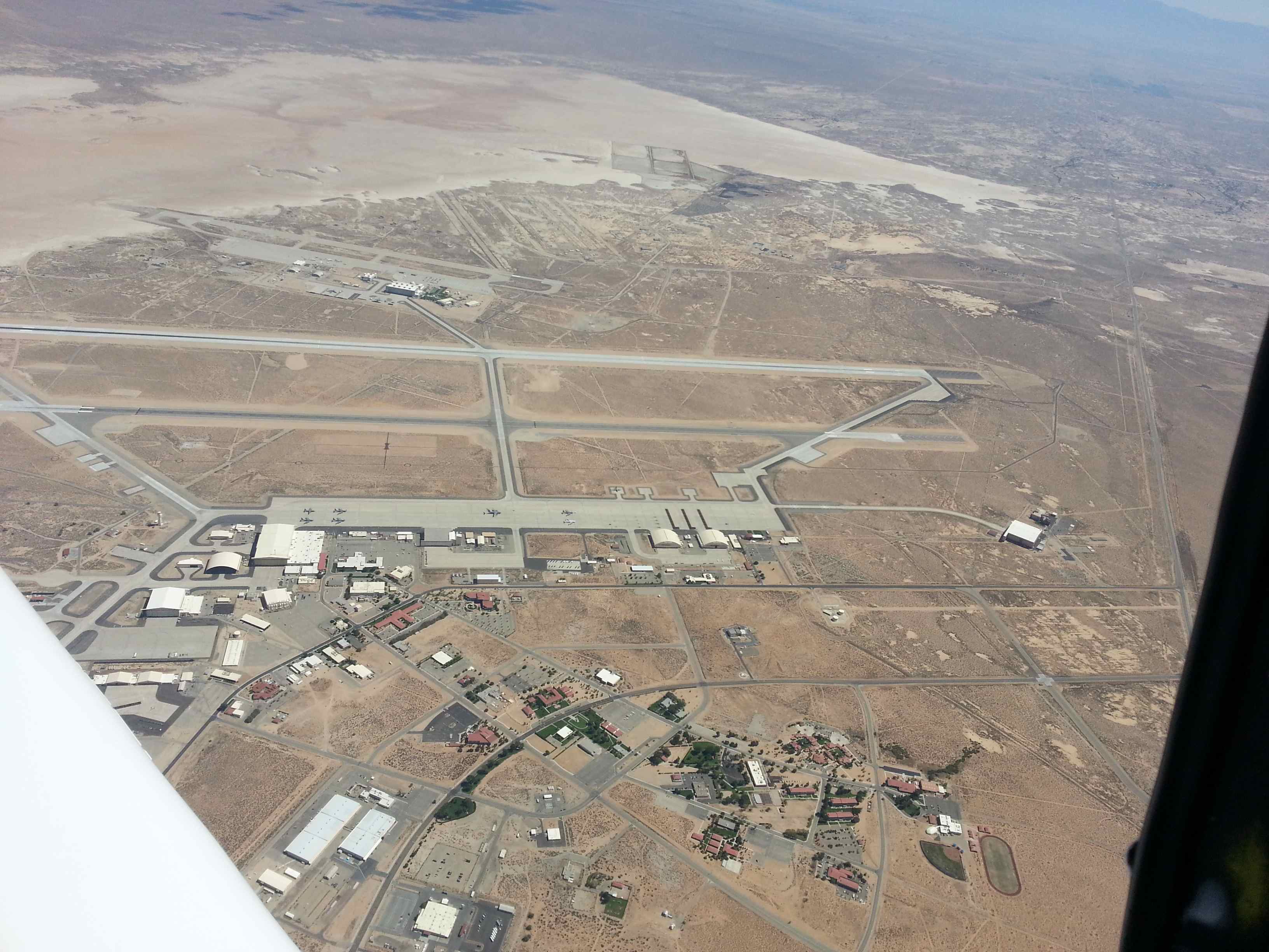
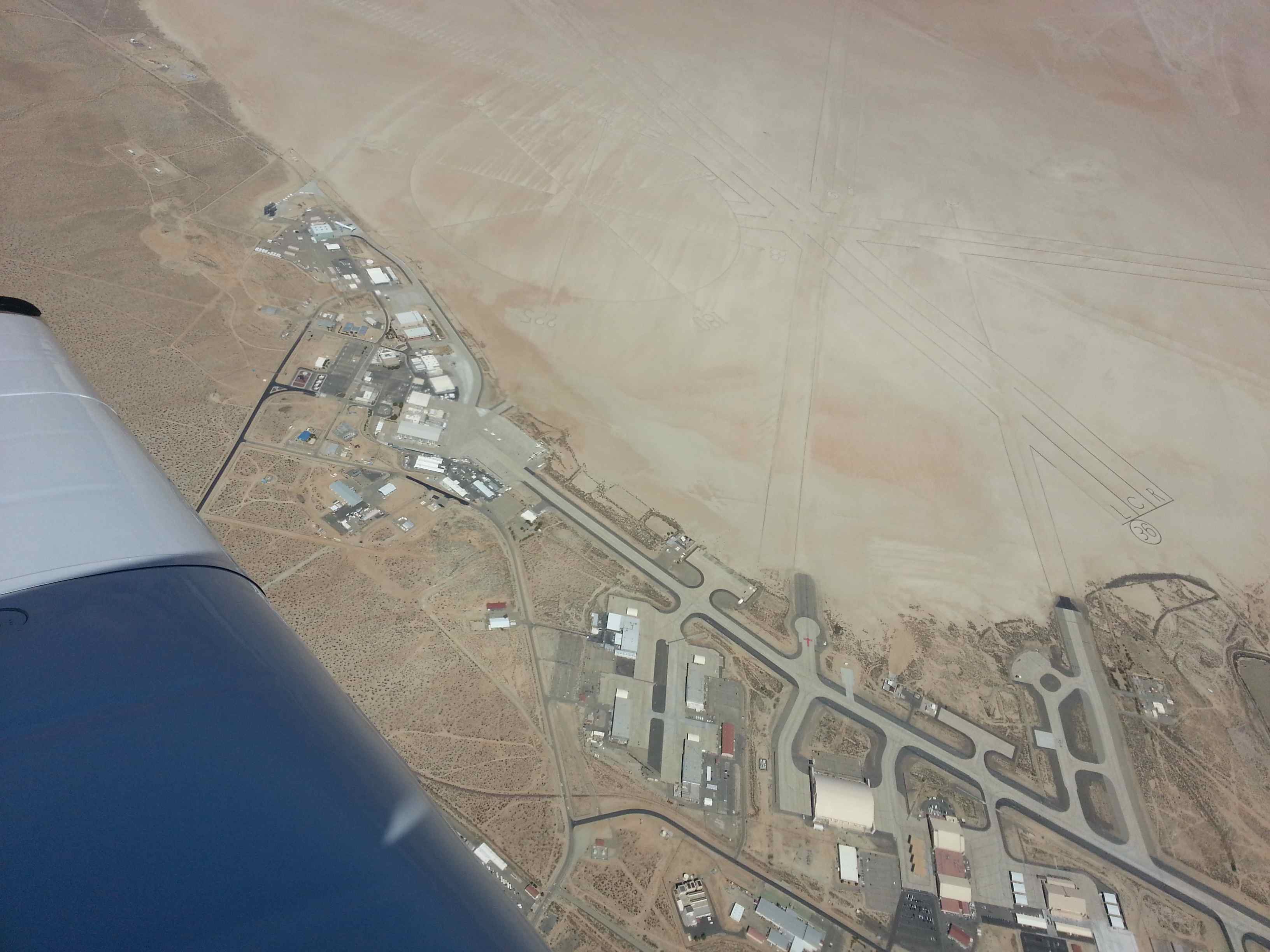
While talking to Joshua Approach during my climb out they remarked that the restricted area around Edwards Airbase (that’s where the “Right Stuff” happened and where the space shuttle landed) was cold today above 7000ft. I consulted my map and couldn’t believe my luck. I could cut across, fly over the airport midfield and take some great pictures. I called them back to confirm that that was in fact the case. When I asked if I could circle to take pictures, their reply was a dry: “You’re VFR and can do whatever you want above 7000ft” – Thanks ATC! I love America. It’s hard to understand having grown up in Germany where ATC treats Airspace Bravo over Frankfurt similar to a high security prison for VFR traffic. I digress. So I got many great shots of parked U-2s (the spy plane), big cargo planes and huge salt flat runways. There’s even a compass rose etched into the salt – maybe a mile in diameter. Aliens could read it from outer space – it’s that big!
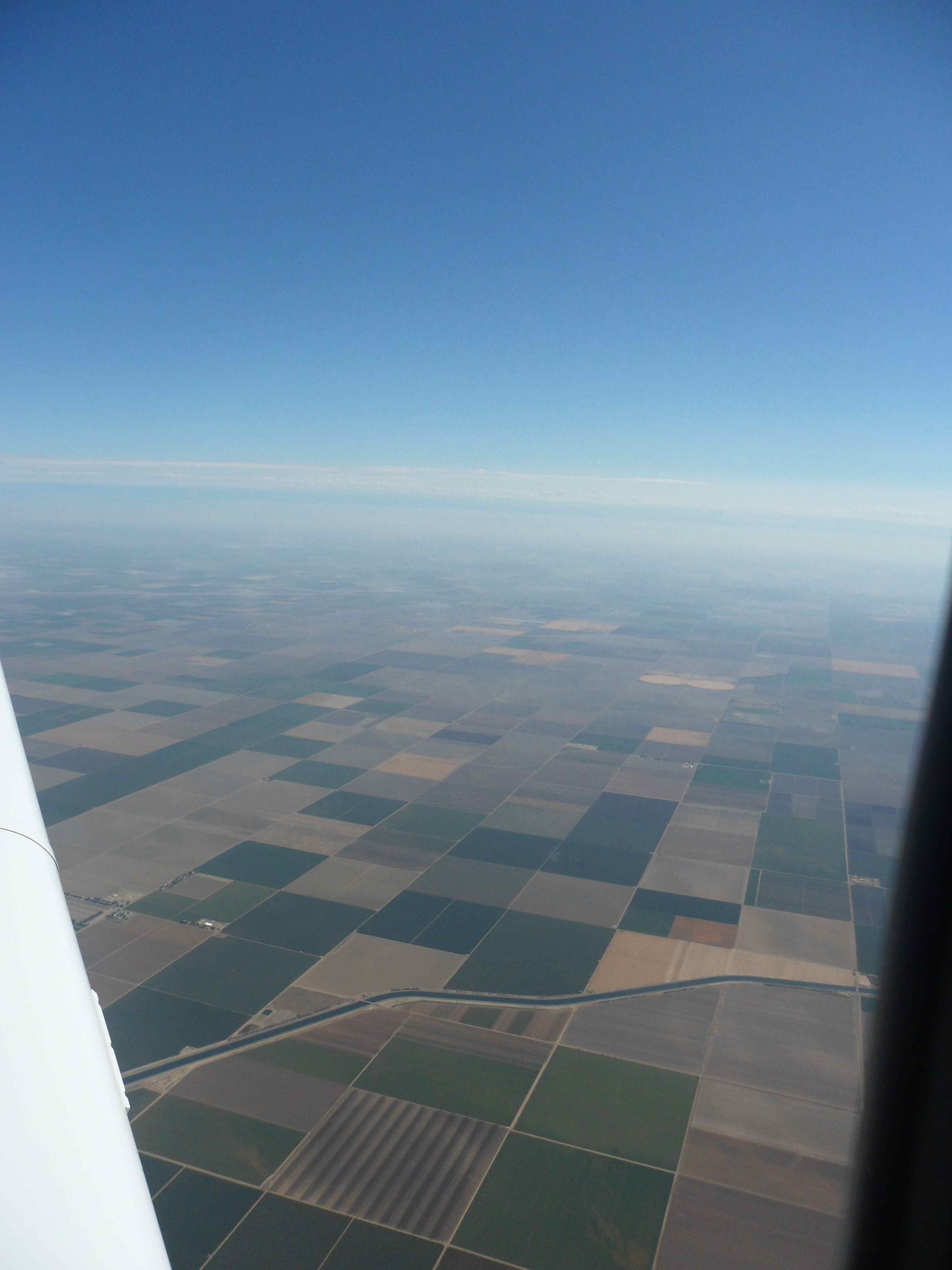
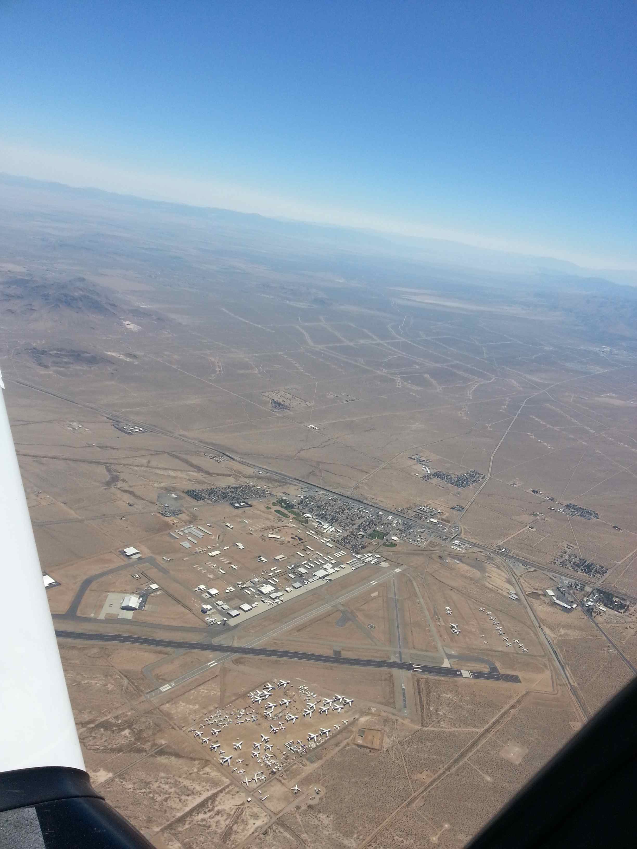
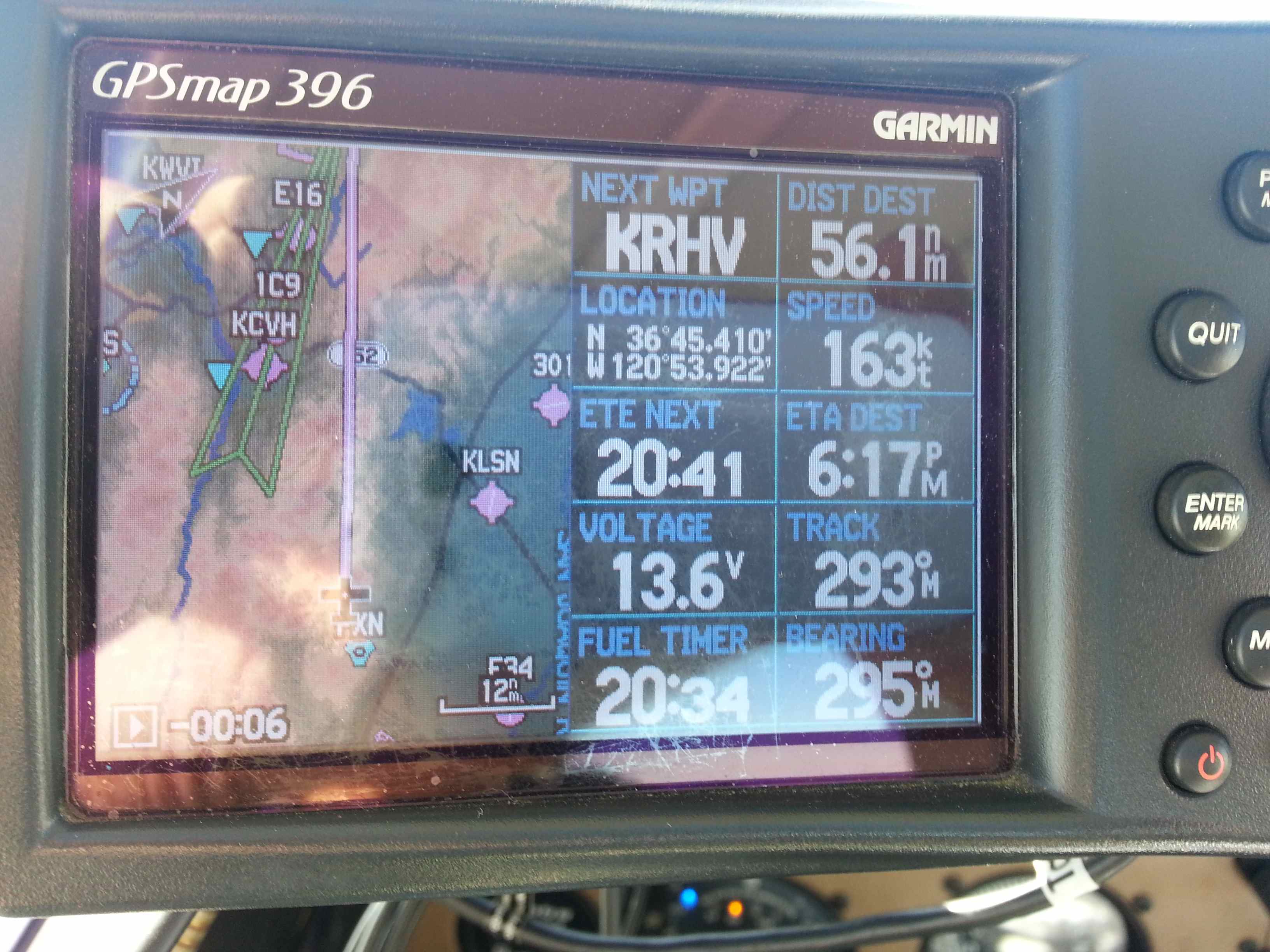
Shortly after I passed by one of the airliner boneyards which looks like a Costco parking lot for airplanes from above. From there I crossed over into the central valley and was a short 1.5h away from my final destination. Poor guys on I-5 hiding from the cops for speeding tickets. I was fire walling my little plane and going at 165kts GS with a favorable tail wind. After a few more frequency changes I was cleared for a straight in for 31R at Reid Hill Airport in the south bay. The marine layer was visible over the pacific with a solid overcast but no threat to the bay quite yet. I touched down, requested progressive taxi to my pre arranged overnight parking position and finally shut down. Quiet. After 12 hours travel and 11.7 hours Engine Time I had arrived. I was exhausted but had a big smile on my face. I flew my own plane all the way to the west coast. What a treat! And I can confirm: Texas is connected by landmass to the state of California.
My personal Lindberg moment

As a first for me I flew with a powered plane from Texas to California all in one day. I had to stop twice for gas but made it three hours ahead of schedule. Ten hours of flight time. It was a long day…
Uvalde WGC 2012 – that’s a wrap!
Uvalde roundup:
Yesterday, Saturday was the last contest day at the record worlds in Uvalde.
After the midair collision in the 15m class the day before (nobody was injured, two ASG-29 were damaged/lost, the french pilot flew back with the damaged ship, the Austrian pilot bailed out with a manual parachute), the last day was one of the trickiest weather wise. We woke up to an overcast sky to the north with midlevel clouds from a trough making its way slowly to the south.
We finally managed to launch the field an hour later than originally planned and Cu development was great towards the south.
On the last two days the city had watered down the dirt landing strips adjacent to the runways each morning, which helped greatly in dust avoidance.
It was a very gusty day and energy management was challenging in the tow planes – we got tossed around in our airplanes quite a bit and each landing was different – some nice, some not so nice ones. Everybody was tired, too.
On one landing I saw a dust devil developping fast on my runway as I was decending through the last 100ft. Someone readioed in: “Checker Tail, you have the dust devil?”.
As I touched down, the dust devil intensified to what looked like a sand storm moving right into my way. I had visions of being flipped over with the tow plane. It was too late for a go around. Instead I hit the brakes hard, and wheeled around it, 45 degrees to the left first, and then 180 degrees around the back side of it back to the grid. “I drove around it!” was my response… I got to see this not so little devil from all sides as it was moving slowly off the airport. Extra excitement!
Unknownst to the public the tow pilots had their own little competition during the contest. 🙂 We had a white barrel for the rope drops on each side with a camera installed on top of it. It was like pumpkin drop with ropes. Only that it was occuring at higher speeds at the end of the green arc…
On one day someone managed to lay his rope over the barrel (the goal was to hit the metal barrel with the ring pair for the “cling” sound – which we managed on several occasions. That particular day a consecutive drop managed to hit the rope off the barrel! Oh, how much fun that was!! And all that with the FAA watching and not taking any issue with the low passes and consecutive 45 bank and pull-ups for a left downwind. Felt like an officially sanctioned low level fun contest. At times there were up to five towplanes in 1/2 mile spacing going in for the drop. Nobody got carried away as the FAA had all our certificate numbers tucked away in their pockets from the previously perfromed ramp checks. 🙂
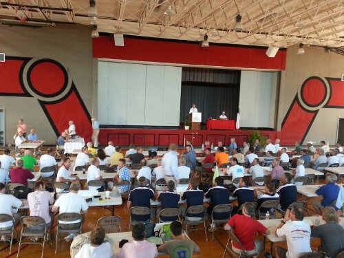
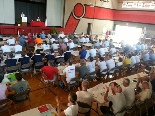
After the last tows the tow plane caravan would taxi back to the FBO, tie down and the pilots gathered in the briefing room for an immediate de-brief while enjoying refreshments and sandwiches. Any safety issues would be discussed immediately – most days we didn’t have any, but there were some with cut off tow planes or conflicting glider traffic in the tow path. I haven’t had any close calls. The mantra of the chief tow pilot was: “Keep it boring!” And his first question at the meeting always was: “Was it boring today? – Good! Keep it that way!!”
For the most part we kept the excitement to the tow rope drops. I will get the DVD and will make it available for general viewing pleasure, though I’m hesitant to post it on the web, despite of the FAA’s officially sanctioning of the procedure… it still puzzles me why they didn’t take issue with it… 🙂
One key learning for me is that contest towing is quite different from club towing. At the contest it’s not about the tow turnaround speed, but all about the tow plane spacing and sequencing. We had 7 tow planes on the east side working the 15 and 18m class. Turnaround times were in the 7-8minute range, so 1 minute spacing ideally, including the full-stop landing and hook-up.
You can imagine that with different tow plane and pilot capabilities the spacing management was challenging at times. I’ve seen the Walmart holding pattern a couple of times to avoid sitting on the runway kicking up dust while waiting for the next tow. The best pilots were pacing themselves to naturally keep the tow planes spaced, which required to be aware of the positions of the three or four planes ahead of you at all times. Since our tow plane is so strong, I had to slow myself down quite often.
Overall we managed 165 tows during the three week period. Thanks to Rich Schaefer, Tom West and everybody else who helped with ferrying for this contest.
The plane is currently in Uvalde and Bill Snead will ferry it back to Spicewood today, weather permitting.
And that’s a wrap!
Wheels up!
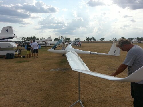
Uvalde WGC 2012 – Wednesday update
I wanted to give an update from Uvalde’s World Gliding Championship (WGC) where I’m towing this week with our club’s Pawnee.
The weather continues to be hot and fast and winners of all three classes (Open, 18m- and 15m FAI) are turning in speeds of 155-160km/h (almost 100mph) over task lengths of up to 700km.
The heat and the amount of flying is taking a toll on the pilots and crews – you can see the exhaustion in many faces.
So far the contest had no major accidents that involved injuries. We had one ASW-22BLE self launching, not getting off the runway and ending up in the fence with some fuselage damage. The unlucky pilot was unable to continue the contest.
But the flying has been great with clouds every day so far and cloud base up to 11,000ft in the Hill Country, but more commonly 8-9000ft.
The launch operations last usually a little more than an hour and take place from 12:30 until 14:00 weather dependent. We tow from two parallel runways with eleven towplanes, mostly pawnees, two Cessnas and Two AgWagons. Our Pawnee is one of the best climbers in the 235hp bunch (the Cessna is stronger).
The FAA from the San Antonio FSDO was there yesterday and today and I got ramp checked – exciting, but we had our paperwork in order. They are also watching operations and ensure that no “aerobatic flight by the FAA definition” takes places during the towing process.
Finishers usually start coming back between 5 and 7p depending on the task length. On one day, the contest finish time was set at 20:12 and some pilots had to land off field – there are hefty penalties for flying after sunset.
Last night there was the international party at the tent at the airfield. Every nation’s team offered a dish and/or bevarage – the Belgian beer and Italian pasta both were very popular.
The dry conditions make the launch operation very challenging due to the dust produced by the landing and taxiing tow planes in the dirt adjacent to the runway. In the interest of turnaround time we land next to the grid, not on the runway. Yesterday I was stuck in a dust cloud unable to taxi in position – it was literally IMC for a minute. The dust leaves a very funny taste in your mouth. Eveybody is suffering a bit on the ground. Today I landed into a developing dust devil and completely lost visibility half way into the flare. I finally found the ground safely. 🙂
The weather prognosis has all remaining days as flying days, so we expect to have three more days of hot races with blistering speeds.
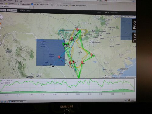
As always, you can follow the track on the WGC Uvalde 2012 website (under tracking, Spot) The start gate times of the competitors are published during the race day on the scoring page.
Saturday will be the last contest day, with a big party in the evening. The worlds will close on Sunday morning with the winners ceremony starting at 9:30a.
That’s it for now.
WGC Uvalde snaps